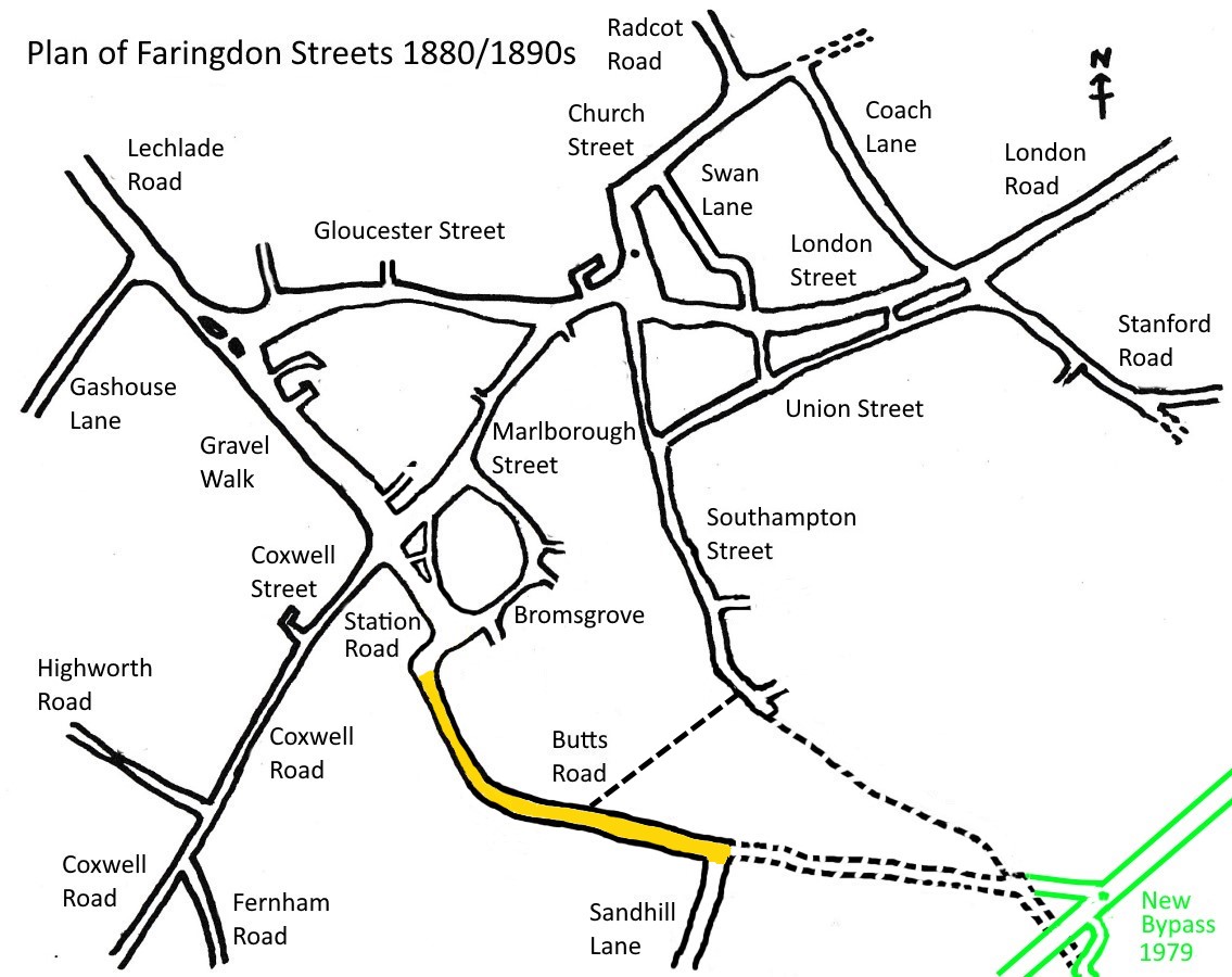
 Park Road was originally a no-through road called Butts Road or Butt’s Lane. It began at the cross-roads of Marlborough Street, Coxwell Street and Gravel Walk and ended at the junction with Sandhill Lane. With the advent of the railway in 1864 the beginning of the road was renamed Station Road as far as the station* and Butts Road continued thereafter. Butts Road was renamed Park Road after the war in the late 1940s, the name was definitely in use by the 1950s.
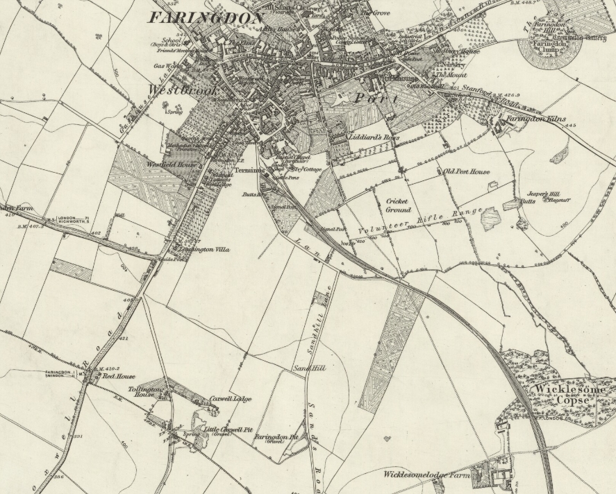
Butts Road was probably named after the archery butts erected on Jasper’s Hill for practising the art of the bowman. The earliest reference to this name was in 1551 and ‘Butts’ can be seen marked centre right on this map dated 1876.
The map also shows an unnamed single-track road continuing from the end of Butts Road at Sandhill Lane to join up with a track or footpath extending from Southampton Street. The track then turns south to Wicklesome Farm. When the A420 bypass was built in 1979 the track from the end of Butts Road was upgraded and extended along the path of the old railway line to join up with the bypass. The short section of track to Wicklesome Farm that was cut off by the bypass still exists as a public footpath on which there remains evidence of earlier tarmacking.
A turning off Park Road called Butts Close was renamed Butts Road as it now leads into what in 1972 became the Marines Drive and Townsend Road housing estate.
* Probably since the closure of the railway station, Park Road now starts from the Swan public house on the corner with Bromsgrove and today forms a major route off the A420 bypass into Faringdon and beyond to Lechlade and Cirencester.
Also see our house by house tour of Park Road in the Year 2000.
See Faringdon Streets for an indexed list of all streets in Faringdon.
A Tour of Park Road in the 1900s
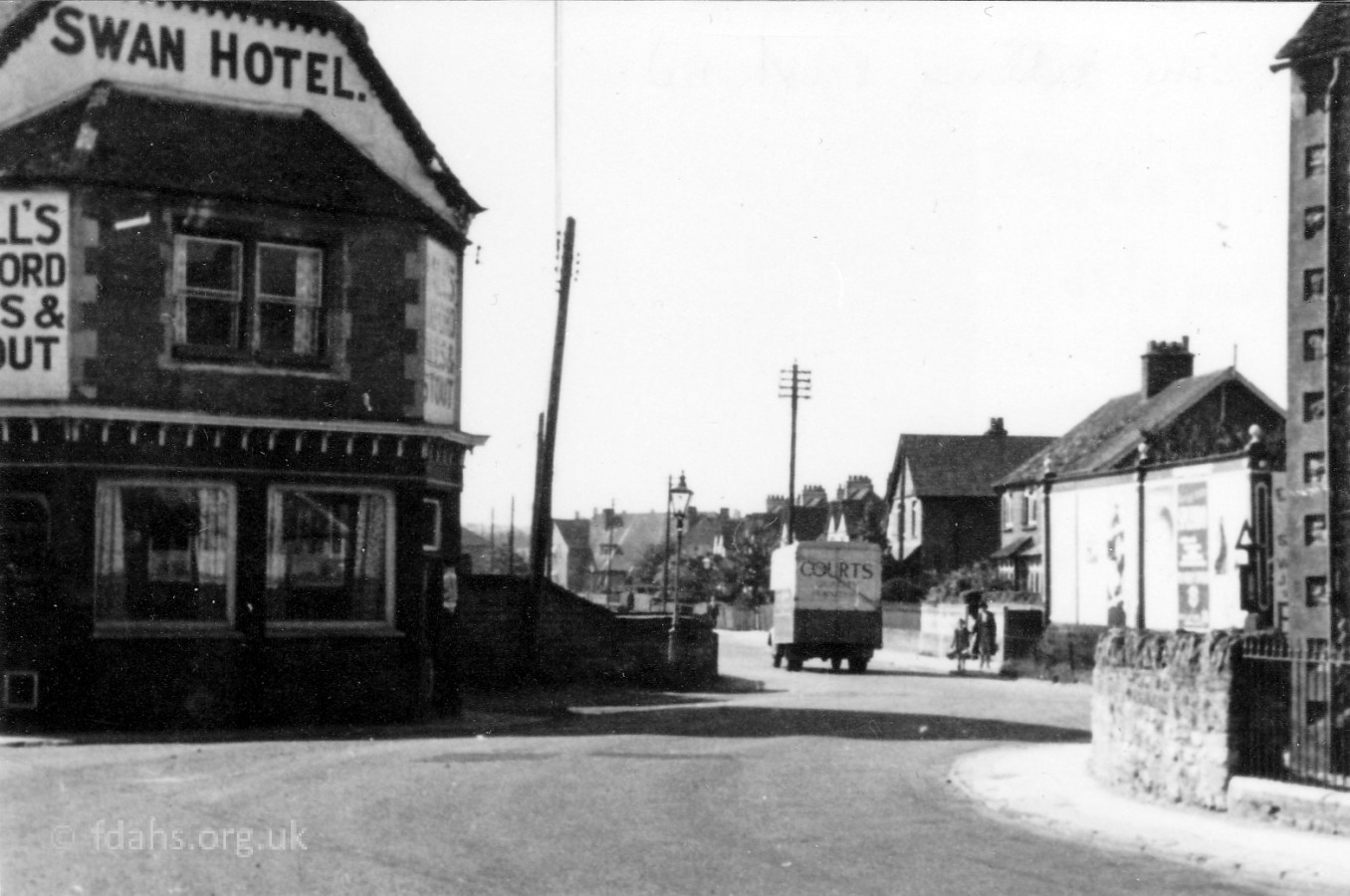
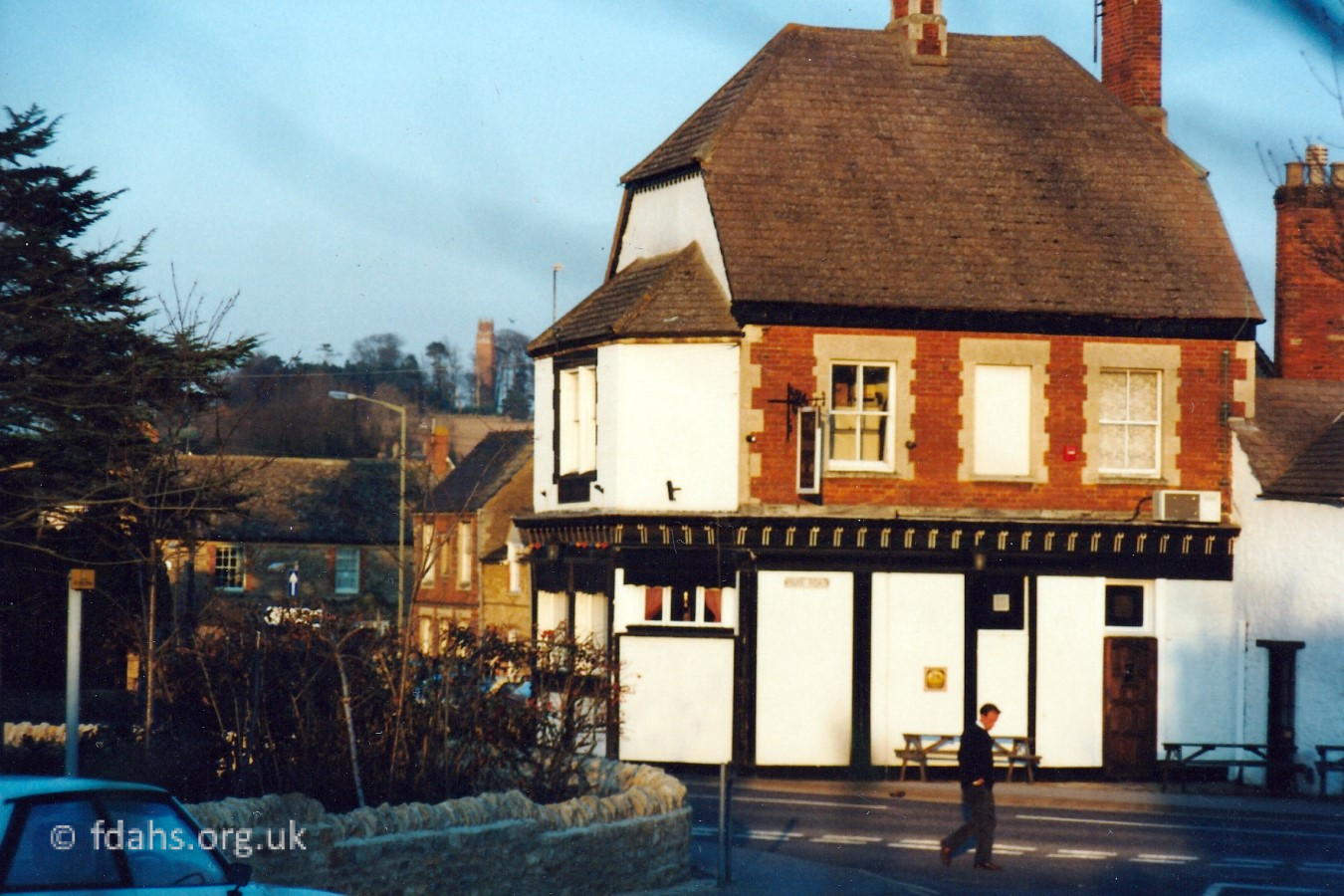
1953. The Swan Hotel at #1 Park Road taken from Bromsgrove. The sweet shop and low stone wall sticking out from the right had to be demolished in the 1970s when Park Road became a main route to the new bypass. The walled garden to the right of the Swan Hotel had to be moved back. Eagle Motors opposite is boarded up and destined to become the start of the Eagles housing development.
1995. The second photo is looking at the Swan taken from the Eagles. The small public garden left from the demolition of the sweet shop is in the foreground left. Bromsgrove is behind the garden.
 1988. Looking up at the start of Park Road. Compare this with the older photo from 1953 above. The white wall on the left is part of the Swan Inn, once a hotel. Opposite the Swan is now a road simply called Eagles, a new residential estate. The name derives from Eagle Coaches that used to occupy this whole area. The nearest corner at the bottom right of the photo is the small public garden mentioned earlier, that used to be Elliott’s sweet shop. The far corner now grass covered was occupied by the Eagle Motors car repair workshop and stores, shown boarded up in the previous photo above.
Mr A.L. Woodward lived in the house on the right just past the grass corner when it was next to Eagle Motors. He had a workshop in his garden where you could get shoe laces or shoes and other leather things repaired. He also had a shoe repair shop in London Street. It was up past A. Allnatt’s, the sweet shop and general stores around the 1930s on the corner of Skinners Lane.
Further up the road in the distance on the left, the new large brick building with a flat roof is Cardinal House. It was occupied by Baker & Sons funeral service in the 1980s/90s, later becoming the Co-operative Funeral Service. It is on the corner of Regal Way and marks the start of the industrial estate that grew up on the site of the old railway.
1910 & 2000. Right next door to the Swan Inn is what is now #3 Park Road. The old photo shows Paul Goddard’s ‘Grampy’ (1877-1931) outside his house with his horse. Next to him is his brother-in-law John Ritchings. Later, Fred and Nora Morton used to live there; they had a general store in London Street until 1986, selling school uniforms, bicycles, toys and lots more. They also used to own the little sweet shop on the corner of the Eagles, mentioned above.
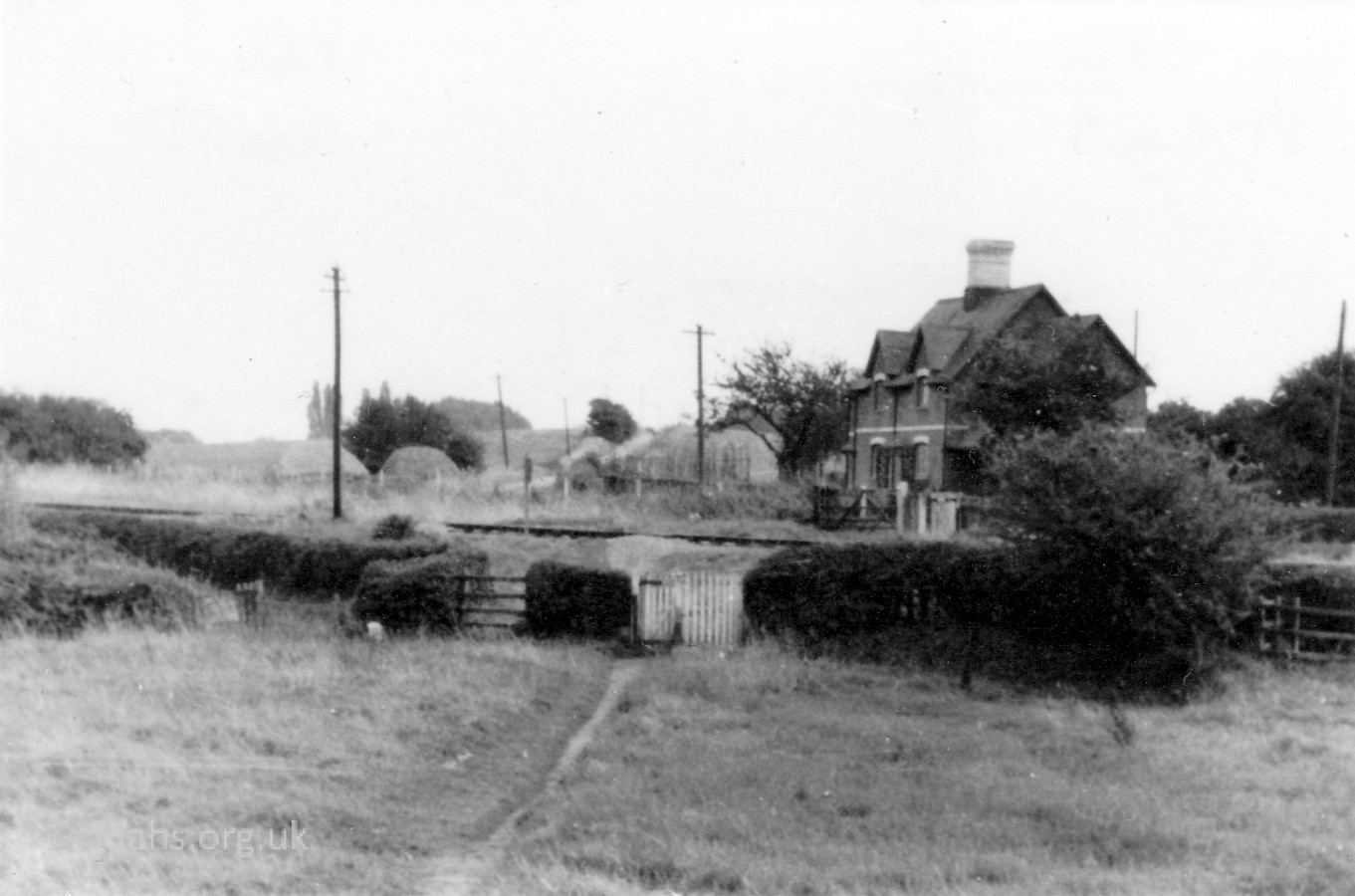
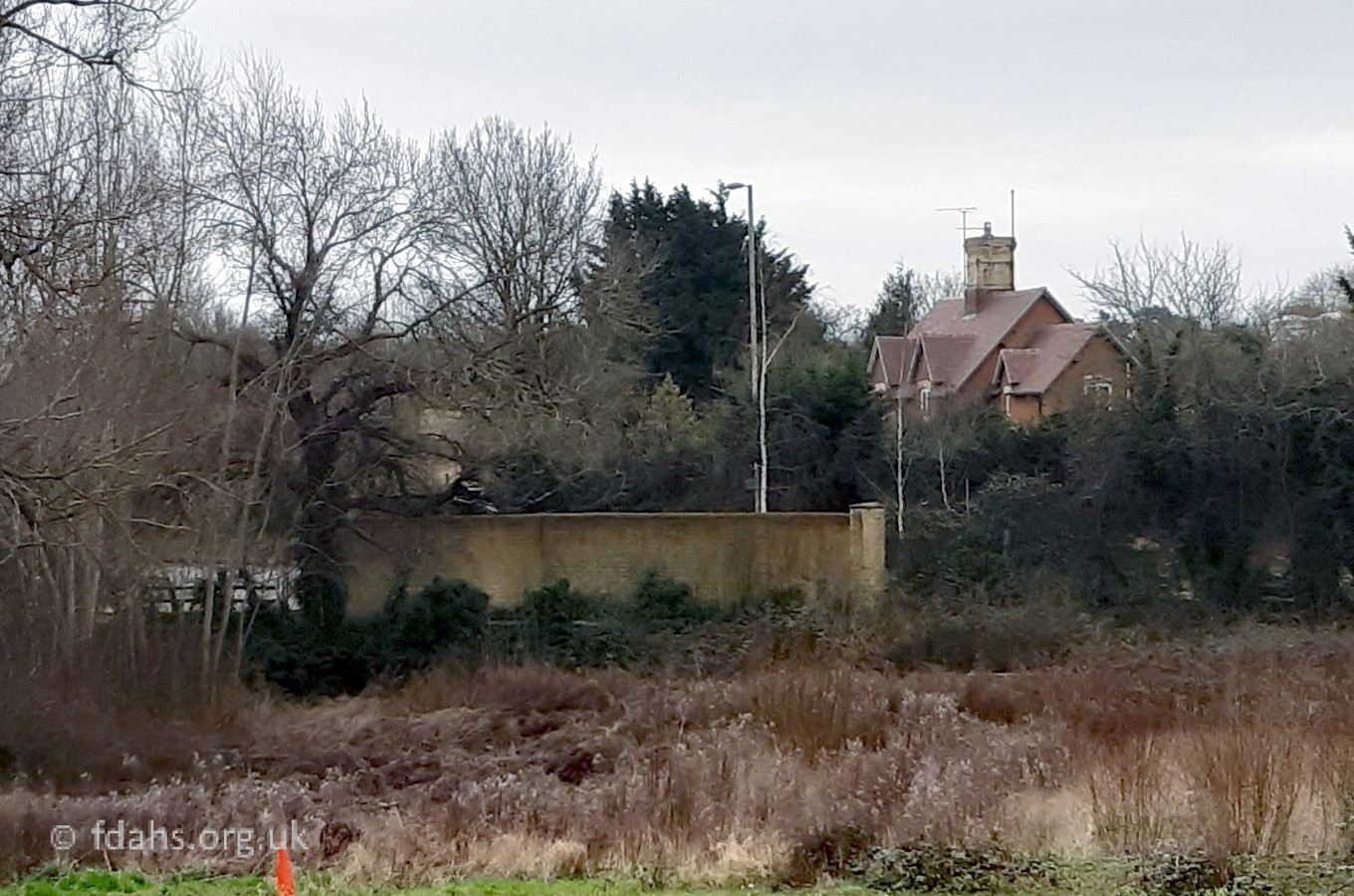
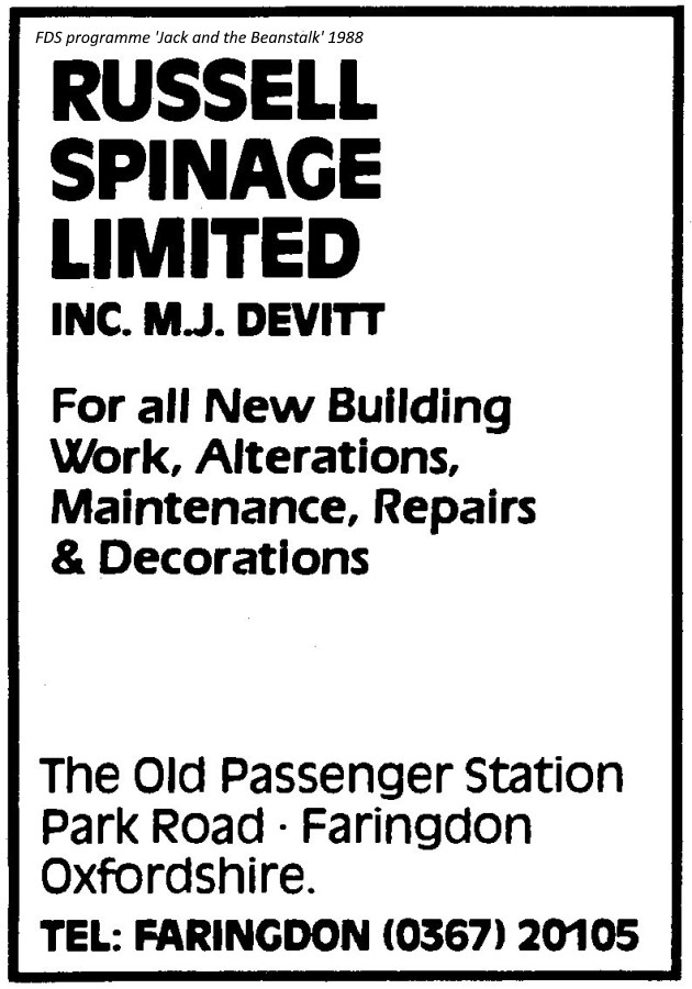
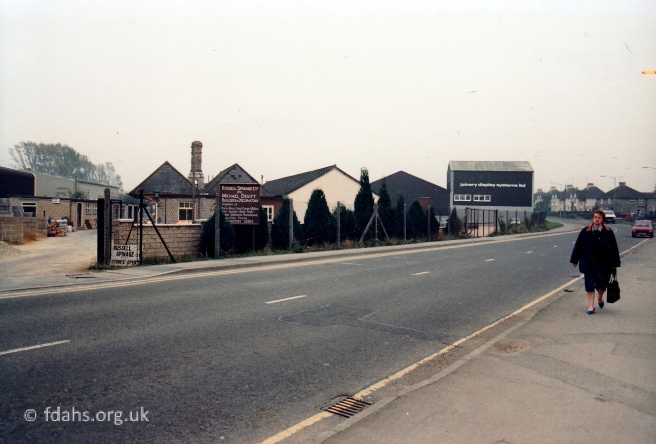 1988. Further up the road, just past Regal Way and Cardinal House is the old Railway Station, which had closed in 1963. For a while, the old waiting room then became an undertaker’s ‘Chapel of Rest’. Shown here, the area was occupied by Russel Spinage & Michael Devitt (builders & decorators). Further up the left side of the road are numerous industrial buildings that sprung up on the site of the old railway line.
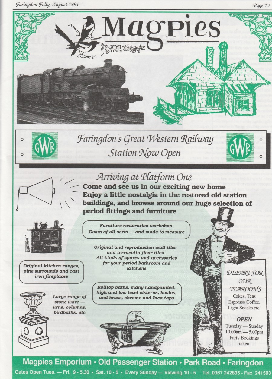
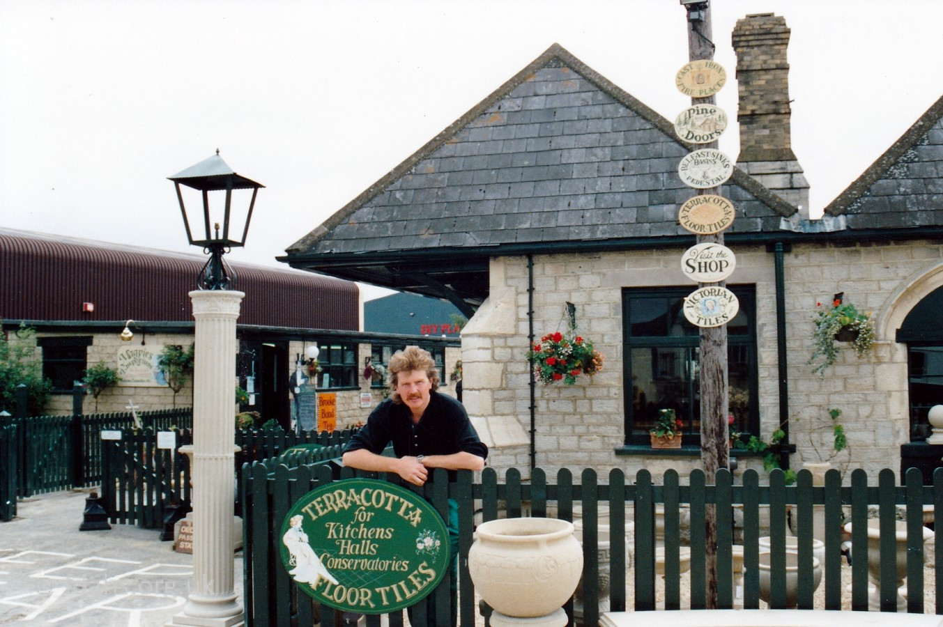 1991. Graham Benton outside the recently restored station buildings for his new Magpies Emporium. Much of the work was done by himself and wife Michelle. (Four years earlier, he built the old Magpies Emporium on a derelict site at #28 Gloucester Street). The shop specialised in house clearance and salvage and was stocked will all kinds of treasures from baths and bicycles to tiles and terracotta pots – see advert below. Many reminders of Faringdon’s lost railway era were also kept scattered around and there was a tea room too. During the late 1990s (?) it became Scats (farmers’ wholesale store). Since 2002, it is now The Old Station Nursery for pre-school children.
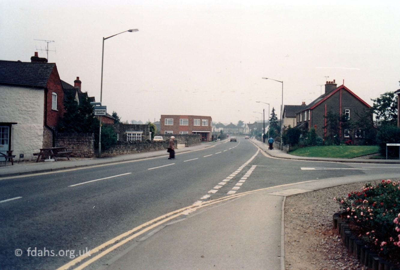
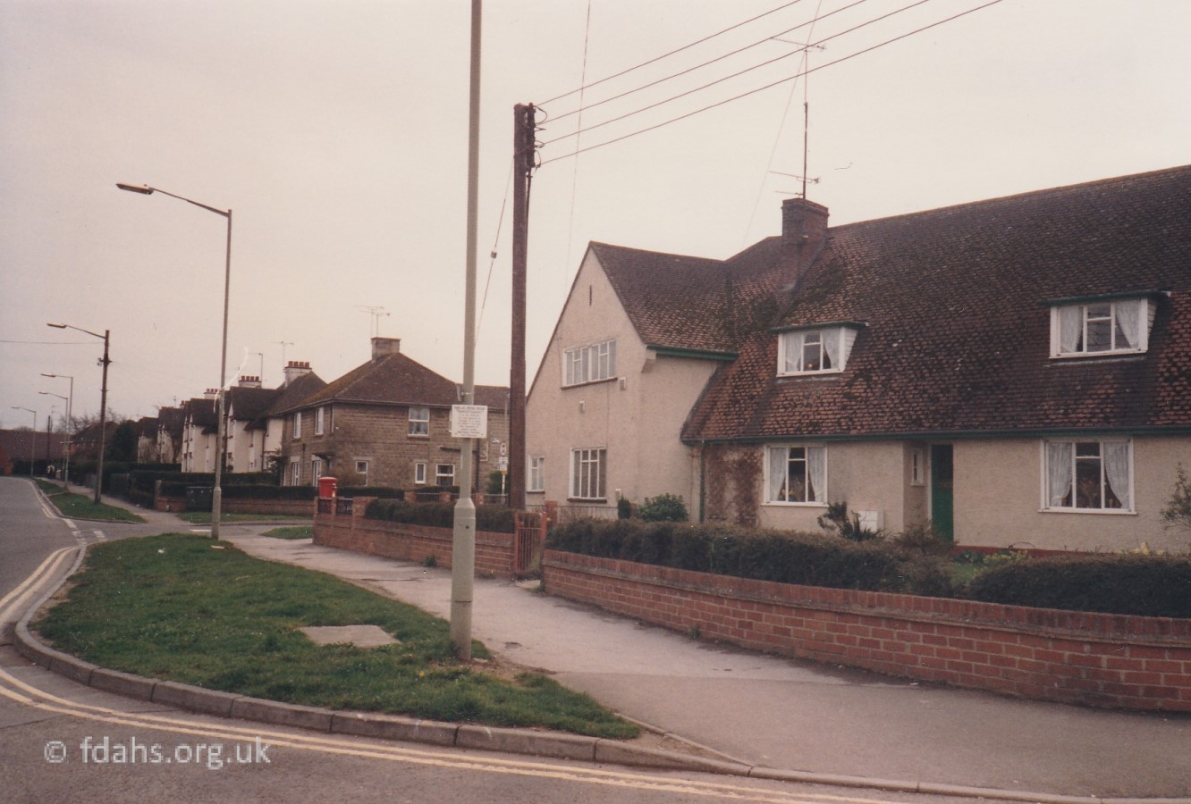 1988. The next junctions on the right side of Park Road are Marlborough Close and Marlborough Gardens, council housing estates that were built during the 1950s. The latter leads up to the housing estate on Folly View Road. Out of view on the left side of Park Road here is now the new Tesco Supermarket car-park, the area once occupied by the Express Dairy.
The Express Dairy
 1966. The Express Dairy in Park Road, next along from the railway station and directly opposite the turning into Marlborough Gardens. There is a milk churn lorry at the milk bay having just collected milk from the local farms. The chimney was 120 feet high and was a prominent feature in Faringdon. Underneath the chimney was a ship’s boiler that came from Liverpool to what was then the Buscot Dairy before it was purchased around the late 1920s by the Express Dairy, who enlarged and modernised it. They took over the old sawmills next door in 1961, but the sawmills continued in their premises further up the road. The business was advertising as the ‘White Horse Dairy‘ in Park Road from 1972-92. The dairy and most of the old sawmills site was later demolished and occupied by the Joinery Display Systems’ factory.4 From 2013 the area became the car-park for Tesco’s superstore.
The dairy was first developed by the Buscot Dairy when they moved from Oldfield Farm, Eaton Hastings back when milk and cheese were transported from Buscot by river to London. The dairy manager and a consortium of local farmers bought the business from Sir Alexander Henderson, the first Lord Faringdon, who had purchased Buscot House and Estate in 1889. They then moved here to Butts Road to make use of the growing railway network and farmers brought in their milk to be processed and sent off by rail to the town markets. A deep well was dug to supply the dairy with its water. Express Dairy bought them out around the late 1920s. They enlarged and modernised the plant, and instituted a daily run by road tanker to their depot in London. Mr Arthur Seary was the driver. and has told some very interesting tales of his exploits. The dairy tankers through the town in the late morning were often a headache for the local traffic – from early in the morning a steady stream of lorries. vans and old fashioned horse and milk floats travelled along Station Road to unload full churns of milk on the dairy ramp. The rattle of the empty churns on the return journey must have annoyed many a resident. When there was a glut of milk, a cheese powder and powdered milk for babies were processed and, depending on the wind or lack of it, you were treated to a heady smell – good or bad according to your taste in foods.
The Steam Saw Mills
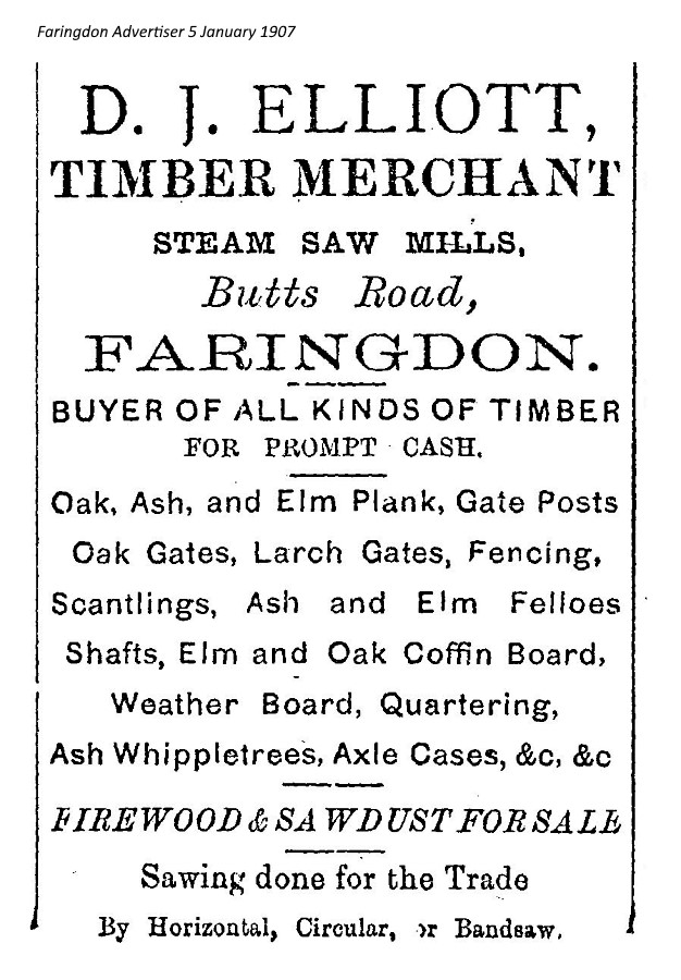
The sawmill, next to the dairy had been there since 1897 and was owned by Henry ‘Harry’ Hodgkins for a few years. It was then purchased by Mr Elliott who traded under D.J. Elliott & Sons, Steam Saw Mills, Butts Road. Mr Elliott, senior, lived in the house called Hiawatha, now Livingstone House, in Coxwell Road. His family made an important contribution to life in Faringdon, his son, Merle Elliott, who later emigrated to Canada, built the Rialto Cinema in Gloucester Street. Miss Eileen Elliott ran Hignell’s sweet shop in London Street. There was also a small sweet shop run by the family on the corner of Eagles, now the open garden.
Mr Elliott bought the boiler from the dairy and the intervening walls were demolished to enable the boiler to be rolled into its new position. To supply the steam for the mill, the boiler consumed waste wood and sawdust plus a truck-load of coal per week. In the later 1950s, the boiler failed an inspection test. It was cut up for scrap and the associated steam engine was dismantled and sold to a lace factory in Nottingham.1 During WWII, the mills were again sold, this time to Montague L. Meyer & Sons, but still traded under the Elliott name.
The sawmill was Faringdon’s biggest employer right up to when it closed. One of whom was Neddie Pauling, who started work at the mill at the age of thirteen, a few weeks after the mill had opened in 1897. His starting wage was 7/6 a week. He was still there when the mill closed in 1961. In the early years their were 9 men and 4 boys, who used to deal with 7 trees per day. The main trade was elm for coffin boards and boxes to hold tinplate which used to be exported from Wales. The sawmill was finally closed in 1961 when the Express Dairy next door purchased the premises. Many of the 32 employees had to find work outside Faringdon, even as far away as Harwell and Oxford, as there was very little other light industry in the town.
![]() The Grand Old Man of the Sawmill 1897-1961 (Faringdon Advertiser 1961)
The Grand Old Man of the Sawmill 1897-1961 (Faringdon Advertiser 1961)
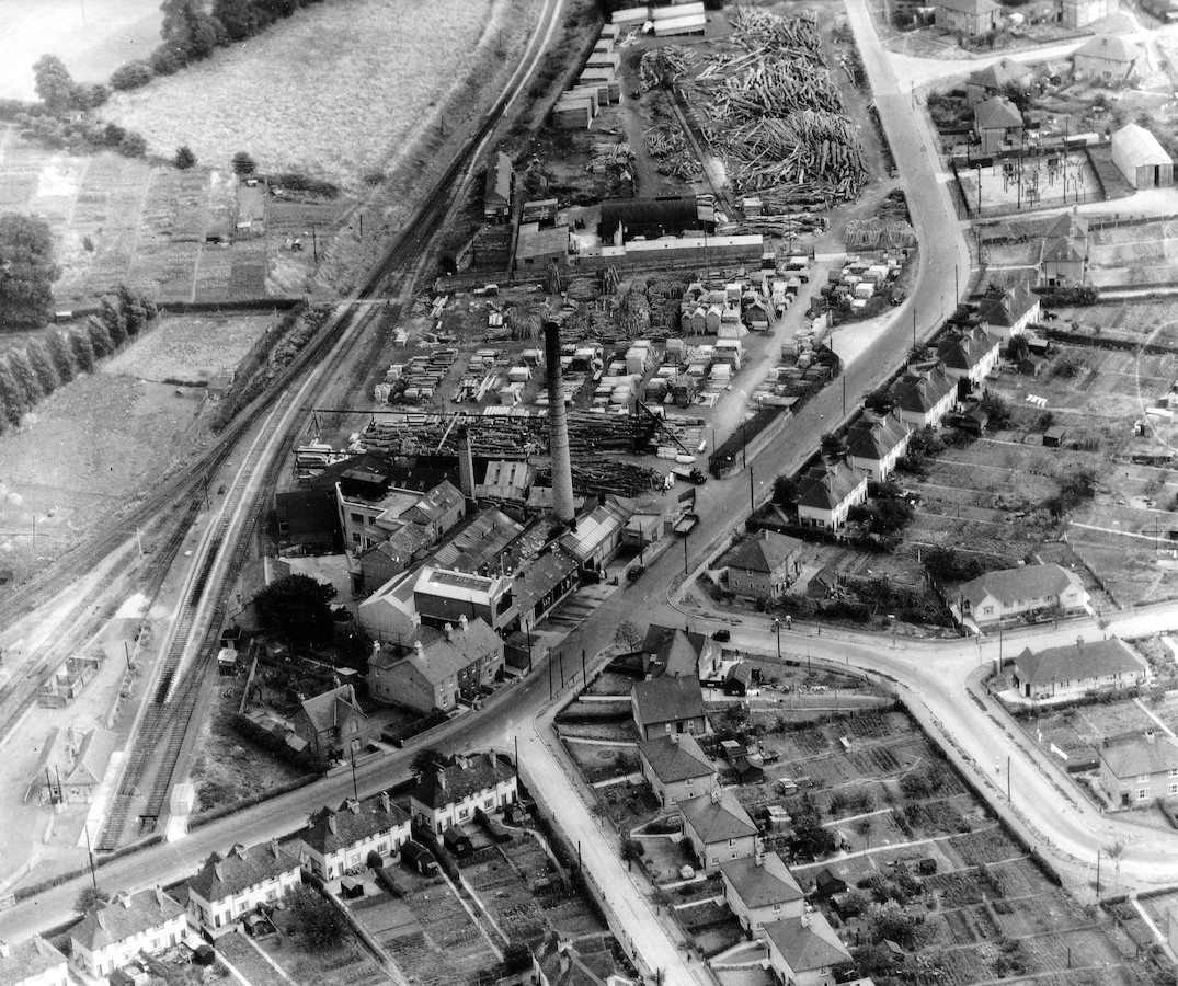 1955. The 120 foot tall chimney at the Express Dairy is adjacent to the smaller 60 foot chimney of D.J. Elliott & Sons Saw Mill. Running up the left side is the Faringdon Branch Railway. The road through the centre-right is Park Road. In the middle foreground is Marlborough Close followed by Marlborough Gardens. In the centre background are the top mill buildings with the new Turner sheds and stacks of tree trunks waiting to be picked up by the travelling crane and taken to the mill. Top right is the entrance to Butts Close leading to the old Royal Marines Camp (more below).
The Hobble Footpath
Looking again at the aerial photo above – along the right-hand edge of the railway line (centre background, to the left of the stacked timber) can be seen at this time a short row of 3 or 4 attached houses called Hobwell Cottages. On the opposite side, left of the railway are the Hobwell Allotments, which were later taken over as the school playing field and now protected waste-land. You can just see a lightish patch on the railway line here, which was a level crossing for the Hobwell Footpath. Now called ‘The Hobble‘, it crosses in a straight line from Park Road towards the secondary school that used to be there at the bottom of Southampton Street.
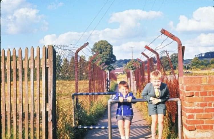
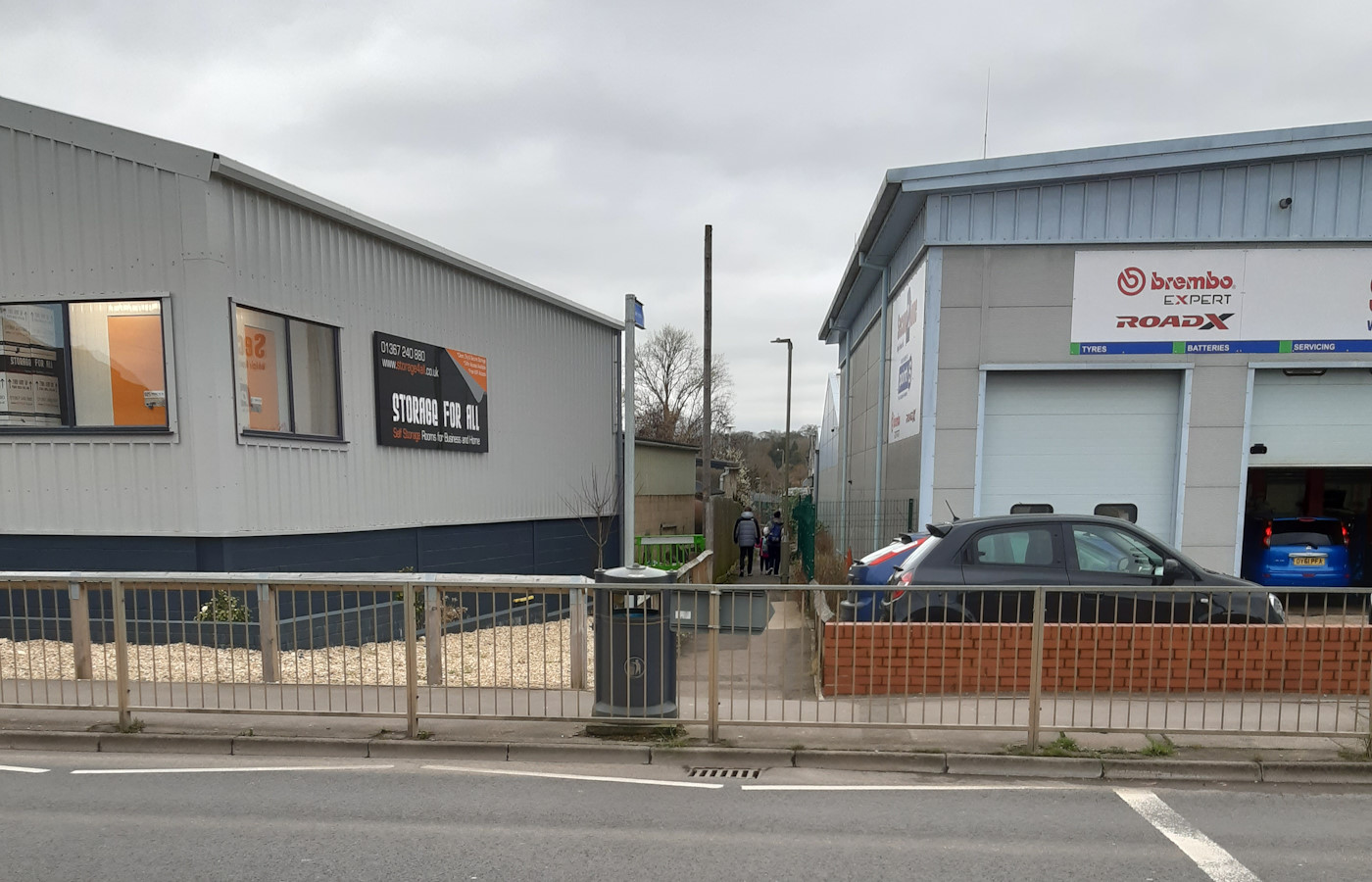
The first photo from around 1963 shows Ray and Micky Pill at the entrance from Park Road as it was back then. The area on both sides, behind the security fencing, must have been cleared of timber ready for the coming industrial developments. Today on the left is ‘Storage For All Ltd’ and on the right is ‘Second 2 None’ for car servicing & repairs. The footpath now provides convenient access to Harding Close and the rest of the new Berners Way housing estate.
Recreation Ground & Tucker Park
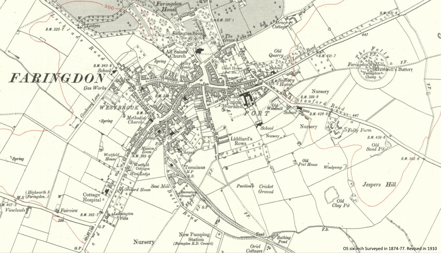 There is a ‘Recreation Ground‘ marked on this map from 1910 on Park Road between the lower saw mill / dairy buildings and the Hobwell Footpath. It is said that it had swings, a roundabout, a see saw, and a shed to play in. The area was, by the time of the above aerial photo taken in 1955, swallowed up by the sawmill storage yards.
Map – Faringdon in 1910. Reproduced with the permission of the National Library of Scotland: https://maps.nls.uk/view/97772849
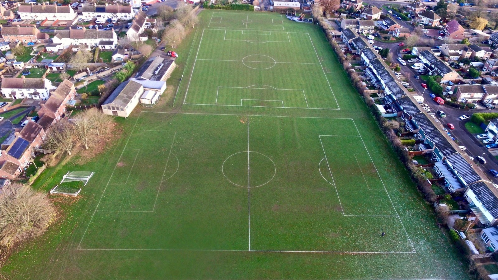 On the exact opposite side of Park Road is the new recreation ground Tucker Park (photo), on land which was given to the town by the Tucker family in 1948 as a memorial to Mike Tucker who had been killed during the war. The family owned Tucker’s Nursery & Garden Centre that used to be off the Stanford Road. Tucker Park has also become the home of Faringdon Town Football Club.
Faringdon Dormy Shed
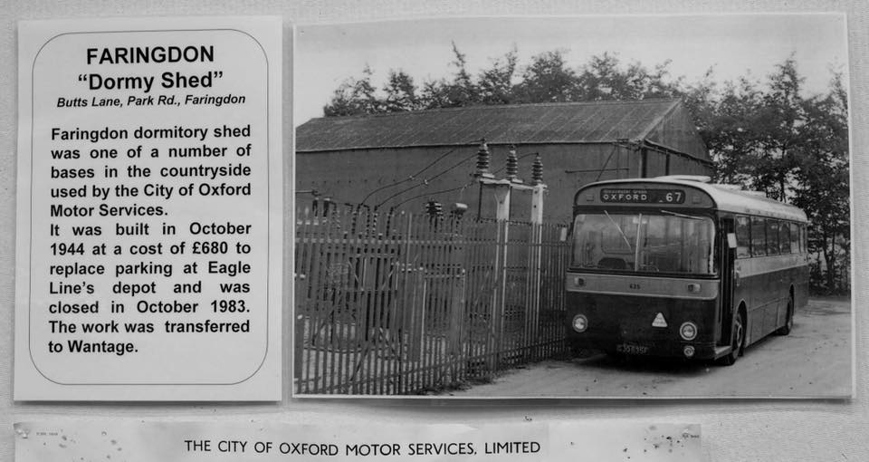 c1945. On the right hand side of Park Road just past the entrance to Tuckers Park and opposite the entrance to The Hobble footpath, there is a short side-road. This was once called Butts Lane and lead to what used to be the Faringdon Dormy Shed. It was one of a number of a countryside bases used by the City of Oxford Motor Services. In 1985 planning permission was given naming “The Old Bus Depot 62 Park Road” for the “demolition of the existing garaging shed for buses and erection of two light industrial units”. It appears to be the same fence still there today. Sephtons (Kitchens of Distinction) was established there the same year on the right-hand corner of the side-road.
Old Sawmills Road
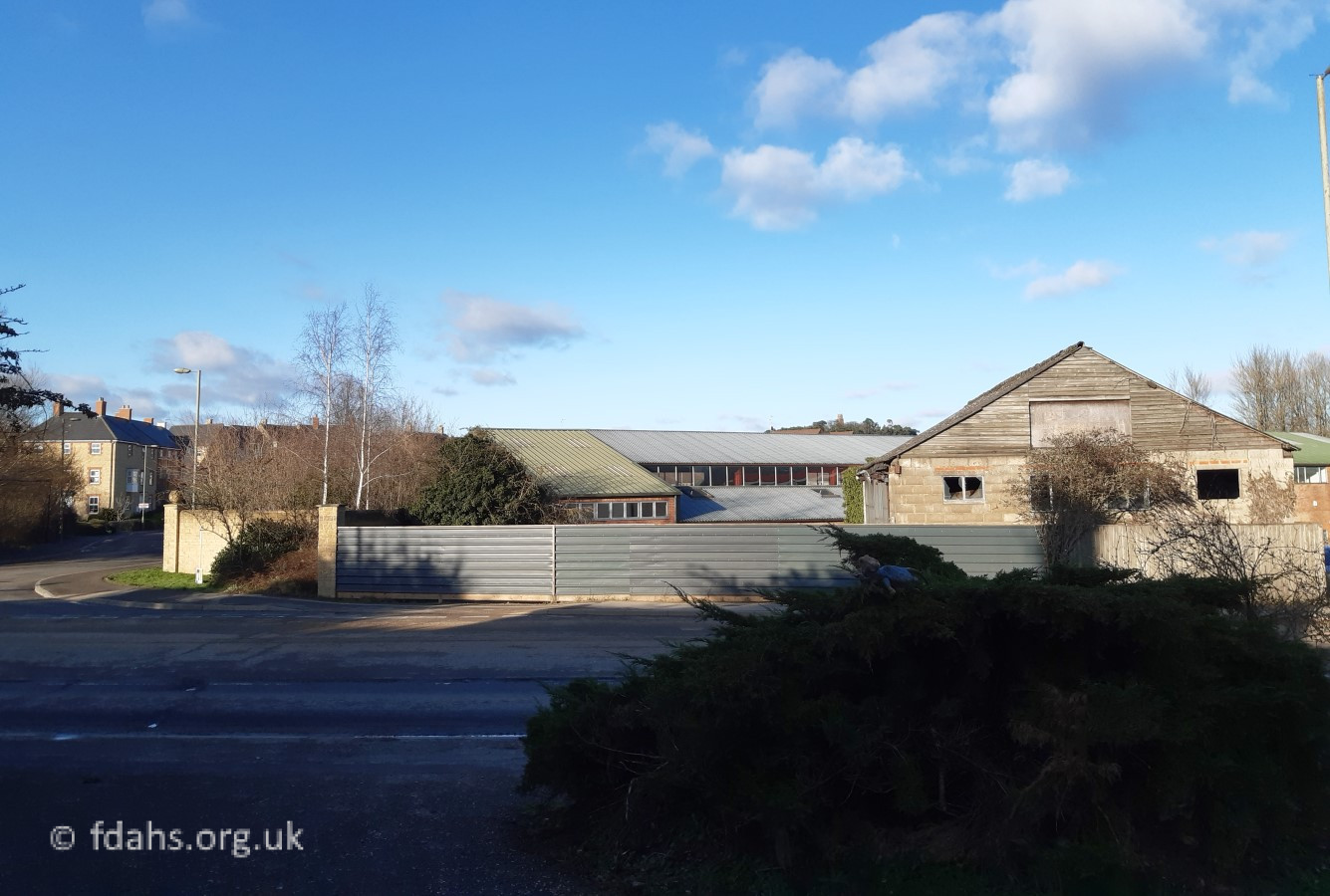
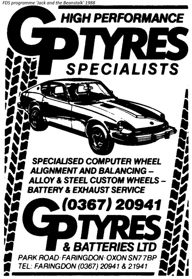
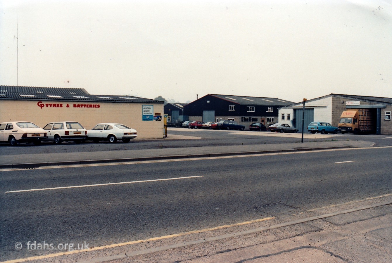 1988. Further up Park Road on the left is Old Sawmills Road, which is named after the timber sawmill that was there since 1905. Since the closure of the railway in 1963, the whole area on the left side of Park Road has undergone much redevelopment. On the left here is CP Tyres & Batteries, which was later demolished and became Second-2-None (car repairs). Cameo Glass, on the other corner has also been rebuilt and is now Active Plumbing Supplies. Cameo Glass moved to larger premises up Pioneer Road (the next turning on the left). The building marked Challow next door is now Screwfix.
Royal Marines Camp
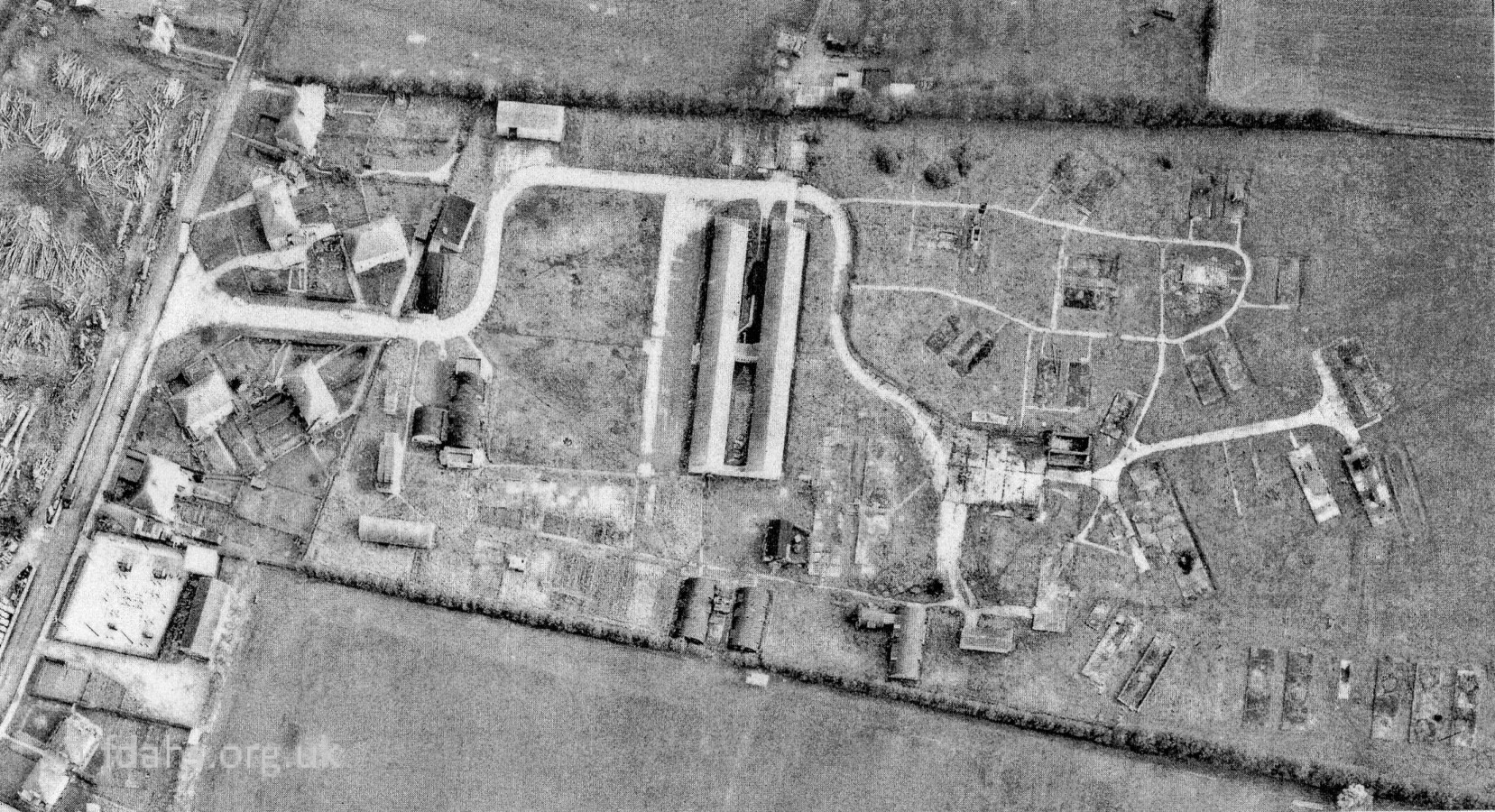
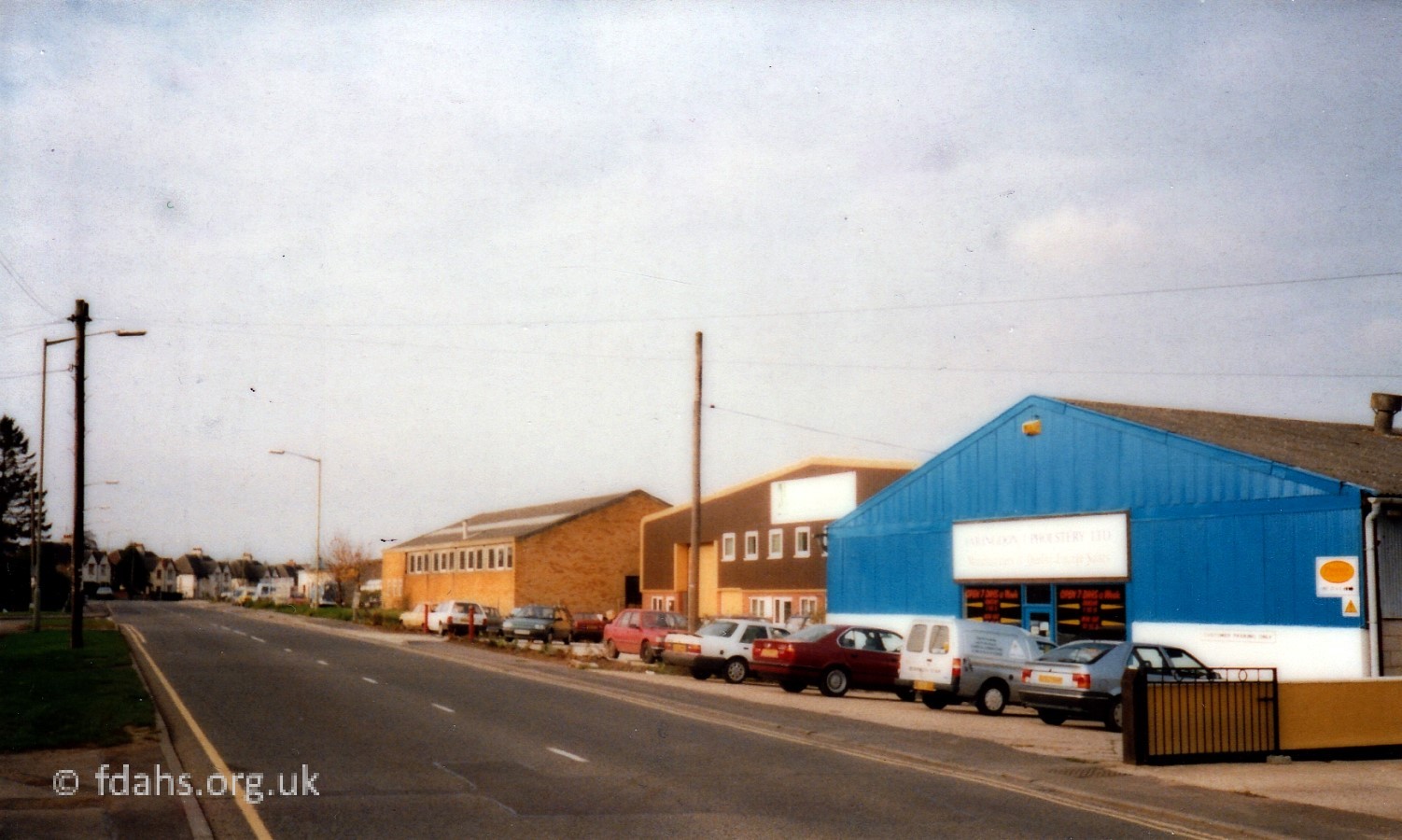
1988 & 1955. A little further up the road, the corner with the present day Butts Road is shown on the right. The building with a blue-grey frontage in the distance across the road on the left is Faringdon Upholstery. This new Butts Road was previously known as Butts Close as it was originally a short ‘cul-de-sac’ with just four houses (aerial photo). During WWII it lead into a Royal Marines Camp. As you went through the main gate there was a large parade ground where they did there training, behind the parade ground was a long line of offices and officers quarters. The huts all around the rest of the camp were the marines’ quarters. After the war it became an Agricultural Training Camp.


In 1952, one of the Nissen Huts (first on the right, just inside the gates), which was used as a cinema and theatre during the war and later just for agricultural storage was converted back into a theatre by Faringdon Dramatic Society.
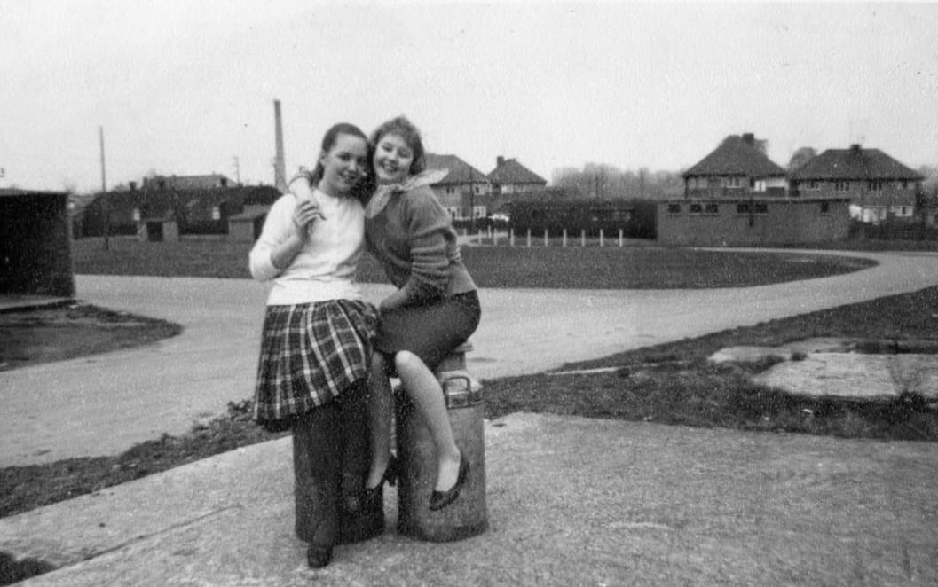 c1960. Carole Vincent and her friend posing inside the grounds of the old Royal Marines Camp with the old parade ground and entrance from Butts Close behind them. The ‘Little Theatre’ can be seen in the distance behind the girls on the left. The tall chimneys of the dairy and wood mill on the far side of Park Road were still there at this time. The entrance from Butts Close is just to the right of the girls and the low flat-roofed hut on the right was used by the local cadets. Some of the other huts (off photo to left and behind) were used for class rooms; a Needlework class took place in one of them
On entering the old Royal Marines Camp from Butts Close … “The Little Theatre was the hut on the right and the Cadets on the left. l remember we put on a production of ‘The Water Babies’ there when I was at school. Our Drama teacher, George Young, belonged to the Club (Dramatic Society). It was very nice, looked so posh with beautiful red velvet curtains across the stage with red cinema seating. I don’t think anyone of us had seen inside a theatre before.” Gloria Stallard Foley.
The rough ground beyond the site became a static caravan site called Sandshill Caravan Park. In 1972 there was a community of 40 families living there, who all had to be relocated when the whole area was demolished that year to make way for a new housing estate – Marines Drive and Town End Road. Both new roads lead off from the end of the ‘close’ now renamed Butts Road.
… and Onwards
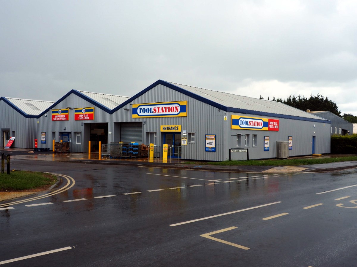
1988 & 2022. Turning around at the corner with Butts Road and looking back into town, the road just visible on the right is Pioneer Road. On the corner is Cameo Glass again, now Active Plumbing Supplies. The next road down on the right is Old Sawmills Road again and you can just see CP Tyres & Batteries, now Second-2-None, car repairs. On the other corner of Pioneer Road, out of sight in the first photo was Travis Perkins, builders merchants, for a number of years, it has since closed and the property was taken over by Tool Station in June 2022.
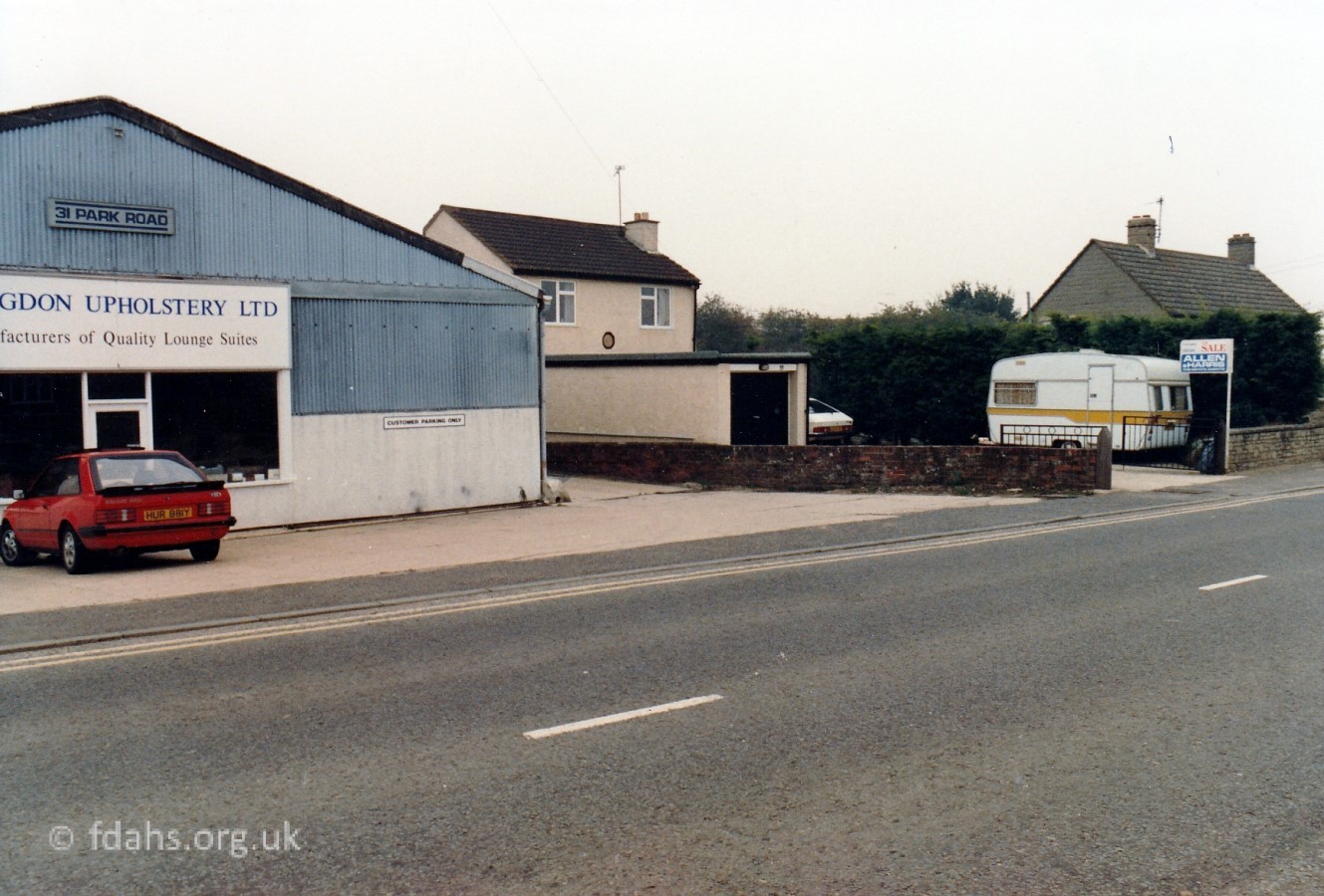
1988. Continuing up Park Road and arriving at #31 Faringdon Upholstery on the left. It was there for many years and has recently been converted into another motor repair garage – Protyre. The second photo is looking back towards town again. On the right is Faringdon Upholstery, then A.P. Heating, and Travis Perkins (timber & building supplies), which is at the corner with Pioneer Road. Cameo Glass can just be seen on the opposite corner at this time.
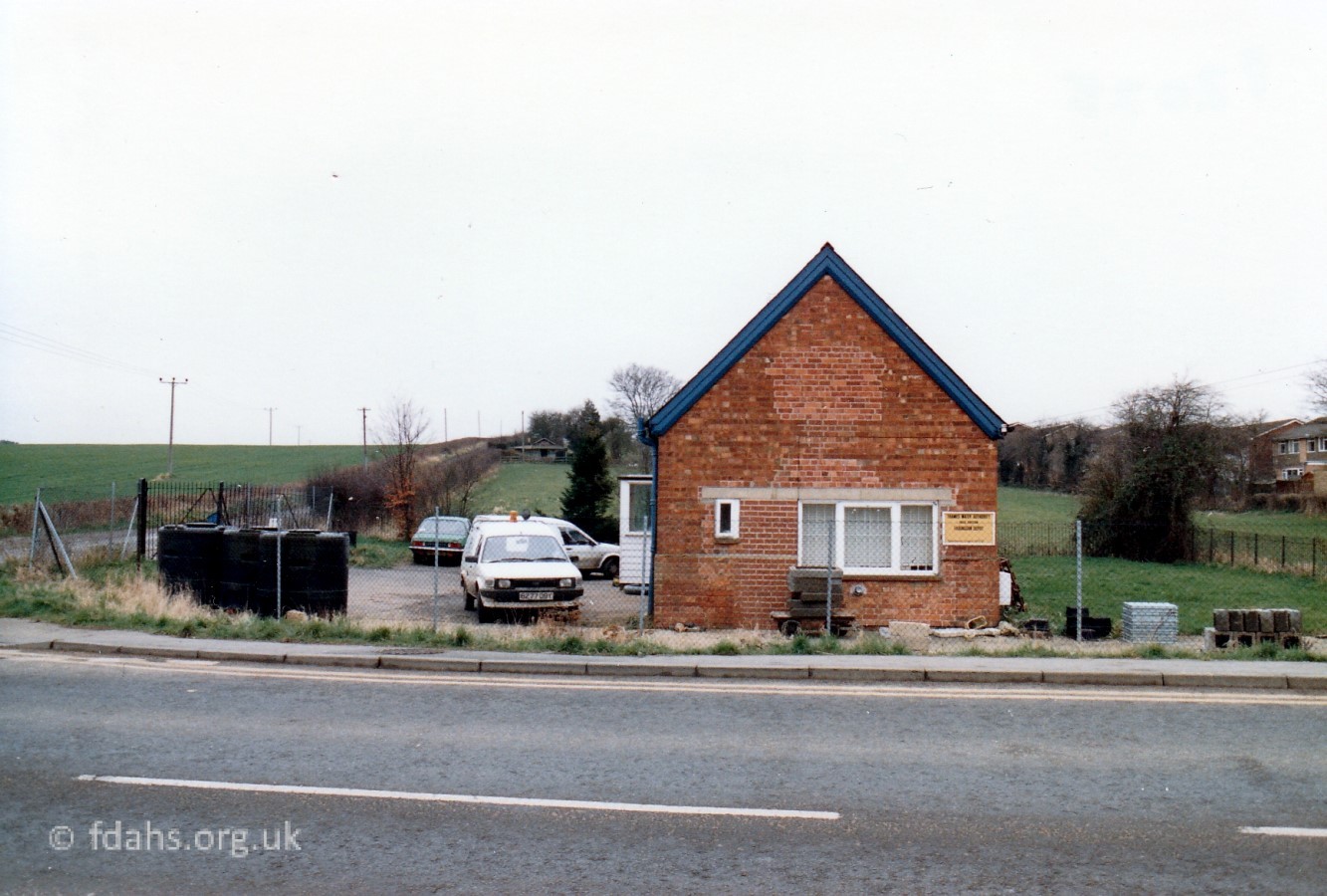
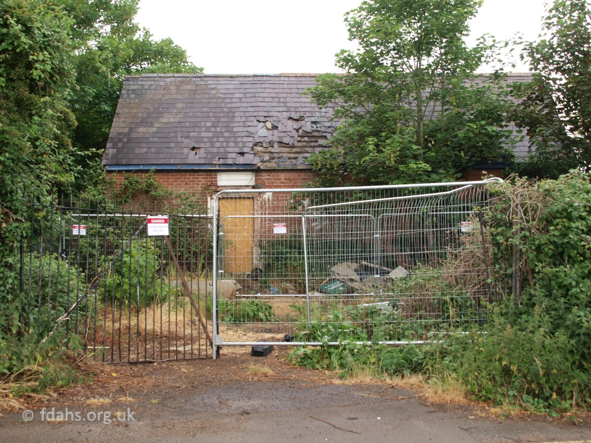
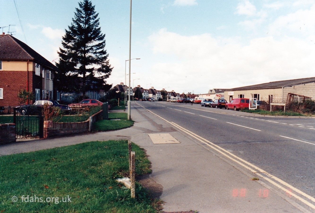
1980s & 2020. Further up Park Road on the right is an old pumping station, which is situated on the corner with Sandhill Lane, now called Sands Hill, just visible to the left. This lane used to be a rough track leading up the hill to an old quarry called ‘Faringdon Pit’, which was used as a town waste dump and later a part of it was taken over by Rogers Concrete. During the war there was a arms installation and munitions dump up there. The track continued to Wicklesham Quarry and then onwards as a public footpath via Cole’s Pits to the village of Fernham. The pumping station was stated as ‘New’ on a map of 1910 and owned at that time by Faringdon Rural & District Council. It appears in the above photo from the 1980s to be still in use and occupied by the Thames Water Authority, probably until nationalisation in 1989. It later became derelict and very overgrown, and was demolished in 2021 to make way for another new housing development. The ‘Old’ pumping station was further up at the end of Sandhill Lane just past what became Rogers Concrete. Park Road more or less ended here before it was extended to join up with the new bypass.
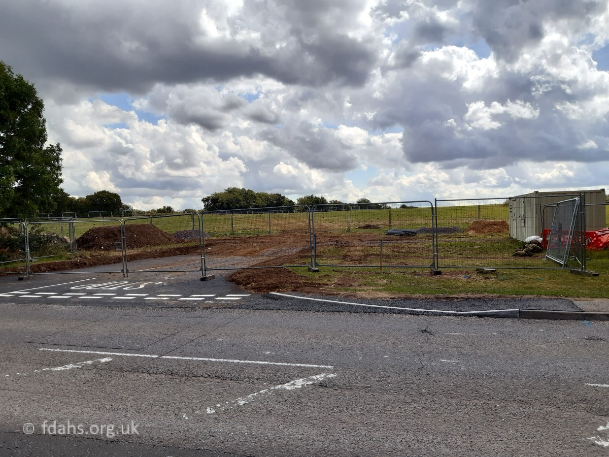
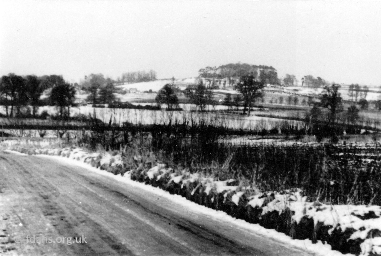 1953. A winter view looking across towards the Folly , taken from the top of the hill on Sandhill Lane. One or two houses can be seen on the Stanford Road, otherwise there was nothing at this time to obstruct the view apart from a few trees. A housing development called Oriel Gardens and a brand new primary school are being built in the field at the side of the lane here in the 2020s.
 2001. Looking back into town a little further up Park Road. The low building just beyond the new ‘town wall’ (officially opened 1997) is the old pumping station and just in front is the turning to Sandhill Lane (shown above). This section from here up to Oriel Cottages was originally an unnamed single-track dirt road that had to be upgraded and extended to join up with the new bypass opened in 1979.

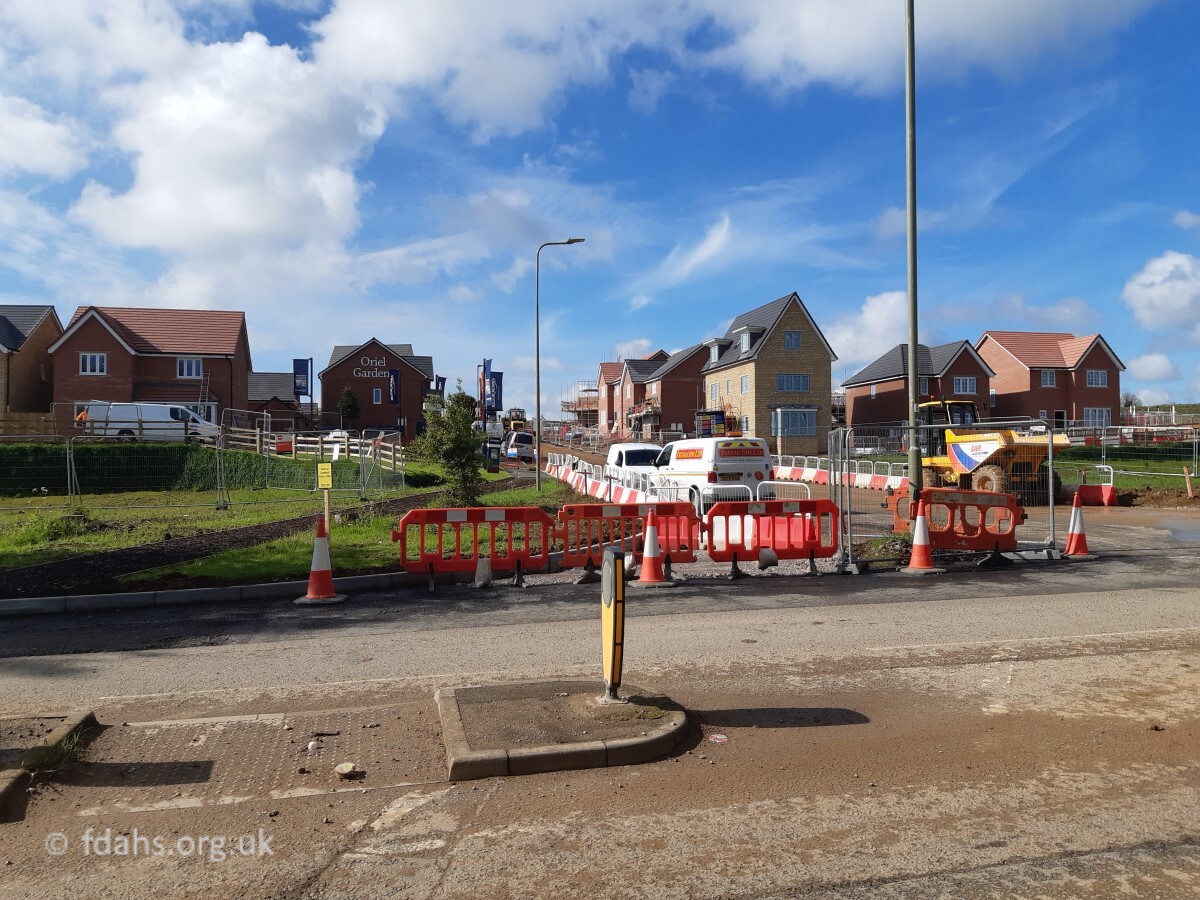
c1990s. Looking up the road just past Sandhill Lane. The old garage on the corner with Palmer Road can be seen in the distance and the new petrol station just beyond. Oriel Cottages is hidden behind the trees on the field boundary. The other two photos taken in 2020/21 are looking at the same fields on the right, where work is starting on a new and very large housing estate called Oriel Gardens. A new primary school will also be built at the top of the hill, expected to open late in 2022.
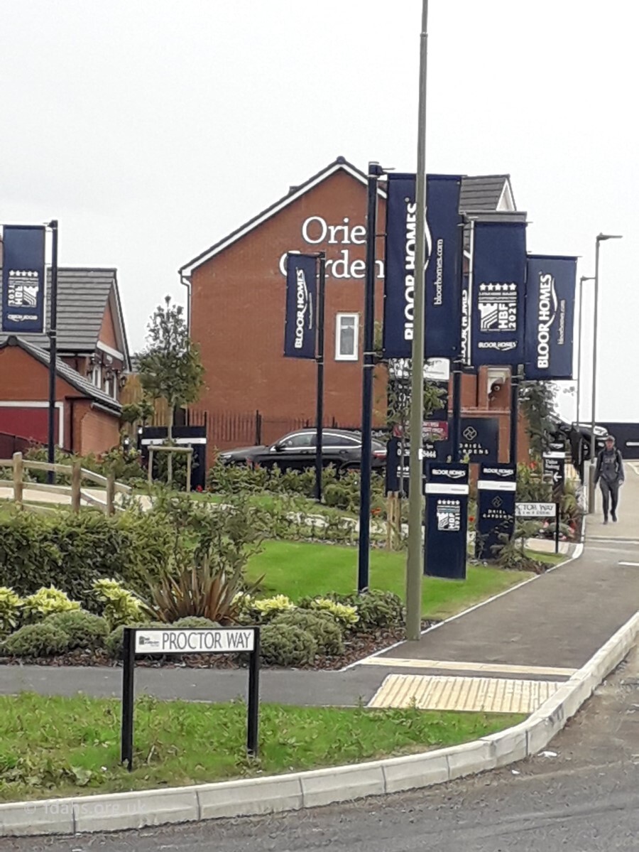 2021. The road into the new estate has been given the name of Proctor Way, after both James Proctor who died at Gallipoli in 1915, and his younger brother, Major Percival Proctor who died in Sudan in 1941 and whose name is also on the Khartoum War memorial as well as the one in Faringdon. Their parents Henry and Sarah Proctor, also deserve to remembered as two of the great characters who left their mark on the town. Read more…
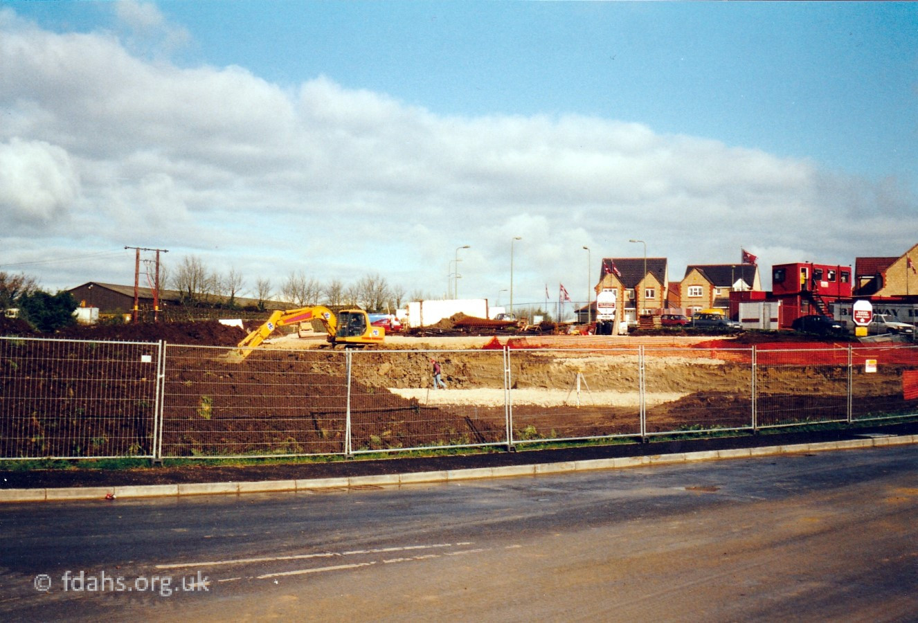
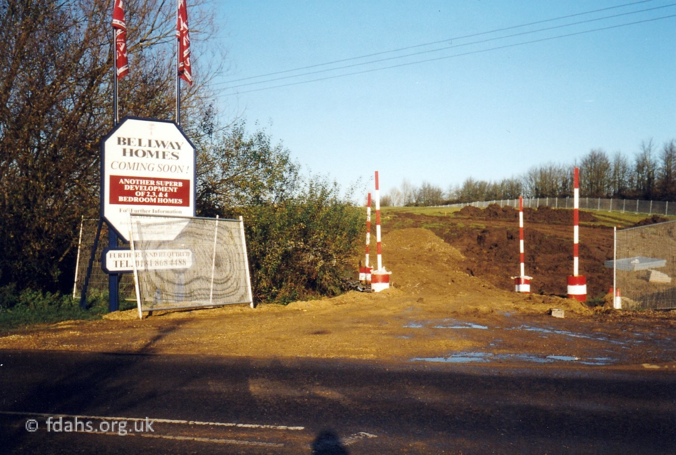
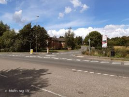
2001. On the opposite (left) side of the road, some of the new houses for the new Volunteer Way housing estate and the land being cleared for the new health centre. 1999. A little earlier, the new road being created by Bellway Homes, just past where the new health centre will be built. 2020. The last photo is looking back at Volunteer Way and The White Horse Health Centre now well established.
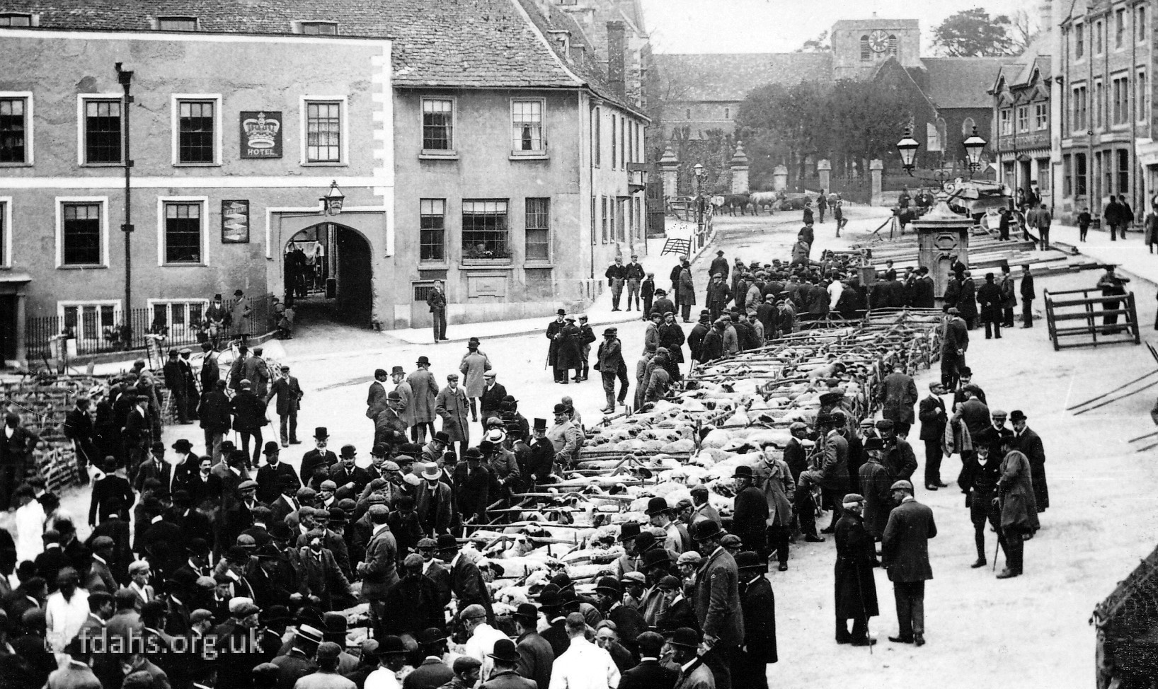
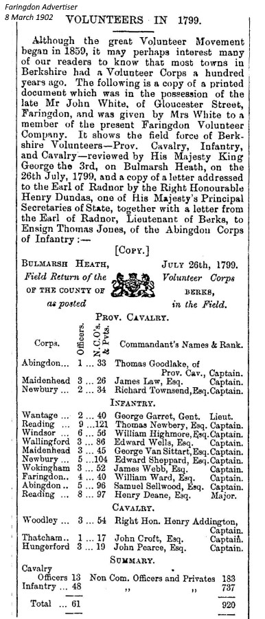 Volunteer Way has been built over the old public footpath from the end of Southampton Street. It gets its name from the route taken from town by volunteer soldiers to their rifle range, since at least 1551. The Berkshire Volunteer Corps in 1799 had an infantry totalling 785, which included 40 men and 4 officers from the Faringdon area under Captain William Ward. The ‘Volunteer Rifle Range’ is marked on the map shown here dated 1876. This was where volunteer soldiers used to practise firing at the butts that were placed at the foot of Jasper’s Hill. It was still being used by the volunteers in WW1.

1999. About 50m up the road on the right is Oriel Cottages, situated on what was originally an unnamed but later tarmacked single-track road leading to Wicklesham Quarry and Wicklesomelodge (Wicklesham) Farm (see 1876 map above). The track remains now as part of a public footpath across the bypass and through the farm to the villages of Shellingford and Stanford in the Vale. The main road shown here is where the railway line used to be (see below). From here on, a brand new road was carved along the route of the old railway line to join up with the new bypass opened in 1979. Oriel Cottages were once very remote and became known as the “Haunted House”. It was said that there was a poltergeist that used to throw stuff about in there and when the family moved away, the ghost, which had fixated on one of the daughters followed them. Oriel Cottages were probably so called after Oriel College which owned a large amount of land in and around the town.
 1953. This older photo shows the railway line, which was still in use but only for freight at that time. The field belonged to the Liddiard family, who had a grocery shop next to Lloyds Bank in the Market Place. The footpath in the foreground is coming downhill across open fields from the end of Southampton Street. The bottom of the field here was said to be very marshy as it was fed by a brook running alongside Park Road. The path goes through a gate and across the brook and the railway line to a gate on the other side where it meets the rough track coming from the end of Park Road to Oriel Cottages. The track continues left a bit then straight on past the front of the cottages and over the horizon to Wicklesome Farm. This can be seen more clearly at the bottom of the map above. At the broken hedgerow and gate to the left of the photo was another footpath that used to lead to an old bathing pond that was Faringdon Swimming Baths for a short time in the 1930s. That path is now Palmer Road.
 2021. This photo was taken at the same place as the older photo shown above. The railway line is now Park Road. The broken hedgerow, footpath and gate to the left in the older photo above is now Palmer Road. The old footpath from the end of Southampton Street has now become replaced by Volunteer Way. At this point the original path has disappeared into a swampy area that has been fenced-off and neglected between Palmer Road on the left and Volunteer Way over to the right, probably when work was started on these new roads at the turn of the century. The brook still runs along the bottom in front of the wall, presumable erected to discourage anyone falling in as it is quite low down and very swampy in the winter. Near the wall what remained of a footbridge over the brook has slowly disappeared.
 2021. Palmer Road on the left now leads to another new housing estate and to the Folly Country Park on Jesper’s Hill, both developed in the late 1990s. It was once a footpath leading to the old bathing pond, about where the RAC building in the background of the photo is today. The earliest available council records show that planning permission was given to Townsend, Waite and Company Ltd in 1966 for this area to be used as a Coal, Coke and Timber Storage Yard. They then built a garage, store and workshop on the site as shown in the photo. Herbie Townsend, president of the cricket club had a scrap yard there in the 1990s. In 1983 permission was granted to Radcot Armoured Components (RAC) to build an industrial development behind the garage, right on top of where the brook and the old swimming baths had been.
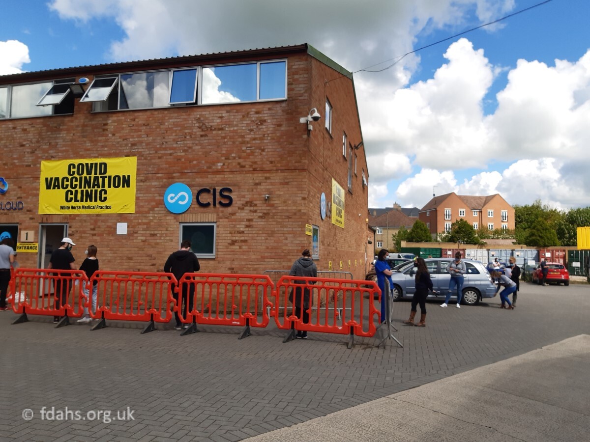 2021. Faringdon’s own Covid Vaccination Clinic. The Coronovirus Covid 19 pandemic was sweeping the world and killing millions of people. A national stay-at-home lockdown started in the UK during March 2020, it lasted for many months and was to be repeated two more times taking us well into the following year. Even so, by the following Spring over 100,000 people had died and hospitals were filled to bursting point. At the start of 2021, all the buildings on the RAC Industrial Site were out of use, so part of the RAC building was taken over by lots of doctors, nurses and local volunteers. Vaccinations were provided for all adults in town and beyond, starting with the elderly in January and working methodically down the age groups to age 16 by the end of August. Note the compulsory wearing of face masks and social distancing of 2 metres between people.
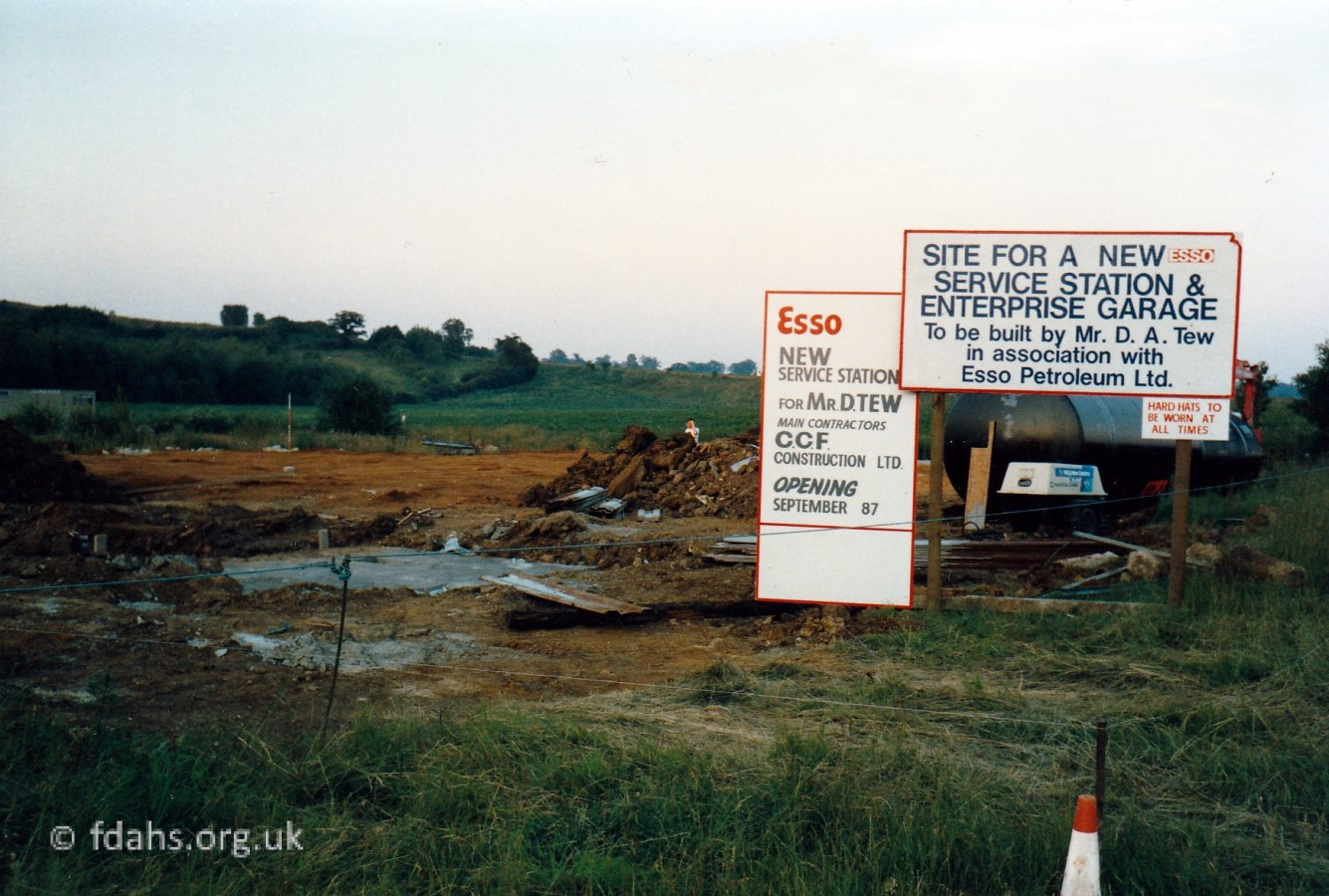 1987. Just to the right of the RAC Industrial Estate that was also being built around this time, the Acorn Garage and Enterprise Service Station was being moved from its previous location on Coxwell Road (on the old A420) where it had been loosing business due to the new Faringdon bypass.
 2021. Henry Blake Way – developed in the late 2010s as a new shopping area occupied by Waitrose and Aldi Supermarkets, and a Costa drive-in cafe. A hotel was added to the site in 2020.
 c1989. Looking back into town at the junction of Park Road with the A420 bypass (opened 1979) before the new roundabout was added in 1992. Oriel Cottages, where the road once ended, can be seen in the distance across the field on the left and the new petrol station on the right. This section of the road follows the route of the old railway line. The open field on the right was developed in the late 2010s and is now a new Henry Blake Way shopping area.
Trade Adverts in Local Media
The following shops and businesses were advertised in Butts or Park Road, Faringdon in the years stated:
ARROW, tyre suppliers, Park Road. FF 1991
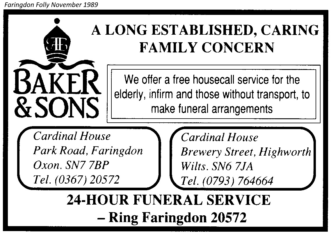
BAKER A.E & SONS, funeral service, Cardinal House, 5 Park Road. FF 1989-96, 1999, 2002. FCC 2006. Now CO-OPERATIVE FUNERAL SERVICE.
BRIAN BURGESS (NMV SERVICES), motor vehicles service, rear of dairy Park Road, FCC 2006.
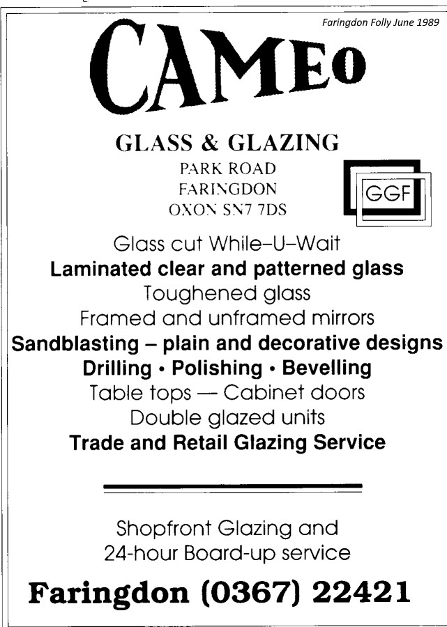
CAMEO GLASS & GLAZING, Park Road. FF 1989, FCC 2006.
CHALLOW PRODUCTS AGRICULTURAL LTD, Park Road, FDS 1978
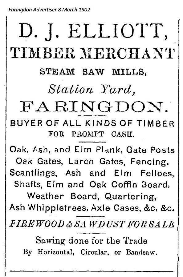
ELLIOTT D.J., timber merchants, Steam Saw Mills, Station Yard, FA 1902, 1904, Butts Road FA 1907, 1914, 1915, 1916, 1918, 1919. & SONS 1915, 1925, 1926, no address FA 1927, 1931, 1936, 1937, D. J. ELLIOTT & SONS FCP 1953.
FARINGDON GLASS LTD, Old Sawmills Road, FDS 1985.
FARINGDON UPHOLSTERY, 31 Park Road, FCC 2006.
GP TYRES & BATTERIES LTD, Park Road, FDS 1987, 1988, 1989, FF 1989.
HOBOMANN (4×4 Specialists) & IMOGEN MOTORCYCLES, 27B Park Road, FCC 2006.
HOME CARE, vacuum cleaner repairs, Unit 1 RAC Ind Est, Park Road. FCC 2006.
JDS GROUP, Park Road, FCC 2006.
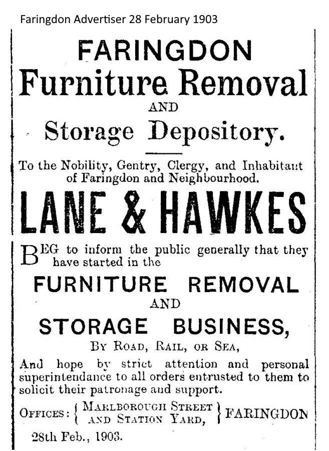
LANE & HAWKES, furniture removal & storage, Marlborough St & Station Yard, FA 1903.
MAGPIES EMPORIUM, period fittings and furniture, The Old Passenger Station, Park Road. FF 1991.
MARTIN SOBET DEVELOPMENTS LTD. Park Road. Assembly of cassettes. FV 1973.
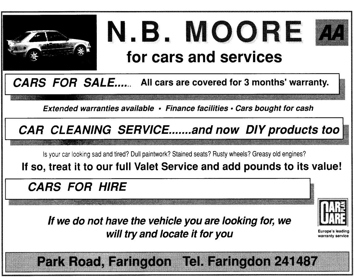
MOORE N.B. for cars and services, Park Road. FF 1990-1995. Unit 3 RAC Ind Est FCC 2006.
PETER KINCH PLANT LTD., Park Road. Building equipment, electric tools, FV 1972.
ROBERTS & LEONARD LTD. Park Road. Wood, bricks, garden tables. FV 1972.
ROGERS CONCRETE LTD, Sandhill Lane, FDS 1985, 1987.
RUSSELL SPINAGE DECORATORS LIMITED (INC. M.J. DEVITT), The Old Passenger Station, Park Road, FV 1972, FDS 1987, 1988, 1989.
SECOND-2-NONE, motor accessories, Unit 5 RAC Ind Est, Park Road. FCC 2006.
THE PORTWELL PRESS, printing services, 62 Park Road, FCC 2006.
WHALLEY M. & J., 31 Park Road, Carpets and Vinyls, FDS 1987.
WHITE HORSE DAIRY, Park Road. Dairymen G. & R. Cameron FV 1972, FDS 1985, 1987, 1988, 1989, FF 1992.
WOODWARD A.L., Boot Repairer and Retailer, Park Road, FCP 1953.
Media Key: FA = Faringdon Advertiser; FDS = Faringdon Dramatic Society; FV = Faringdon Venture; FF = Faringdon Folly; FCP = Faringdon Coronation Celebrations Programme 1953; FCC = Faringdon Chamber of Commerce 2006.
![]()

References:
- The Changing Faces of Faringdon and Surrounding Villages – Bk 1 p38,40,87. By Rosemary Church, Jim Brown, Millie Bryan and Beryl Newman. Robert Boyd Publications. Now out of print.
- Faringdon Advertiser 8th March 1902, etc..
- Faringdon Folly, August 1991, p12 Full Steam Ahead!
- Faringdon Folly, January 1992, p15 When milk was delivered by river by Jim Brown.
Researched by Ian Lee, December 2019.