Faringdon’s importance came from the crossing of two ancient ways: one from London, via Oxford and Abingdon, to Cirencester and on to Gloucester and South Wales, or to Bristol, Bath and Somerset; the other from the North of England, via Coventry and Burford, to Marlborough, Winchester and Southampton. These routes were of such importance the main streets were named after the places that they were leading to: for example Southampton Street, London Street, Gloucester Street and Marlborough Street.
London Street was referred to in a deed of 1689 and at various times up to the late 18th C. when it changed its name to Bull Street after a public house in the street. By 1881 it was being referred to in a deed as London Street otherwise Bull Street.
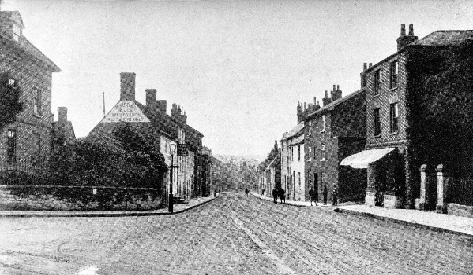
Southampton Street was simply called Suthstrete in 1399 and South Street in 1464 and then from 1537 it was known variously as Hampton Street or Southampton Street.
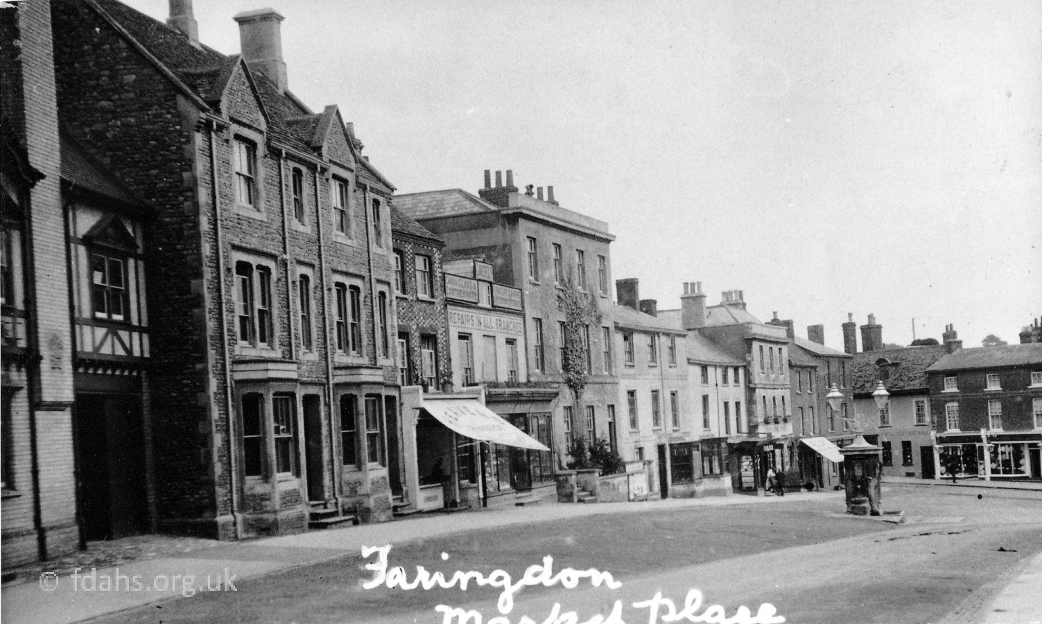
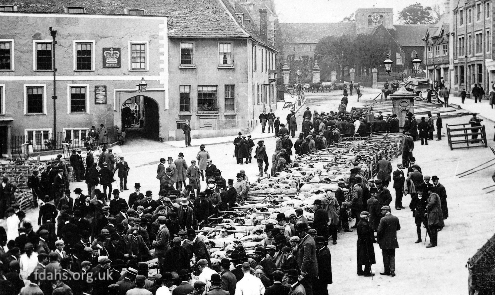
Market Place – In 1551 the centre of Faringdon was referred to as Highe Strete als [alias] Chepe Strete. Later it became Market Place presumably because the market, a Charter being granted by Henry III in 1218, was held there. Part of it however was referred to as Port Well in deeds of the late 18th and early 19th C.
The other roads leading from the outskirts of town indicate the direction in which they are heading, such as Lechlade Road, Coxwell Road and Radcot Road.
Faringdon was divided into two tithings, the boundary of which was the brook which now runs under the Narrows dividing the Market Place and the Corn Market. The tithing to the east of this brook was called Port and the one to the west was called Westbrook. For a long period of time deeds only referred to these two tithings and the main streets.
Most of the names of the roads and streets of Faringdon fall into four main categories: Location; Commemorative – of people, family, businesses; a Combination of the two; and the Natural World.
Street Names based on Location:
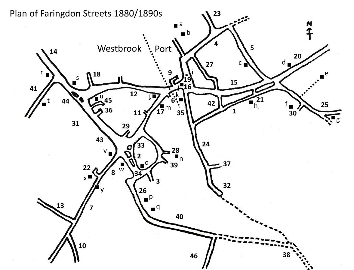
Key: The numbers [in brackets] refer to the numbers on the street plan. Street names in plain bold are old ones i.e. before 1900 and newer streets are in italic bold. An asterix * indicates streets and names no longer extant.
The names of the main streets link to their own pages containing more information and photographs from the 18/1900s.
Back Street* [1] – see Ferndale Street.
Badbury Close
Block Green* [2] – mentioned in the censuses 1861-1881. A block of houses built on the edge of a farmyard and facing on to a green.
Chapel Walk* [3] – led off Bromsgrove to a Strict Baptist’s Chapel. It later became known as School Lane.
Church Street [4] – indicates that it runs by the parish church.
Coach Lane [5] – shortened from the earlier name of Coach House Lane and this would indicate that a coach or coaches were stored there, probably at the wider end next to Church Street.
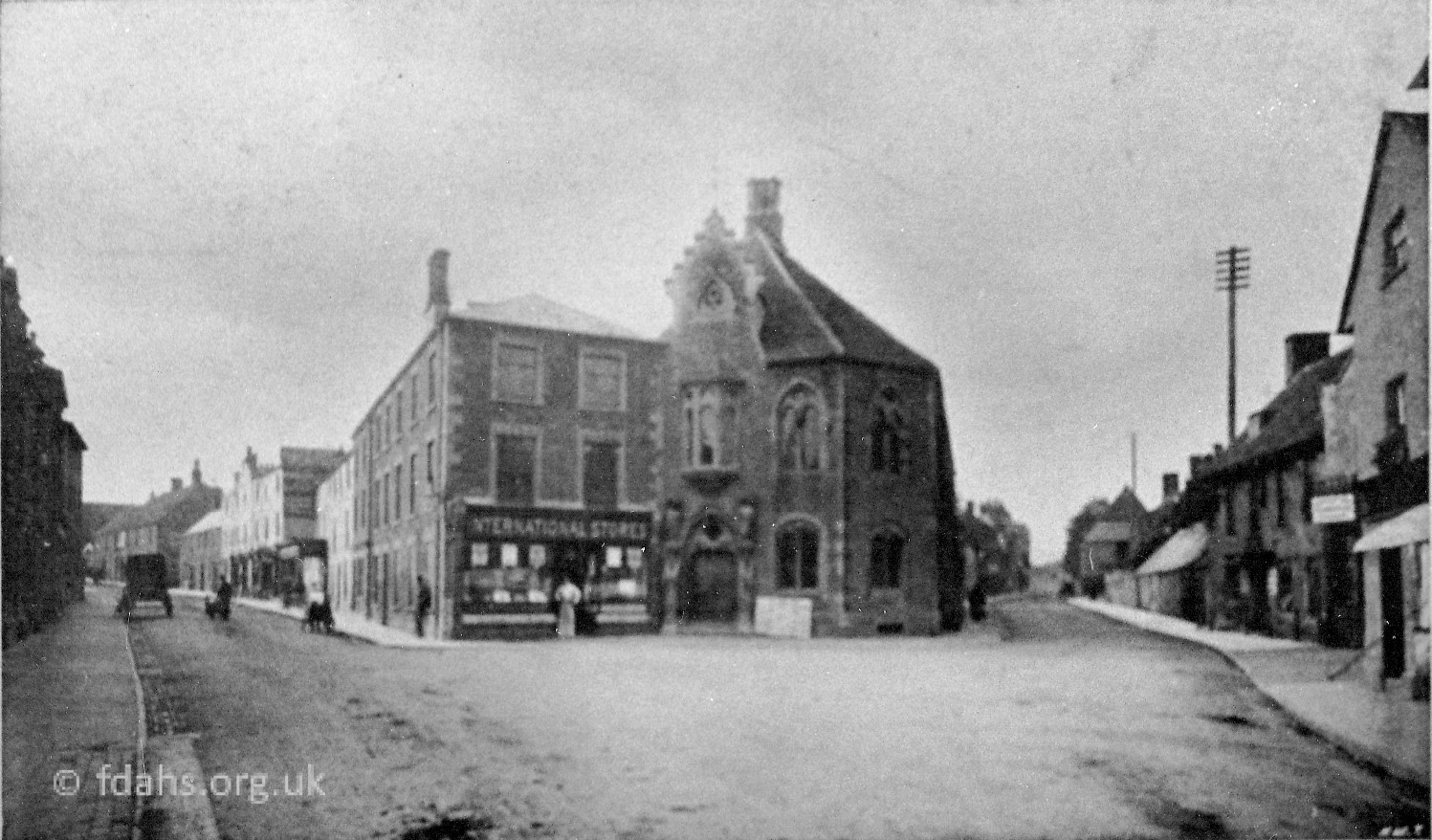
Corn Market [6] – on market days the farmers used to sell their corn there, away from the animals, so that their produce would not be interfered with. Later, in the 19th C., the Corn Exchange was built there so that transactions could take place under cover.
Coxwell Road [7] – leading to Great Coxwell, earlier called Shrivenham Road.
Coxwell Street [8] – the first part of Coxwell Road or Shrivenham Road.
Crown Yard* [9] – a small yard behind the Crown Hotel and which had a few small cottages there in the middle of the 19th C.
Fernham Road [10] – leading to Fernham, earlier called Little Coxwell Road.
Folly View Road
Foundry Lane* [11] – off Marlborough Street. The foundry it led to was owned by a man called Knapp.
Gloucester Street [12] – see Introduction.
Highworth Road [13] – leading to Highworth.
Lechlade Road [14] – leading to Lechlade.
Little Coxwell Road* [10] – see Fernham Road.
London Road [20] – see Introduction.
London Street [15] – see Introduction.
Market Place [16] – see Introduction.
Marlborough Street [17] – see Introduction.
Meadow Way
Nursery View
Parsonage Lane* [18] – see Pound Close.
Port Well* [19] – see Introduction.
Pound Close* [18] – off Gloucester Street. Near the junction with Lechlade Road there is a small lane which used to be known as Pound Close, probably after the pound where stray animals were kept, which was nearby. It is referred to by this name in deeds of the 17th and 18th C. and then in a deed of 1876 it is referred to as Parsonage Lane. This latter name could be connected to its proximity to the Wesleyan Chapel. Later it became known as College Row and recently has become part of Gloucester Street.
Pump Lane [21] – off London Street. Where there used to be a pump for householders to draw off water.
Queens Arms Yard* [22] – behind the Queens Arms public house in Coxwell Street.
Radcot Road [23] – leading to Radcot.
Sandsview
School Lane [3] – see Chapel Walk.
Shrivenham Road [7] – see Coxwell Road.
Southampton Street [24] – see Introduction.
Stanford Road [25] – leading to Stanford, earlier called the Wantage Road.
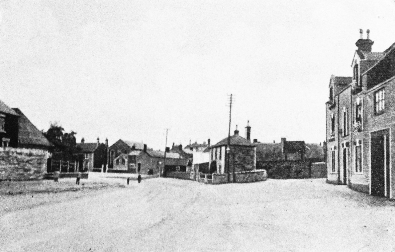
Station Road [26] – was originally Butts Road but with the advent of the railway it was renamed Station Road as far as the station and Butts Road continued thereafter. The only part of Station Road now remaining is from the Coxwell Street/ Gravel Walk crossroads up to The Swan public house and then it becomes Park Road.
Swan Lane [27] – in a deed of 1811 was called The Lane. It was given its present name after the Swan public house, no longer in business, which was at the junction with London Street.
Tan Yard Lane* [28] – led off Bromsgrove to a tan yard.
Town End Road
Union Street* [1] – see Ferndale Street
White Hart Walk* [29] – by the White Hart public house which stood on the corner of the Gravel Walk/ Marlborough Street crossroads.
Windmill Lane* [30] – mentioned in the census of 1841, was by a windmill on Stanford Road.
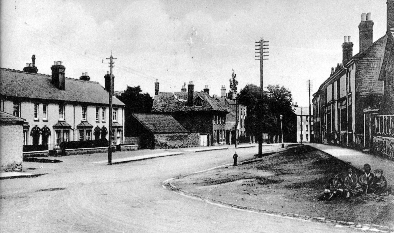
Westbrook* [31] – off Gravel Walk, named after the tithing and to the west of the town.
Westland Road
Windy Ridge
Worlds End* [32] – at the end of Southampton Street. Likely to have been called this as it was the furthest habitation from the Market Place on the Port side of town.
Commemorative Street Names:

Arthurs Hill [33] – H. N. Arthur, a coach and harness maker, whose business was located there. The road had to be lowered to the right of Arthur’s Hill as it was too steep for the intercity stagecoaches and the heavily laden horse and carts travelling to and from the market.
Bennett Road – the Bennett family owned Faringdon House during the 19th C. and the last member of the family died in 1918.
Berners Way – Lord Berners’ mother rented Faringdon House from about 1910 and later on Lord Berners bought the property and came to live here around 1931. His heir was Robert Heber-Percy and Lord Berners built the Folly Tower which had its grand opening on Nov 6th 1936, Robert Heber-Percy’s 21st birthday.
Cadels Row – the family of Cadel or Cadle have been recorded in the Parish Registers of Faringdon since the 16th C. The firm of Cadel the builder had premises in Church Street and in Southampton Street. There are no Cadels remaining in Faringdon today.
Carter Crescent – Frederick Carter owned the land and had a garden nursery on it. He was chairman of the F.R.D.C. from 1946-48 and again from 1952 to 1958.
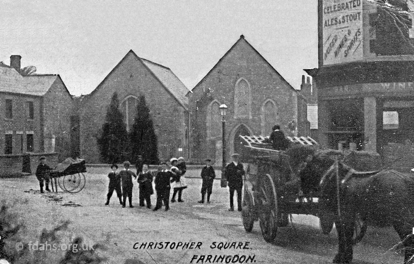
Christopher Square* [34] – called this in the 1881 Census and Trade Directory of 1931, origin of the name unknown.
College Row* [18] – mentioned in the census of 1881, see Pound Close.
Cromwell Close – Oliver Cromwell came to Faringdon in April 1645 and summoned the Governor of Faringdon House, which was held for the Royalists, to surrender. The Governor refused and Cromwell attacked on April 30th. He failed to subdue the garrison and departed a few days later.
Eagles – named after the Eagle Motors business which was at the junction of the Eagles and Park Road. They had a car repair workshop and stores, car-hire service and a fleet of coaches.
Ferendune Court – the Saxon name for Faringdon was fearn – fern-covered, and dun-hill. Faringdon has been spelt in many different ways over the centuries including Farendon, Chepyngfarendon and Farington.
Fletcher Close – was built on Norman Fletcher’s garden adjacent to his house. Norman was the last member of his family to run the baker’s shop in London Street.
Goodlake Avenue – the Goodlake family lived at Wadley House during the 19th and early part of the 20th C. and left money to the Westbrook Blanket Charity for the benefit of the poor. Mrs Mary Goodlake gave some stocks and shares to the Cottage Hospital in 1909.
Hampden Close – Sir Robert Pye married John Hampden’s daughter a year or so before the Civil War broke out and one of his sons was named after him. John Hampden was a Member of Parliament and brought differences between King and Parliament to a head by his refusal, on principle, to pay Ship Money, a subsidy, which the King was demanding without the consent of Parliament, for the maintenance of the Royal Navy.
Harness Lane* [35] – first mentioned in 1551. It was the first part of Southampton Street where it exited from the Market Place, possibly named from the goods produced there.
Harris Yard* [36] – Gravel Walk had a small yard leading off it called Harris Yard, having been owned by the Harris family. Mr Harris was a builder, stone mason and monumental mason.
Lansdown Road – Douglas Warren Lansdown was chairman of the FRDC from 1950 to 1952.
Liddiards Row [37] – the Liddiard family owned grocery and wholesale businesses in the town from the middle of the 19th C. The family also owned land in the area, some of which they loaned, granted or held in trust for various local clubs. Both George Ernest and Leslie Ernest Liddiard became Chairman of Faringdon Rural District Council, the former in 1929-1930, 1931-1935, and the latter from 1968 to 1970.
Marines Drive – during World War II the Royal Marines had a camp there.
Nichol Court – Elsie Nichol was Town Mayor from 1983 to 1987 and was greatly involved with local events and charities.
Oriel Cottages [38] – was probably so called after Oriel College which owned a large amount of land in and around the town.
Old Sawmills Road – named after the timber sawmills which was in Butts Road, now Park Road, from about the 1890’s to 1967.
Parkers Close – a business man named Parker owned a corn store, tea rooms and shop in Marlborough Street from around 1895 to the early part of the 20th C. His son donated money to the Physiotherapy Unit at the old Health Centre and it was named after him.
Pulling Close – the family of Pullen or Pulling can be traced back to the early part of the 18th C. The road was named after Dr. Pulling who practised in Faringdon in the 20th C.
Pye Street – the Pye family bought the Manor of Faringdon in 1623. Sir Robert Pye, the second of that name, supported Parliament during the Civil War while his father sympathised with the Royalists. Another member of the family, Henry James Pye, built the present day Faringdon House in the mid-18th C. and was Poet Laureate about 1790.It is said that the nursery rhyme ‘Sing a song of sixpence’ was written because of his constant references to vocal groves and feathered choirs in an ode to the King’s birthday.
Pymans or Peymans Yard* [39] – Ied off Bromsgrove and was probably named after the family who owned it or lived there. The Pyeman family can be found in the Parish Registers of the parish church during the 17th C. and 18th C.
Rawdon Way – Sir Marmaduke Rawdon was a famous Cavalier soldier. A slab in the church has an inscription, partly obscured by a choir stall, that says ‘this stone was placed here by Marmaduke Rawdon Esquire’, but it is not clear whether it marks the grave of Sir Marmaduke. The Governor at the time of the surrender of Faringdon House, June 1646, was Sir George Lisle, but he was in Oxford so the acting Governor at the house was Sir William Courtney. He was also in command of Sir Marmaduke Rawdon’s Regiment,
Regent Mews – the Regent cinema used to be on the site.
Sandhill Lane [46] – leading to quarries.
Spinage Close – Russell Spinage owned a building firm and was also involved in setting up a Youth Club in the town.
Untons Place – the Unton family owned Wadley Manor and became Lords of the Manor of Faringdon in 1590. The last male member of the family to hold the manor was Sir Henry Unton. He was a courtier at the court of Queen Elizabeth. He fought against the Spanish in the Netherlands earning his knighthood at the battle of Zutphen in 1586. He became the Ambassador to France in 1591. He gave the Portwell to the town and left money to be used in charitable causes for the relief of impotent and poor people of the town.
Combination Street Names:
Butts Road [40] – was probably called this because of archery butts erected for practising the art of the bowman, the earliest reference to this name was in 1551.
Canada Lane [41] – the road by the Infants School was known as Canada until in the middle of the 19th C. it became Gas Lane, Gas Road or Gas House Lane because the Gas Works were built there. After the demolition of these works it reverted to its name of Canada Lane. Canada, being a country far away, was often used for an area on the outskirts of a town to indicate it was quite a way from the centre.
Colliers Row* [42] – see Skinners Alley.

Ferndale Street [1] – this road was known for many years as Back Street as it ran along the back of London Street. After the Faringdon Poor Law Union Workhouse was built in 1835 it became known as Union Street and later on as Ferndale Street. All three names are used by local people today.
Gas Lane, Gas Road or Gas House Lane* [41] – see Canada Lane.
Skinners Alley/Lane [42] – was originally Colliers Lane or Row and as such was referred to in deeds of 1689. The family name of Collier was in the town during the 16th C. and 17th C. so presumably they had a business there or owned the land. The name was changed in the late 19th C. or early 20th C. and called Skinners Alley after Skinner’s Bakery which was located along the alley.
Tuckers Road – a Nursery Garden owned by the Tucker family was on this site. Robert Tucker was Chairman of the F.R.D.C. from 1958 to 1960.
Volunteer Way – in the late 19th/early 20th C. there was a place to the left of Butts Road where there was a volunteer rifle range called the butts, this was used by a detachment, ‘K’ Company, of the 1st Volunteer Battalion Princess Charlotte of Wales Regiment (Royal Berks).
Street Names based on The Natural World:
Mainly roads and streets named from the middle of the 20th C. to the present day, for example:-
Ash Close
Beech Close
Catkins Close
Cedar Road
Chestnut Avenue
Elm Road
Gravel Walk [43] – relating to the gravel pits that were there.
Hawthorn Road
Maple Road
Orchard Hill
The Pines
Walnut Court
Woodview
Unknown:
Blind Alley [44] – a cul-de-sac, blind because it has to ‘eye’ or passage through it.
Red Row* [45] – leading off Gravel Walk. [not sure of exact site, this is an educated guess]
Key: The numbers [in brackets] refer to the numbers on the street plan. Street names in plain bold are old ones i.e. before 1900 and newer streets are in italic bold. An asterix * indicates streets and names no longer extant.
Researched by Rosemary Church, March 2003
Acknowledgements: Text extracted from: The Changing Faces of Faringdon and Surrounding Villages – Book Three p7-15. By Rosemary Church, Jim Brown, Millie Bryan and Beryl Newman. Robert Boyd Publications. Original photographs scanned in from FDAHS archives.