Shrivenham is situated just over 5 miles south-west of Faringdon on what was the A420 to Swindon but like Faringdon it now has a bypass. The 2011 Census recorded the parish population as 2,347, making it the largest in the district at that time. It is a thriving village with many thatched cottages, stone walls, an ancient pump and a Norman church.
The name of the village was first recorded as Scriuenham and Scrivenanhom in 821 (the Anglo-Saxon ‘sc‘ was pronounced ‘sh‘). The village is mentioned as Seriveham in the Domesday Book (1086). The current spelling Shrivenham appeared by 1217. The Anglo-Saxon word ‘scrīfan‘ means ‘decree, allot, pass sentence on, impose penance’ so it is possible that the estate may have been given to the church in satisfaction of an ecclesiastical claim. As the village overlooks a belt of marshy ground, the ending ‘ham‘ is thought to be derived from ‘hamm‘ meaning ‘riverside meadow’.2
Shrivenham parish once included the villages of Bourton, Longcot and Watchfield but they all became separated by the end of the 19th century. The parish church was built in the reign of James I and finished in that of Charles I. Extensive repairs took place in 1782.
To the south of the village is the route of the old Wiltshire and Berkshire Canal which was once important to the village for local trade. The canal was superseded in importance by the Great Western Railway which was built in 1840. The village is no longer served by the railway and the station was closed in 1964.
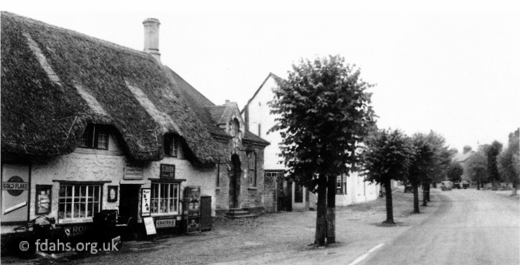 1960’s Shrivenham High Street. Anyone who came to visit the Military College of Science in the 1940’s and 50’s was met at the bus-stop outside Dyke’s store. This store was run by Mr & Mrs Moon, she was a daughter of Mr Dyke. The store sold groceries and some newspapers. Behind the first tree can just be seen the old Post Office which was run by the Misses Locke. One of whom lived into her nineties and was still marvellous at adding up figures. They originally came from a Post Office on the outskirts of Lechlade.1
Public Houses: Barrington Arms, 25 High Street (1863/George Canfield – 1931/Edwd Hy Chambers), Crown Inn, 11 High Street (1891/William Rowland), Prince of Wales, 14 High Street (1891/Edward Busby), Victoria Tavern (1863/George Canfield – 1931/Robert J Brickell).
More… Oxfordshire Villages website: http://www.oxfordshirevillages.co.uk/valevillages/shrivenham.html
References:
- Photo and text scanned directly from The Changing Faces of Faringdon and Surrounding Villages – Book 2 p61-70 by Rosemary Church, Jim Brown, Millie Bryan and Beryl Newman. Robert Boyd Publications 2001.
- The English Place-Name Society search page – https://epns.nottingham.ac.uk/search