 Southampton Street heads south from the Market Place. In 1399 it was simply called Suthstrete, South Street in 1464 and then from 1537 it was known variously as Hampton Street or Southampton Street. Nearly all the original buildings on the street have been demolished to make way for new housing developments and parts have been closed off to traffic. Outside the old town it becomes a footpath and continues down beside what is now Volunteer Way past the new health centre to what was once the very end of Butts Road (now Park Road). It then continues as an old disused tarmacked road blocked by the A420 bypass, on its way to Wicklesham Lodge Farm. There is then a dirt footpath continuing across the fields but it is doubtful if this is what remains of an ancient route though Berkshire into Hampshire and all the way to Southampton; Southampton Street just points in that direction.
Also see our house by house tour of Southampton Street in the Year 2000.
See Faringdon Streets for an indexed list of all streets in Faringdon.
First a quick tour down the street in more recent times then follows some old views before all the demolitions and developments:
A Tour of Southampton Street in the 1900s
 1999. The start of Southampton Street heading south off the Market Place between the Bell Hotel and what was then Barclay’s Bank, until about 2014. This was once known as Pocock’s Corner as Pocock & Son’s tailor shop was here from 1891 to 1926 when it then became Barclay’s Bank. Behind the bank at this time was Jackson & Browning (undertakers), previously the Electricity Generating Company.
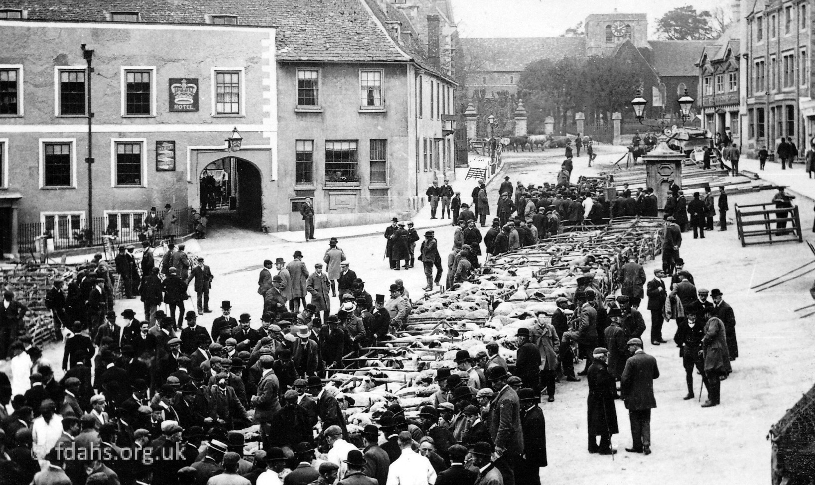
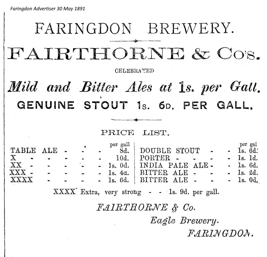
A similar but very old photo 2 believed to be from the 1870s shows this building labelled as ‘Faringdon Clothing Mart’ and behind it, the entrance to the Eagle Brewery. In 1863 it was called the Vale of the White Horse Brewery but changed its name in 1876 to the Eagle Brewery. The photo shows a bowler-hatted man standing under a sign which appears to read ‘The Rising Sun’. A cast-iron swing jib hoist with rope attached is visible, and later a projecting tallet was erected to jut out over the pavement so that the sacks of salt and large barrels, etc., could be hoisted up or lowered into the cart below.2 An advert for the brewery from the local paper in 1891 is shown below.
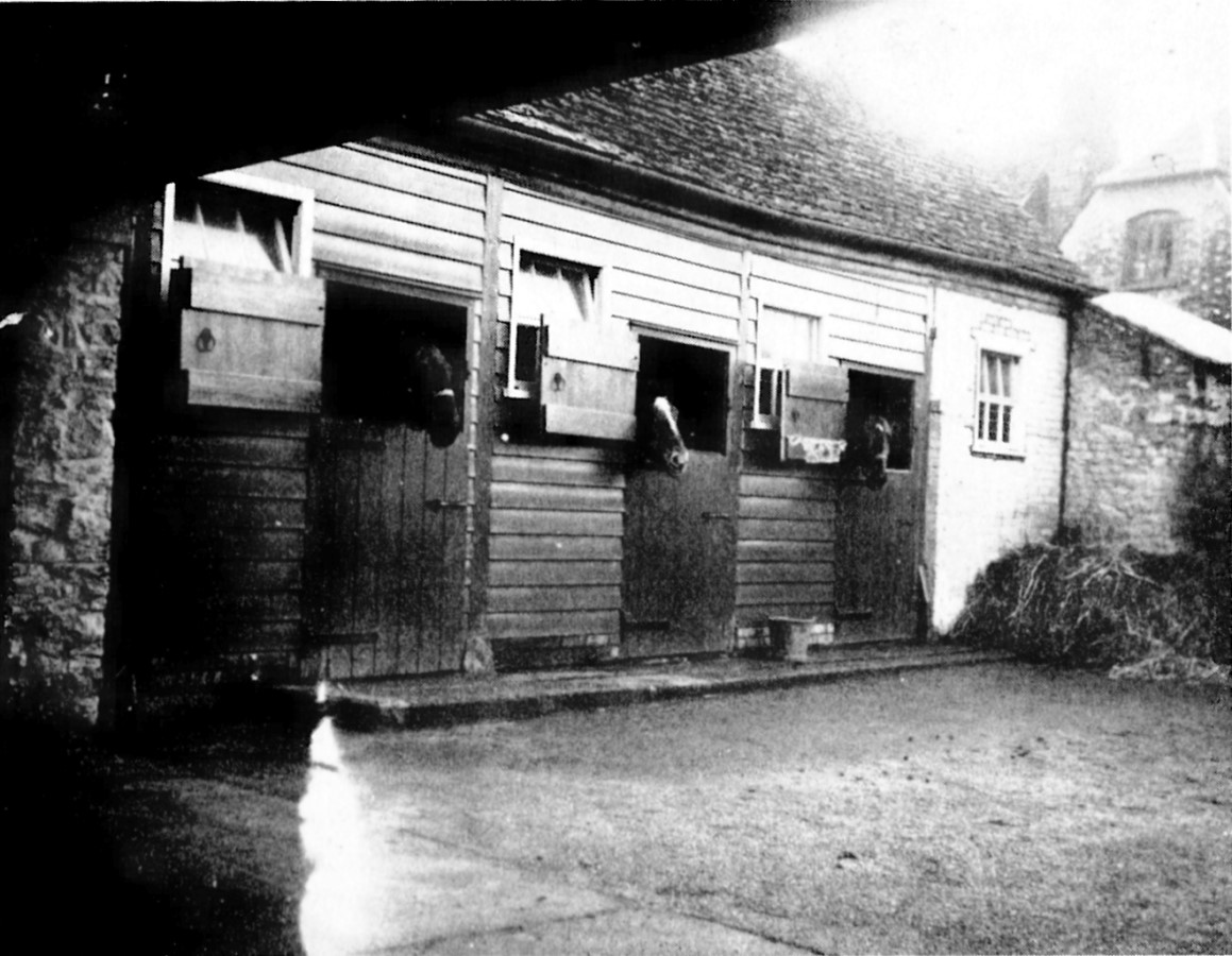 c1930s. The stables behind The Bell Hotel. The horses could well have been hired out for a day’s hacking around Faringdon. The gable end of the house on the right is of the old brewery building across Southampton Street from the Bell yard. At this time the brewery yard was the headquarters of the Wessex Electricity Supply Co., manager Mr J.A. Lowe. The public toilets now stand where this house was. When the brewery was operating the house was known as the Brewery Tap (‘The Rising Sun’ mentioned above?) and beer was sold, I am told, through the window facing on to the pavement below the window visible in the photo.3
 1999. Looking to the right of Southampton Street at the public toilets and town car-park created in the 1960’s behind the bank. Once this site was Taylor’s (a cobbler) and old cottages were said to be there. Also a brewery yard with large stables for teams of horses and a long shed for the drays.
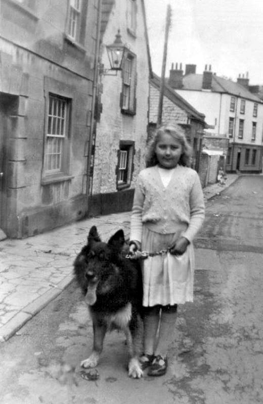 c1951. Looking back towards the Market Place. Carole Vincent and her dog in Southampton Street before the houses on the left were demolished to create the car park. The white building at the end is Pocock’s Corner on the Market Place, that was then Barclays Bank.
Faringdon’s very first Post Office is also thought to have once been in and presumably somewhere at this end of Southampton Street.
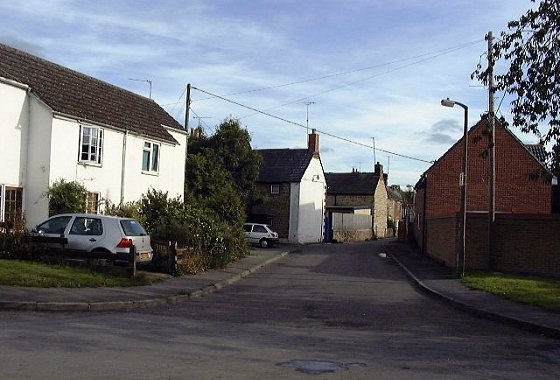
 1999. Looking up Southampton Street just past the car park with Portway branching off to the right. The new flats on Portway can just be seen behind the trees on the right. A map of 1910 shows cottages here all along the right hand side of Southampton Street. On the left, out of view, are private houses #1-3 shown below.
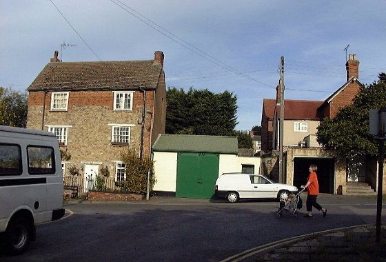 1999. At the same point looking up from Portway. #3 Southampton Street is up the steps on the far right. The large house at #1 is a Grade II Listed Building. It used to be a dress and drapers shop. Mr and Mrs Morton were owners and before them Mr and Mrs. Wilkes. In the early years of the 20th century it was owned by the Vincent family. The Vincents ran a heavy haulage firm that was based in the Brewery Yard directly opposite in what is now the Southampton Street car park. They used heavy horses and steam engines. Des Vincent who, in the 1950s worked for Harold Indge the coal merchant in Gravel Walk was an expert on the operating of steam engines and was often consulted by the users of them.
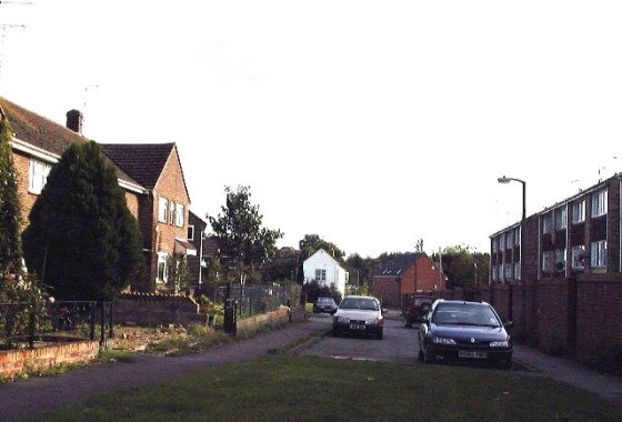
1999. Just across the junction with Ferndale Street (previously Union Street) and the new Hart Avenue (a link road to Bromsgrove). New private houses #6-12 on the left. On the right is the back garden wall of the new flats on The Lees estate built in the 1960s/70s. Note the grassed area in front of the photos, effectively cutting off the street – it can now only be accessed by foot from this direction. The house on the left can be seen at the top in the previous photograph. A map of 1910 shows cottages here along both sides of the street.

1999. Bennett Road crossing. A new road, which now provides the only vehicle access to this part of the street. Private houses #23-25. The third photo shows the same house, but looking back down the street across Bennett Road to the cut-off at Ferndale Street. The pink house at #1 Ferndale Street belonged to Raymond Hutt, who donated his verbose photographic tour in and around Faringdon to the society: Hutt Collection 1953. The white gable-end wall up the street in the first photo is #27 and it is also shown in the photo below with the red door.

1999. Private houses #27-35 on the left-hand side. #35 at one time was a grocery & sweets shop. Immediately opposite these houses on the right of the street, once a row of old cottages and orchards in 1910, became three tennis courts for a while and now all new housing..
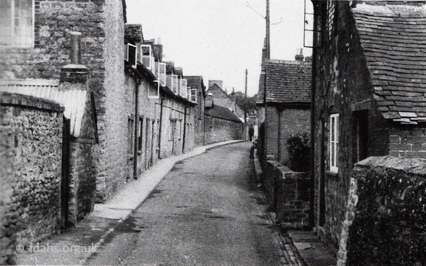
1953. Backing up a bit to have an older look along Southampton Street, at a point somewhere beyond the crossing of Ferndale Street (previously Union Street). These rows of cottages were occupied by many old Faringdon families, for example Archer, Barnes, Timms, Long, Phillips, Haynes, and Greenaway. Most of the houses on the left have been demolished. The houses on the right were all later demolished and replaced with a housing estate called The Lees. The last house on the left with its bedroom windows open, also shown close up in the second photo, is Jane Long’s grocery & sweet shop at No 35. Next door was Cadel’s stable and cart house (note the feed loft). Now demolished, there is a narrow passageway there to houses behind, called Cadel’s Row. The low building with the long roof was the monumental masons, carpenters and painters shed and was owned firstly by Cadel, then Mr. Reason and finally Russell Spinage.
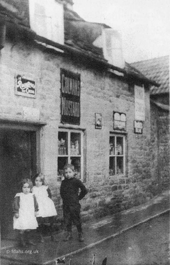 c1913. An earlier photo of No 35 when it was a grocery & sweet shop and once the home of Mr. & Mrs. Frank Long. The three children shown outside the shop are Nellie Phillips (3yrs) with her elder sister Margaret (5yrs), and her brother Leonard (7yrs) who unfortunately died only two years later. Later Margaret married Robert Davis and Nellie married Montague Webb. It is said that their mother, recently widowed Mrs Rose Phillips was running or at least working in the shop at that time. Rose had only recently moved from London with her husband who had died very soon after.
In 1905, Rose had married Leonard Dewe Phillips, who was recorded as being a carriage driver in Battersea at that time. Leonard was actually born and raised in Faringdon; his father was publican and post-boy at the Crown in the Market Place and later the Marlborough Arms in London Street. Leonard soon returned to Faringdon bringing with him his wife and two children, Margaret and Leonard (Jnr). They then had another child, Nellie in 1910. The three children are shown in the photo about 3 years later. Legend has it that Leonard Phillips returned from London in a strange way: “Mr Porter, of the Corn Stores in Gloucester Street, was one of the first people in Faringdon to buy a car and, as he was frightened to drive it, he decided to go by train to London and ask the first taxi driver he met to become his chauffeur. That driver just happened to be Leonard and he persuaded him to return to Faringdon and work for him.” Unfortunately Leonard died soon after at the young age of 42. He collapsed at the wheel while driving Mr and Mrs Porter home from Reading in 1910. It has been said that “Mr Porter set up his widow in the sweet shop in order that she might earn a living.” In the 1911 census, Rose and the children were living in Lechlade Road and not actually in the shop but they may have moved there by the time this photo was taken. Newspaper reports after Leonard’s death confirm that Mrs Porter and two others did set up a ‘Subscription’ for Rose and the family.
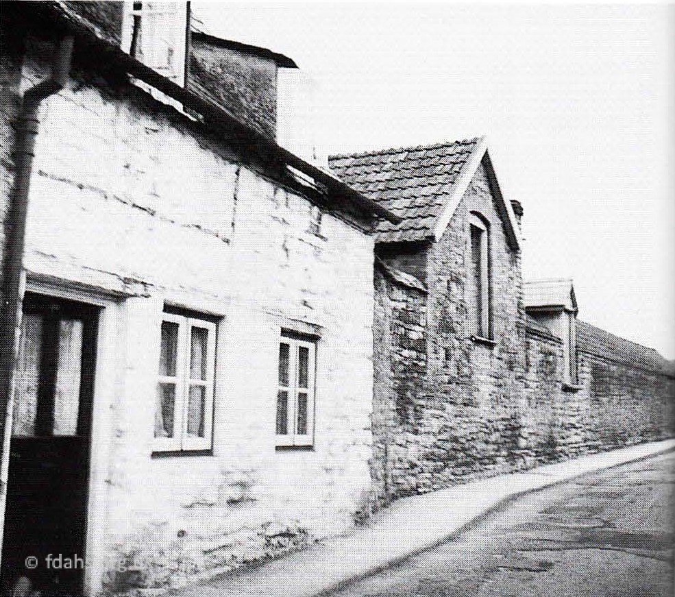
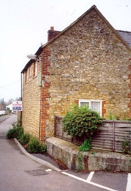
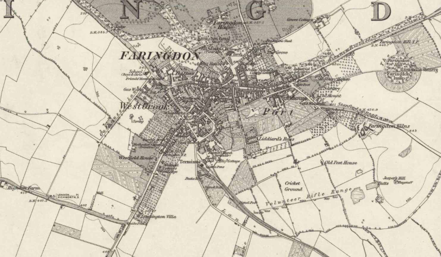
 1999. House #35 again on the left and the high fence of the tennis courts that were there at this time on the right. Between the house and the garage with the green door is a footpath called Cadel’s Row which leads to a row of old cottages running perpendicular to Southampton Street. A little further up is another perpendicular row of old cottages called Liddiard’s Row (built pre-1910). It is accessed through a gated gap in the wall at the lamp post. More on these below. On the opposite side, the high fence shows where Faringdon Tennis Club’s recently resurfaced and extended tennis courts were at this time. The renovations were done by Mr Ron Liddiard in the early 1990s. The land had been donated to the club in 1915 by George Ernest Liddiard. Houses were built on the site sometime after 2008 and the club moved to its current location on Jespers Hill in the Folly Country Park. The turning to the right just past the tennis courts now provides pedestrian access to the new housing development of Willes Close. This was a self-build scheme in 1988 where residents built their own homes. It was once the site of Faringdon Girls’ School and adjoining Infants School in the 1920-30s. The school became Faringdon Secondary School in the 1930s, then Faringdon Secondary Modern School before that moved to its new site in Fernham Road. It reverted to a Junior School in 1964 but was demolished in 1986 to make way for Willes Close. It was named after the last headmaster of the school, who was the rather fearsome Arnold Willes. The White Horse Dairy and Russell Spinage’s builders yard were also on the right of the street opposite the wall. See older photos later. Beyond the wall in the distance are private houses #41-43.
 1953. Worlds End, Southampton Street. This is exactly the same section photographed in 2000 above, but looking back towards town from the far end of the wall, which is the boundary wall of Liddiards Row cottages and gardens. The house at the end of the wall is #35, which was Jane Long’s sweet shop at this time. The building on the left was occupied by the Lang and Arlott families, the latter being cook and caretaker for the school. It was called ‘Worlds End Cottage’, possibly because it was the last building in the street that soon disappears as a footpath across wide open fields. The White Horse Dairy is next on the left.
 1953 Southampton Street School was on the end of the street on the right-hand side. Prior to 1925 the right hand side of the school was built for Infants and on the left a school for girls. The main hall was built to join the two sections when the Infants moved to Lechlade Road and it became Faringdon Secondary Modern School in 1937. The separate Domestic Science and Woodwork block is out of sight on the left. In 1964 it became the Junior School when the Junior children were moved from Lechlade Road. In 1986 the Junior children were moved again, this time to the Elms site in Gloucester Street, and these old buildings were then demolished. A small housing estate, Willes Close was built on the site.
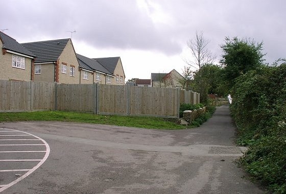

1999. On the corner of private houses #41-43 is access on the left to Harding Close (part of the new Berner’s Way housing estate). Southampton Street now continues straight on as just a wide tarmacked footpath. Turning around to look back at the same point (second photo) shows part of the new housing development of Willes Close, where the school used to be. 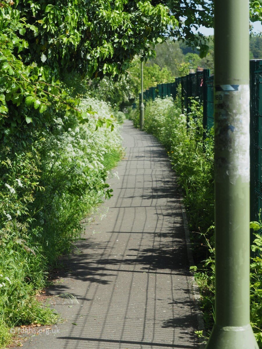 There is an old footpath running along the wall to the left of the new houses. It once lead to a recreation ground and Hobwell Cottages, which were between the railway line and Park Road until around the late 1950s. The now neglected scrubland to the left of the path was once Hobwell Allotments. Today, the Hobwell Path, now called ‘The Hobble‘ provides a useful walking route to Tesco’s, the industrial estates that replaced the railway, and across Park Road to Tucker Park. Turning further around and looking back down the street (third photo), are private houses #41-43 Southampton Street that were mentioned above.

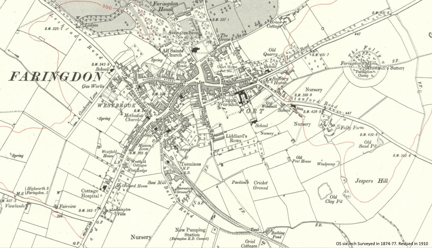
1999. Continuing on up the wide tarmacked footpath there is an access point on the left to the end of the Berner’s Way housing development. It once lead to the town cricket field before the houses were built, see map below. This marks the end of the old Southampton Street, although a footpath continued onwards and still does today.
Back in the 1970s before all these new housing estates were built, there were the ruins of a prison of war camp on the left-hand side of the footpath. The prisoners were taught to speak English and Agricultural Machinery; some stayed in Faringdon after the war to work. The huts continued to be used as extra classrooms by Faringdon Secondary Modern School back up on the street itself. They were reported to be bitterly cold in winter, even with the ‘tortoise heaters’ that were provided. They were known colloquially by their occupants as “The ‘Uts”. They were reached along the lane by the cricket field, which in winter often flowed with rainwater, inevitably known as “The River ‘Ut”.
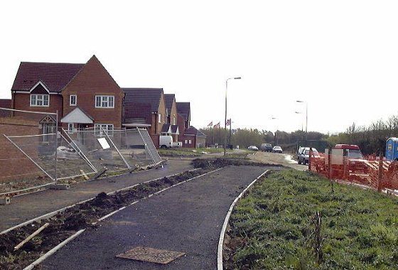
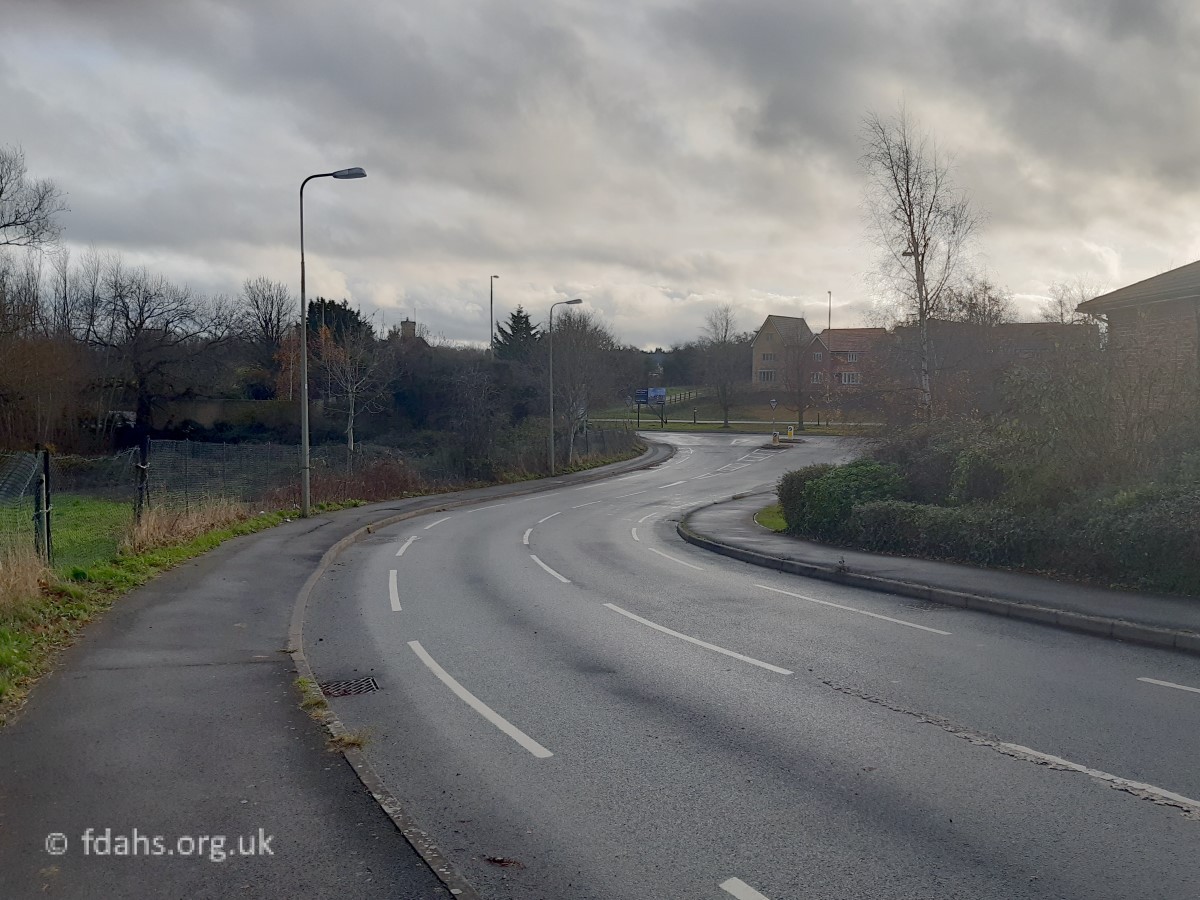

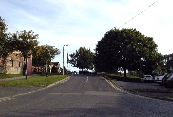
The first photo above shows the newly laid tarmacked footpath off the end of Southampton Street that was once a muddy route across open fields, and another new housing development on the left. The old path now continues along the side of a new road called Volunteer Way towards the new White Horse Health Centre. Finally onwards (with a wiggle) to Oriel Cottages on Park Road, the chimneys of which are just visible above the trees to the left in the second photo.
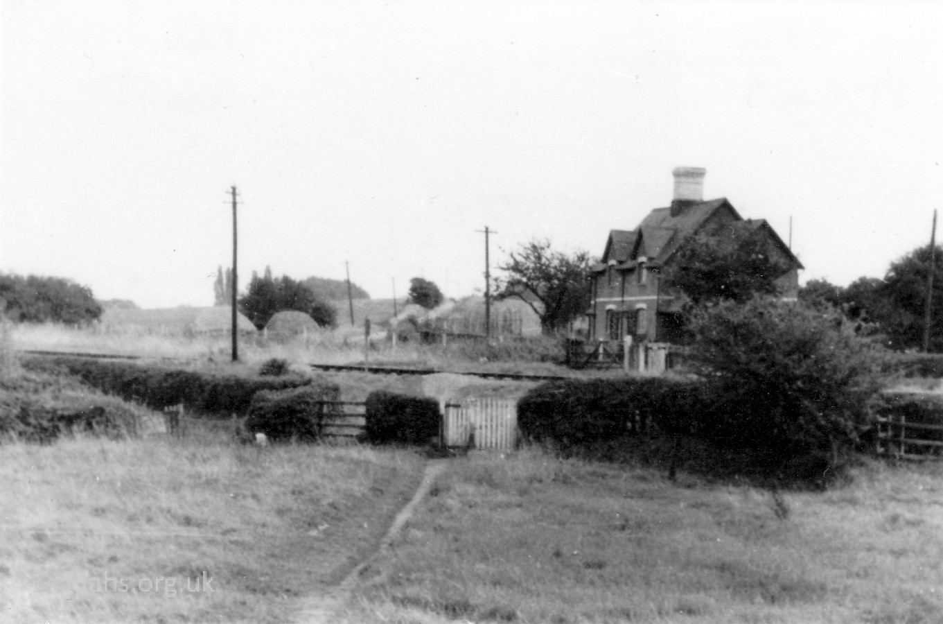

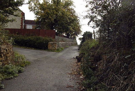
Before Volunteer Way was built, the old footpath used to go straight down the muddy field directly towards Oriel Cottages. You had to cross a brook that once led to the swimming pool then walk across the railway tracks (now Park Road). Finally, the route becomes a tarmacked lane past the front of the cottages and straight on to Wicklesomelodge (Wicklesham) Farm and Quarry. It has now been cut off by the A420 bypass but is still accessible on foot.
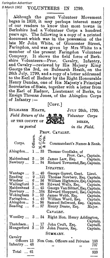 Volunteer Way gets its name from the route taken from town by volunteer soldiers to their rifle range, since at least 1551. See ‘Volunteer Rifle Range’ marked on the map dated 1876. The Berkshire Volunteer Corps in 1799 had an infantry totalling 785, which included 40 men and 4 officers from the Faringdon area under Captain William Ward. This was where volunteer soldiers used to practise firing at the butts that were placed at the foot of Jasper’s Hill. It was also used by the volunteers in WW1.
Business Directories & Advertisements in Local Media
The following shops and traders were advertised in Southampton Street, Faringdon in the years stated:
BARTON Wm., excise officer, Southampton Street, PIG 1844
Blackwell Henry, beer retailer, Southampton Street, DG.
Bradley William, basket maker, Southampton Street, DG.
CADEL John Monk, carpenters, Southampton Street, PIG 1844
CHAPMAN John, Retailers of Beer, Southampton Street, PIG 1844
COX Joseph, Retailers of Beer, Southampton Street, PIG 1844
COX Joseph, butchers, Southampton Street, PIG 1844
COX Susie, dressmaker, at Miss Wheeler’s Southampton St, FA 1916.
Cooper Geo., market gardener, Southampton Street, DG.
FAIRTHORNE & CO, Faringdon Brewery at Eagle Brewery, FA 1891, 1894, 1897 (became PHILLIPS & SONS).
GOLDBY Harriet, milliners & dress makers, Southampton Street, PIG 1844
GREEN Ann, stay maker, Southampton Street, PIG 1844
HARVEY Wm., agricultural implement mkr., Southampton Street, PIG 1844
JUDD & BOND, boot and shoe makers, Southampton Street, PIG 1844
JUDD Jane, shopkeepers & dealers in groceries & sundries, Southampton Street, PIG 1844
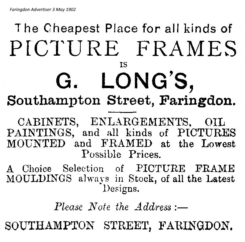
LONG G., picture frames, art etc, Southampton St, FA 1902, 1903 (W. Long), 1904, 1907 (G. Long).
Lander Alfred, chimney sweeper, Southampton Street, DG.
MEDLEY Charles, brewers, Southampton Street, PIG 1844
NOAD William, coopers, Southampton Street, PIG 1844
Noad William, cooper, Southampton Street, DG.
PEYMAN Henry, bricklayers, Southampton Street, PIG 1844
PHILLIPS W.G. & SONS, Eagle Brewery, Faringdon, FA 1902, 1903, 1904 (was FAIRTHORNE & CO).
REASON W.G., Builder, Decorator, Undertaker, Southampton Street, FCP 1953.
SHUGAR Thomas, accountant & coal dealer, Southampton Street, PIG 1844
SMART James, coopers, Southampton Street, PIG 1844
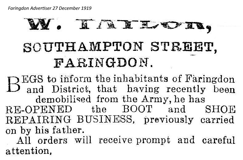
TAYLOR W., boot & shoe repairs, Southampton St, FA 1919.
WHEELER Miss, Southampton St, FA 1916.
WHITE HORSE DAIRY (G. Cameron & Sons), Southampton Street, FCP 1953.
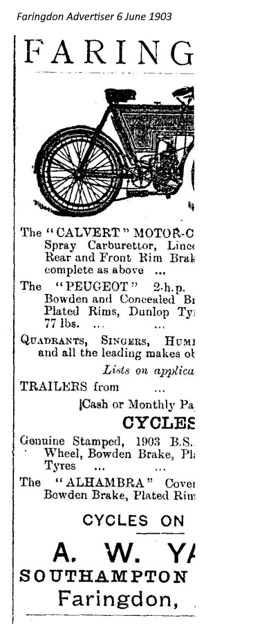
YATES A.W., cycles, Southampton St, FA 1903, YATES T. & SON FA 1907, moved to London St by 1914.
Media Key: FA = Faringdon Advertiser; DG = Directory & Gazetteer of Oxon, Berks & Bucks (Dutton, Allen & Co. 1863); FCP = Faringdon Coronation Celebrations Programme 1953; PIG = Pigot & Co.’s Directory of Berks & Bucks 1844.


References:
- The Changing Faces of Faringdon and Surrounding Villages – Bk1 p25-26 (now out of print) & Bk2 p17 & 26. By Rosemary Church, Jim Brown, Millie Bryan and Beryl Newman. Robert Boyd Publications.
- Faringdon Folly – article by Jim Brown p9, November 1989. Faringdon Folly November 1989 (pdf)
- Faringdon Folly – article by Jim Brown p15, March 1992.
Researched by Ian Lee, December 2019.