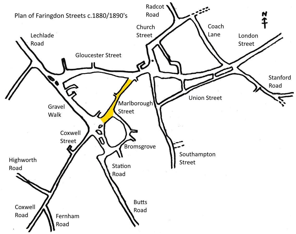
 Marlborough Street heads south-west from the town centre of Faringdon. It was once the main road (A420) to Swindon, and onward to Marlborough and Salisbury or Bath and Bristol before the bypass was built in 1979.
See Shops & Businesses for an updated history of occupation and Business Directories & Advertisements for Marlborough Street.
Also see our house by house tour of Marlborough Street in the Year 2000.
Views of Marlborough Street in the 18/1900s
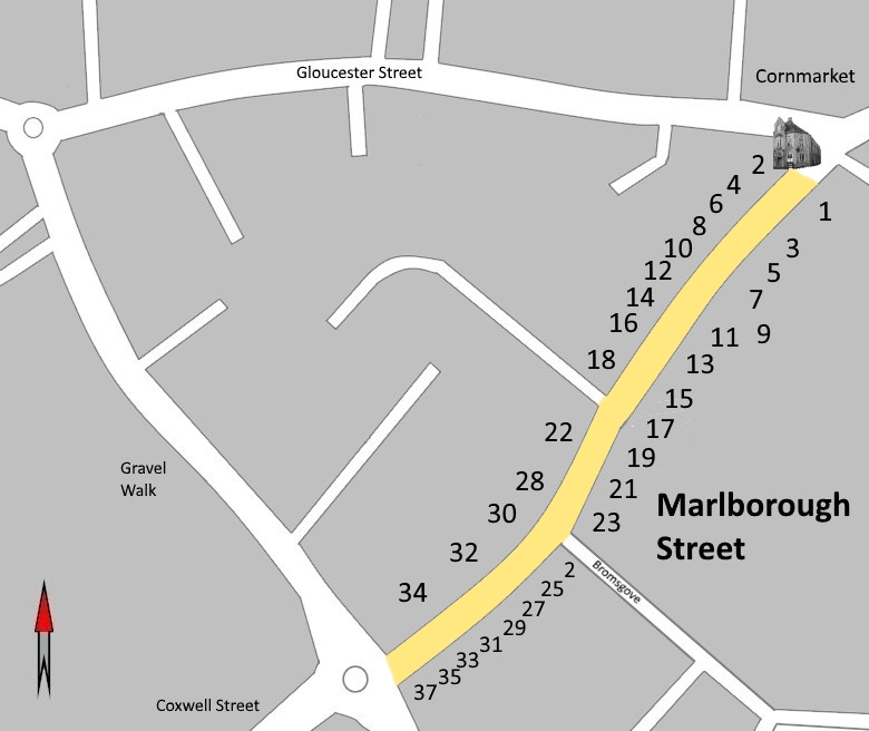
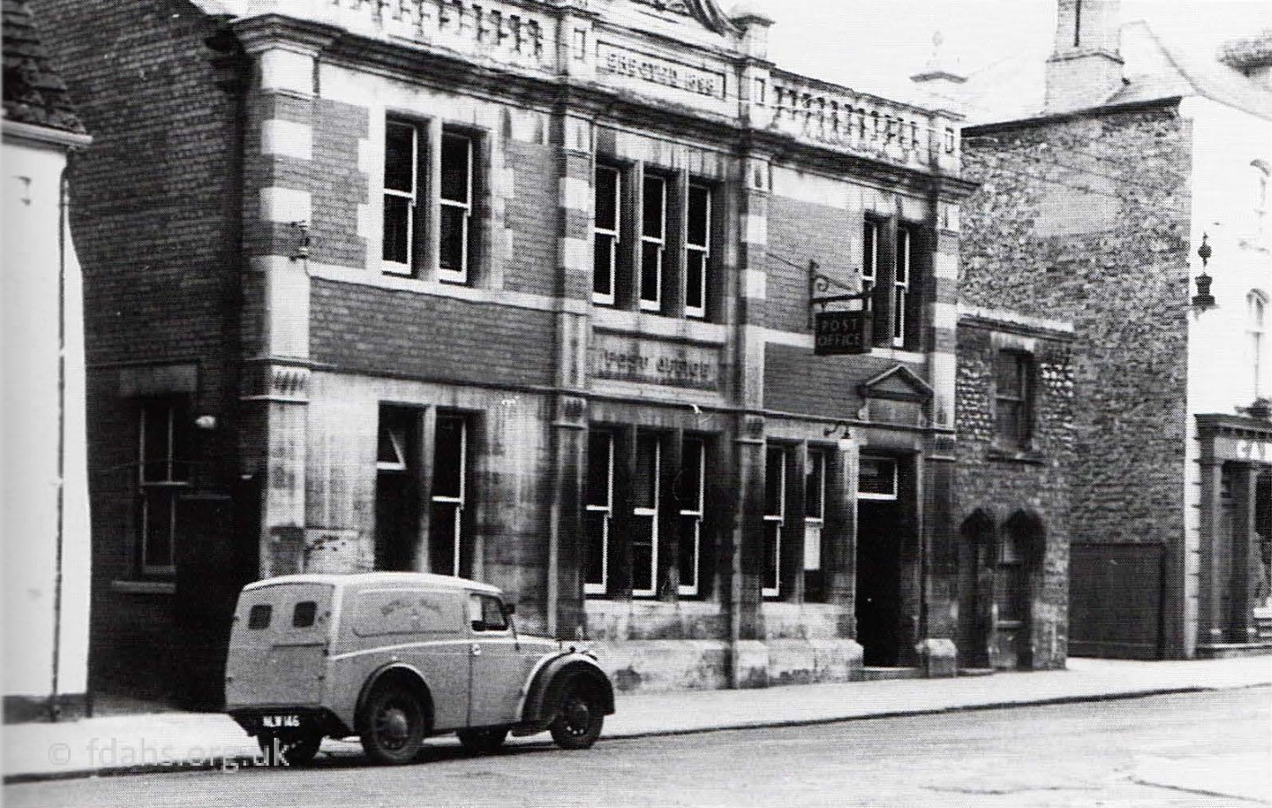 1953. #1 The Post Office in Marlborough Street. It was built in 1898 when the building housing Taylor’s fish shop was demolished. The small building at the end was used as a storeroom by Carter’s until it was demolished when the shop became a supermarket, The enamel signs on the facing wall of Bicester House (Carter’s) have been removed, thanks to pressure from Mrs Cyril Carter.
Around 2014, the post office moved to McColl’s Newsagents in the Market Square and was occupied by the Bangkok Kitchen for few years. Around 2017 it was split between Caprinos Pizza and Just Eat.
 1921. An earlier photo looking up from the bottom end of Marlborough Street. Just the wall and gate of the small building attached to the Post Office #1 can be seen on the far left. All the enamel signs mentioned above can be seen here. In the doorway of #3 Carter’s is Mr Cyril Carter. The arched windows of #5 behind him was a cafe. The shop #10 on the right, which juts out, was Goulding Goddard’s drapers. The sign left to remain on the roof says Frank Lane & Co, Ironmongers & Furniture Store. It was later re-fronted and split into two to form a small shop #10a on the corner currently Faringdon Cobblers, the larger part beyond became Betfred, a betting shop.

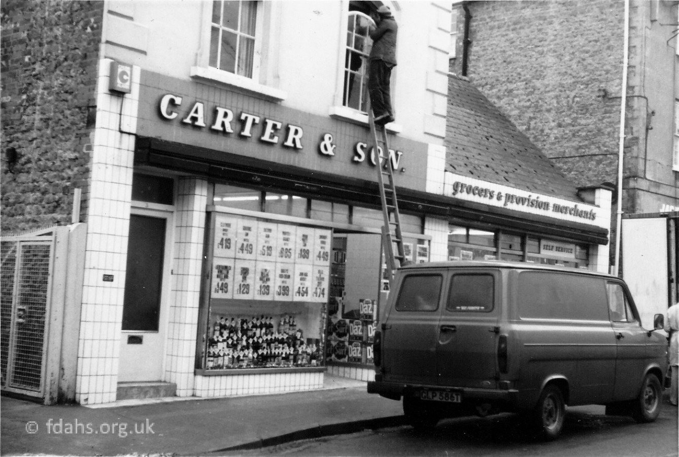
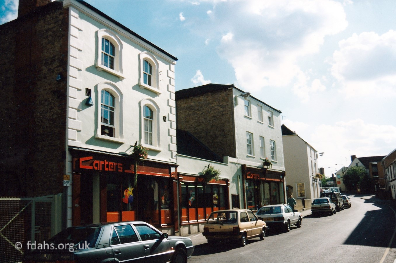
1916, 1970 & 1990s. #3-7 Carter & Sons in Marlborough Street (became Budgens). The shop was owned by four generations of the Carter family – John, Albert, Cecil, John and Norman, until it was sold in 1996. The original shop #3 was a grocery, butchers, paraffin and corn stores. Deliveries were made to all the surrounding villages, firstly with horse and cart and later with motor vans. In Carter’s at this time the counters went round the sides of the shop and assistants served the customer over this counter. The bill was paid at a small wooden kiosk just inside the door. The men all wore long white aprons and this continued until well into the 1950s. The Carter family lived over the shop; note the lace curtains in one of the upstairs windows. When John and Norman took over the shop they gradually enlarged the business, taking over #7 the shop next door in 1978, which had housed Jack O’Newbury’s cleaners. On the retirement of Mr Percy Taylor from his butcher’s shop in the Corn Market the premises were purchased by Carter’s who continued to run it as a butchers and slaughter house. The meat business moved back into the main shop and the premises extended at the back. The small building #5 in the middle was the office for the shop. Previously this had been a cafe run by Cyril Carter’s sisters, Phyllis Johnson and Kathleen Hogan. They eventually moved to the bakery in the Market Place (Lays) which became Hogan’s. Albert Carter is the man outside in the bowler hat. Young Cyril Carter was driving the delivery trap as, during the war, labour was scarce so he had to help out whenever he could.
In 1996 Carter’s was taken over by Budgens. Some years later a large Tesco supermarket was built at the top of Park Road, followed by an Aldi and Waitrose, with the result that Budgens eventually closed down in 2018. The premises has been empty since, except for #7, which was taken over by Costa Coffee. Plans are in progress in 2020 to convert all three buildings to domestic flats, but plans get easily changed.
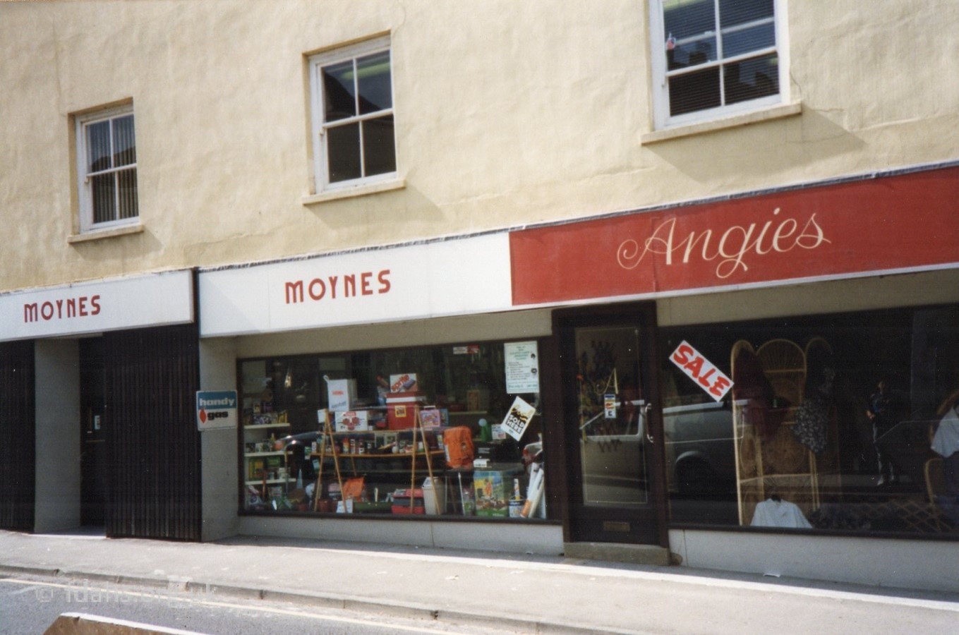
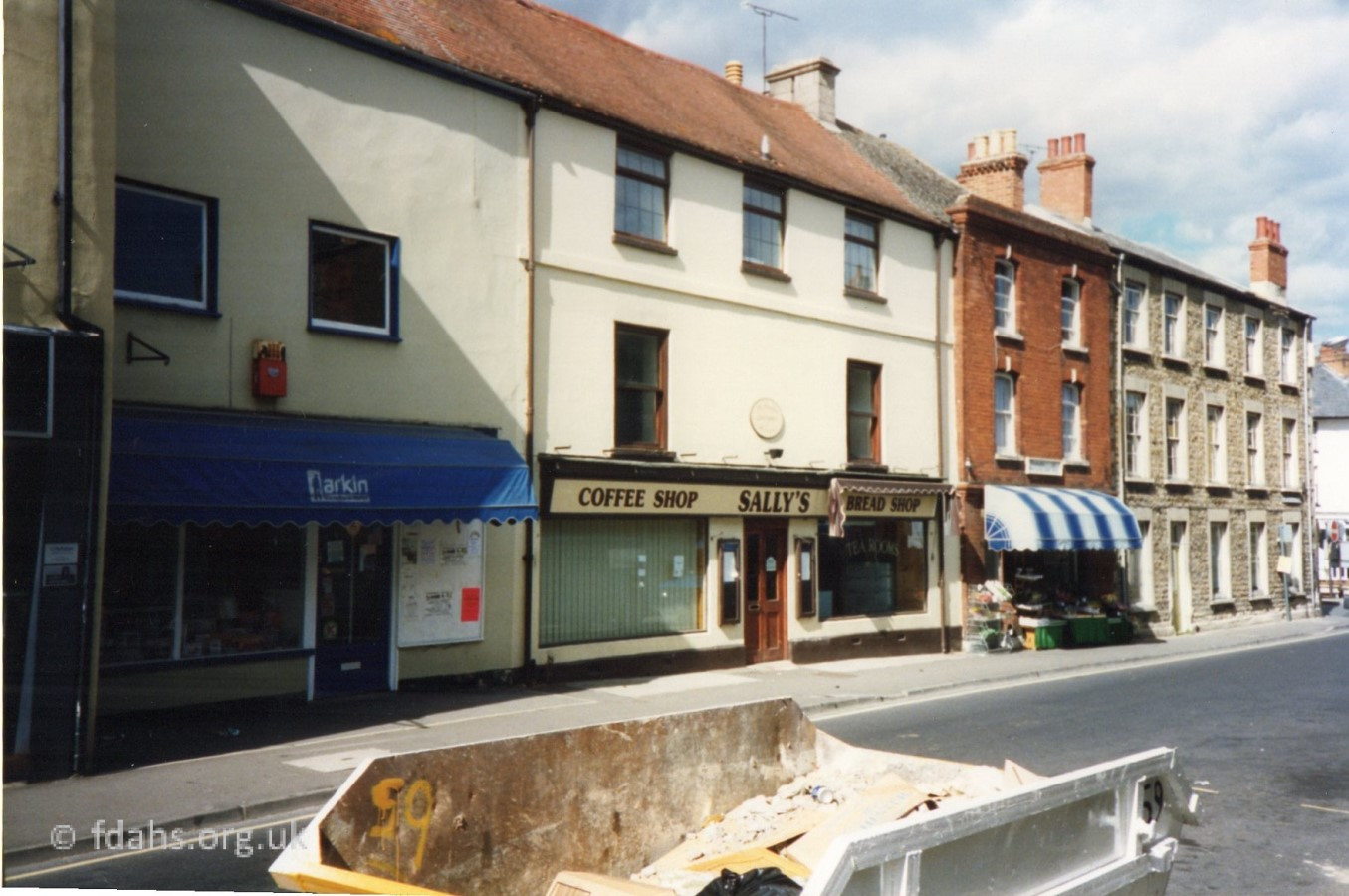
c1988. On the opposite side of the street #10 Moynes (ironmongers) was known to have been there in 1987. #8 J.P.Larkin Television Centre, #6 Sally’s Coffee Shop & Bread Shop, and under the awning at #4 is Faringdon Fruit & Veg, which was known to have been there in 1984.
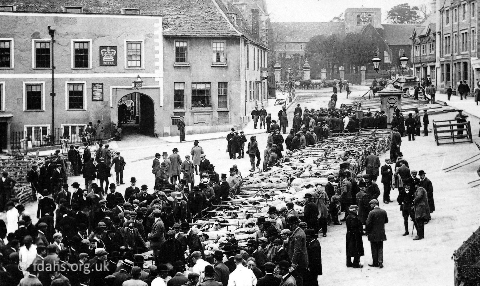
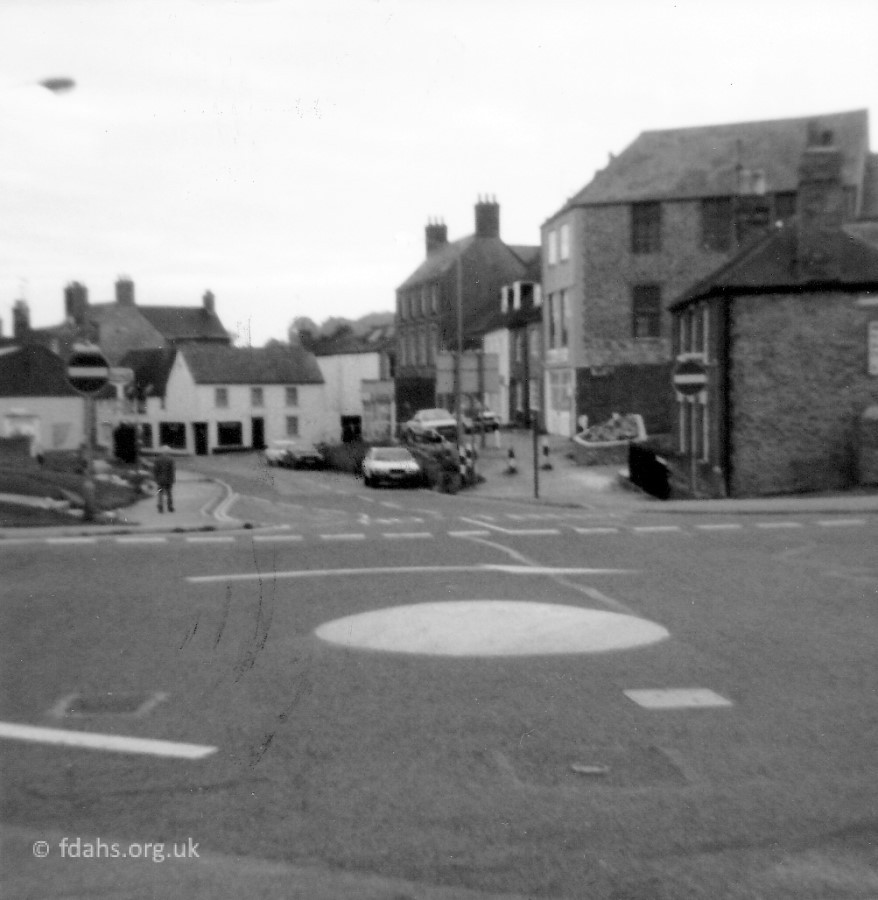
 c1908. An early picture looking down Marlborough Street towards the Corn Market. At the bottom of the street, on the right, is the Post Office with Carter’s grocery store next to it. Counsell’s clock is visible outside what is now the Nut Tree. Near the front of the picture on the right is the wall bordering the Congregational Chapel, which is set back from the road and is now the Roman Catholic Church. Just opposite must be #10, which was Frank Lane & Co (engineering, cycles & repairs) at that time. The person bending over the bicycle could be mending a puncture, a regular hazard at this time due to the condition of the roads. A big problem for the pneumatic tyre at this time, and well into the fifties, was the abundance of horses, many of which were prone to shed the nails from their shoes. The first house on the left with a bay window can be seen as the second building in the photo below.
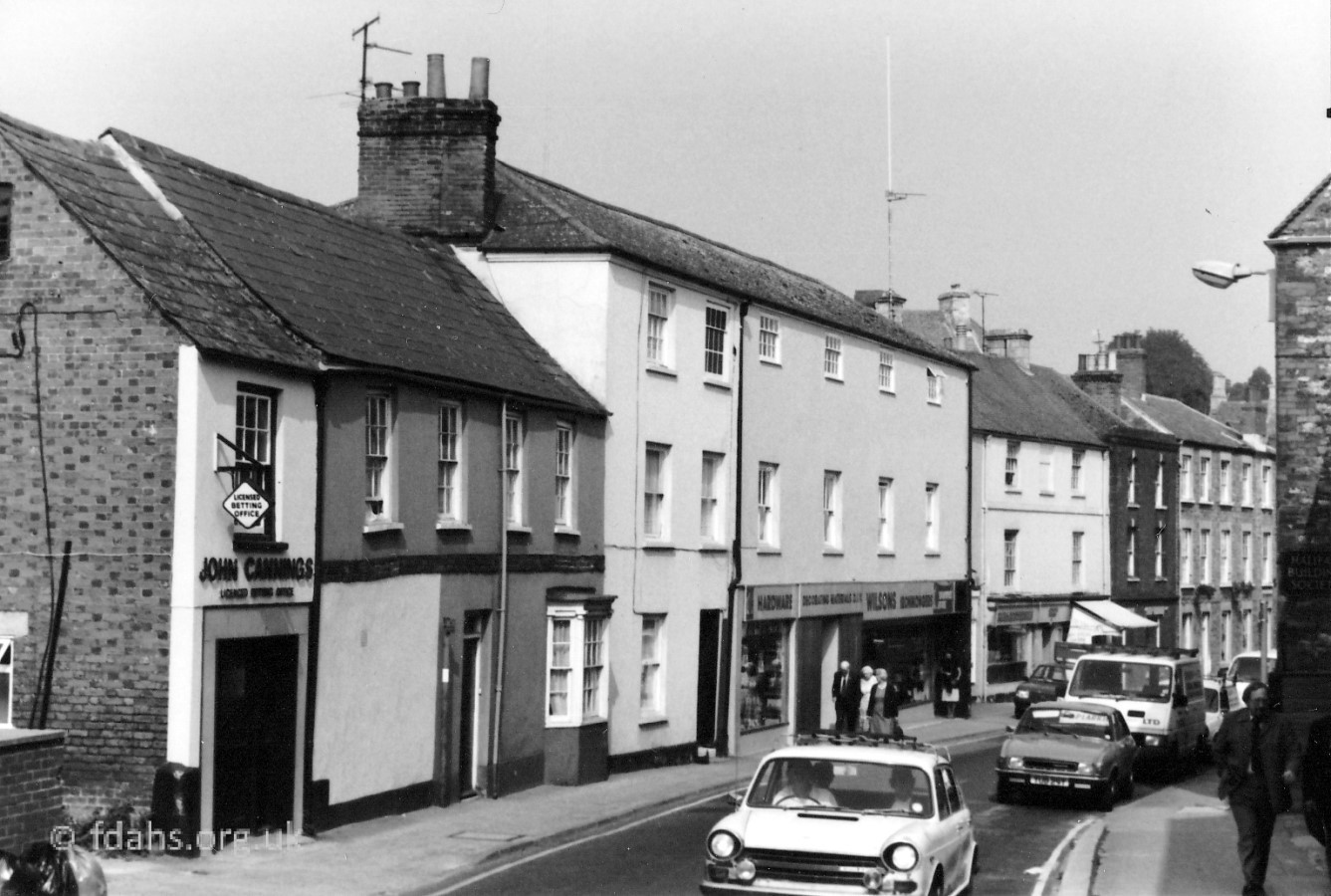 1982. Looking down towards Corn Market, just a little further back. On the far left between the corner wall of the new police station and the blank wall of #16 John Cannings (bookmaker) is Foundry Lane. The lane remains now as an unmarked, partly paved track, with a sign which directs to a business called ‘Curtains Plus’. Next door at #14, a private house with the white bay window is the first building shown in the photo above. Further down at #10 was then Wilsons Hardware before Moynes took it over. Larkin’s at #8 is tucked in and out of sight. #6 with the awning might be Sally’s Coffee Shop & Bread Shop. #4 was a private house at this time.
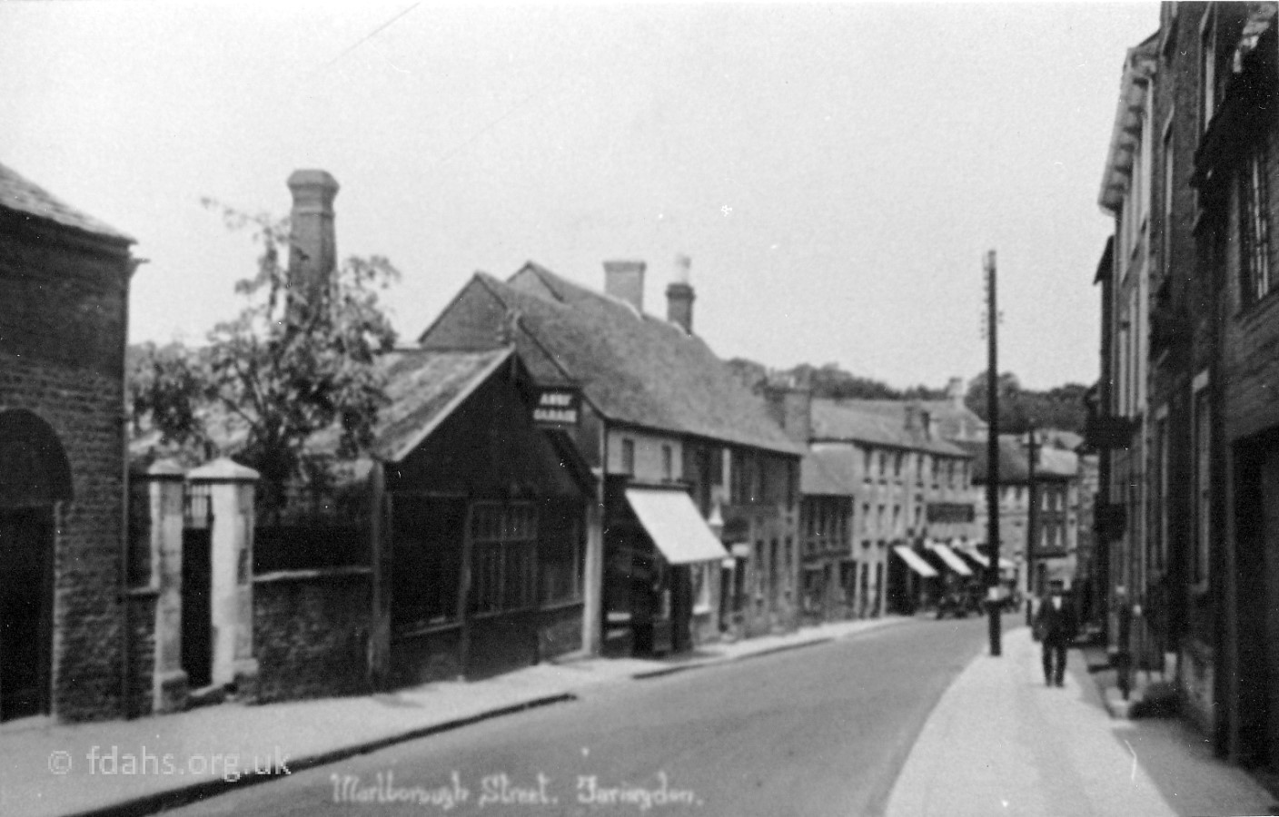 Early 1920s. Further back up the street, looking down towards Corn Market. The shop with awnings in the distance is Frank Lane (engineering, cycles & repairs) at #10. The small dark two-story building next door is #16-14, the one shown at the start of the photo above. The closer shop with an awning is Drew’s (butcher & fishmonger) and next door is Anns’ store shed. Both were demolished to build the police station in the 1970’s.
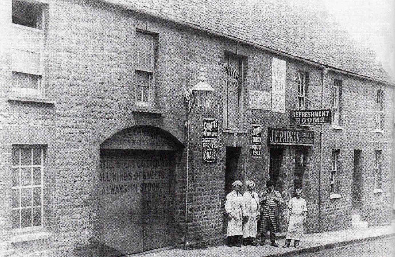 1916. A little further back up the street, #18-22 at this earlier time was Mr Parker’s Corn Stores, Tea Rooms and shop in Marlborough Street. Mr Parker had been there from at least 1895. Left to right Mr Edgington; Horace Hickman; J. Parker; Frank Wheeler. The Telephone Exchange now stand on this site.
 Late 1950’s. Turning around to look towards the top end of Marlborough Street and Arthur’s Hill (more below). Note the lack of traffic and people. Today there is a continuous line of cars parked on the left hand side. At the corner of Bromsgrove and Marlborough Street, on the left-hand side of the picture by the lamp post, is #23 the grocery shop belonging around this time to Mr Manners (more below). On the right are shop fronts of Drew’s (butcher & fishmonger) and the Co-op, all now demolished. The Police Station and Telephone Exchange now stand on this site.
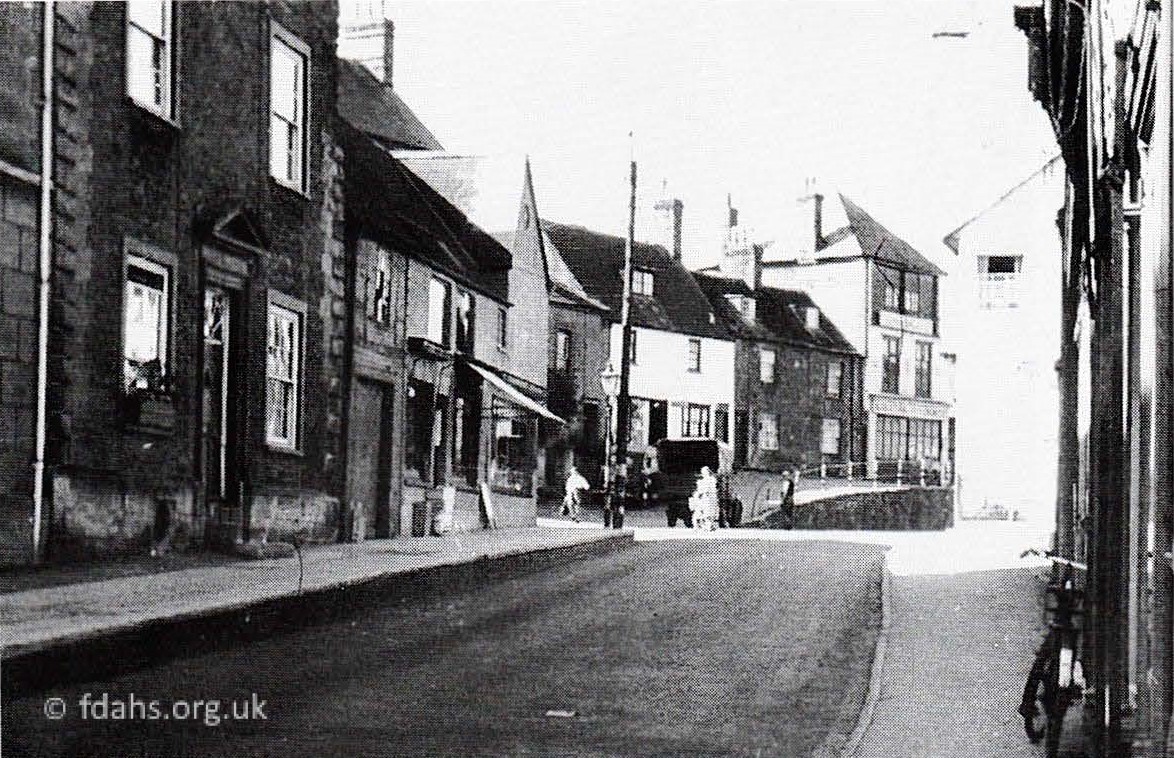
 c1915. Looking back into town from the corner with Bromsgrove and a lot earlier. On left are the only two buildings that did not get demolished on this side of the street. The gated entrance shown here goes through to the back of the shops and was later converted into another shop (more below). The private house with the chequerboard brickwork on the right at the junction of Bromsgrove, is #23. It was built by Hughes Bros., painters, paperhangers and bell hangers. It later became a grocery shop and had a variety of owners such as Billy Long, Chapman, Paddon and in the 1950’s Manners. Recently it has been a pet shop, then a shop selling second-hand items, before becoming empty and derelict for a while. It has since been converted to two private houses.

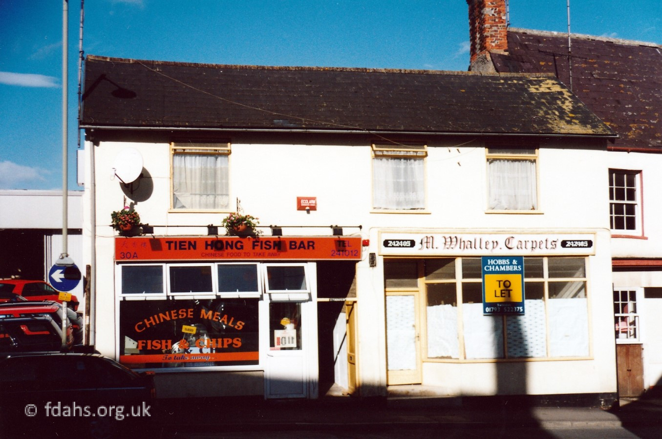
1902 & 1990s. Same place, then and later. As mentioned above, #30 was ‘Buffer’ Foard’s grocery shop. It later became E.T. Beavis (boots & shoe repair), Michael Bishop Watch Mender, then M. Whalley Carpets in the 90s. It was left unoccupied for many years but lately in 2022 is being refurbished. The gated carriage entrance shown next door in the older photo went through to back of shops. It was filled in by 1977 to become #30a Webb’s Taxis 1977, Tien Hong Fish Bar 2000; and Ming’s Takeaway 2012. In 2020, it became vacant until it reopened in 2024 as a Chinese takeaway called the Hong Kong House. The open door in the newer photo shows what is left of the earlier gateway; now just a narrow entrance corridor to the back of the shops.
Next door is #30 ‘Buffer’ W. Foard’s family grocery and bacon curer shop since at least 1902. It later became E.T.Beavis (boots & shoe repair) 1953, Michael Bishop Watch Mender 1972, and finally M.Whalley Carpets in the 1990s. It was left empty in 2014, then refurbished in 2023 as Suzy’s Convenience & Vape Store but has since closed again, very soon after.


1890’s, 1916 & 1990’s. A little further back up the street, an early picture of Arthur’s Hill looking back towards town and a more recent one. The road, as still partly there next to the buildings, had to be deepened during the coaching era to ease the horses’ load up the steep gradient. The hill was named after H. N. Arthur, a coach and harness maker, whose business #35 is the 3-storey building on the far right of the pictures above. The building was later taken over by Frank Lane’s carpenter shop and during WWII was used to house the ambulance; shown here in the 1990s it is an antique centre. Next door #31-33 was the home of Mr Smith who was the first recorded professional photographer in Faringdon, The adjacent cottage # 29 became Ron Young’s barber’s shop before he moved into London Street. The large house at the end of the rank (addressed as #2. Bromsgrove) is Marlborough House. The smart looking private house, with its original chequerboard brickwork, at the junction of Bromsgrove is #23. As mentioned earlier, it was built by Hughes Bros., painters, paperhangers and bell hangers. It became a grocery shop belonging to Mr Manners in the 1950’s, a pet shop in the 80’s and a junk shop in the 90’s, and has since been converted into two private houses.
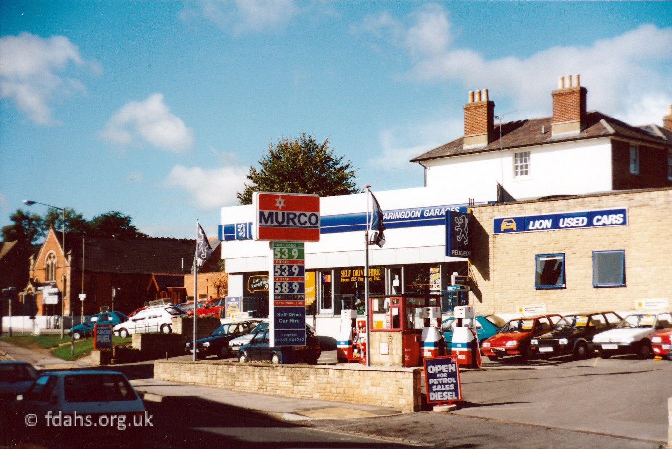 1990s. On the other side of Arthur’s Hill, at this time, was Fish Brothers’ Peugeot franchise at the end of Marlborough Street on the corner with Gravel Walk. Various businesses occupied this site in the past – Peek Freans (biscuits); Bernard Poole (garage); Anns Garage 1953; Pakemans (lorry garage). All the old buildings were demolished in 1948 when local man Mr. D.J. Fish built, what he then called the Faringdon Garage, which later became a Peugeot franchise. Fish Brothers moved during the 1970s to very large sites on the western outskirts of Swindon where they now have Ford, Honda, Kia, Peugeot, Toyota and VW franchises.

Reference:
The Changing Faces of Faringdon and Surrounding Villages – Bk1 p22-24. By Rosemary Church, Jim Brown, Millie Bryan and Beryl Newman. Robert Boyd Publications. Now out of print.
Researched by Ian Lee, April 2019.