A photographic tour of Faringdon using archive photos from around the turn of the century 1880-1910, which all appear elsewhere on this website. Put together here purely to accompany and provide a comparison of an earlier generation with the other photo tour collections that we have for the years 1953 and 2000. Some digital enhancement was possible after scanning but these photos are over a hundred years old and definition is often poor as their chemistry has deteriorated with time.
What was happening around 1900? At this time steam trains had been coming to Faringdon for over 30 years but the petrol-driven motor vehicle had only just been invented and therefore rarely seen. Wireless radio and aeroplanes were still experimental. Transport mainly involved horses for those who could afford to keep one and most people walked to work along the many footpaths between surrounding farms. Most people did not travel very far at all. The so-called safety bicycle, similar in design to today’s was becoming very popular and enabled the common people to get more quickly to and from the local villages and even towns. For example, it would be unreasonable to walk 9 miles from Wantage and back in a day and have any time in town but by bicycle the trip one-way could be done perhaps in one hour (instead of 4-5) depending on the state of the roads. It is said that the use of a bicycle vastly improved the genetic mix of future populations. Many homes in the UK were starting to be wired up with electric power but the only lighting in Faringdon at this time was by candle, oil lamp and perhaps gaslight if you were close to town. Electricity first came to Faringdon about 1911-12. There were at least 20 public houses for the men of Faringdon to retire to of an evening, after a hard day of manual and often heavy work; woman mostly worked in the home and were discouraged or even barred from entering a public house.
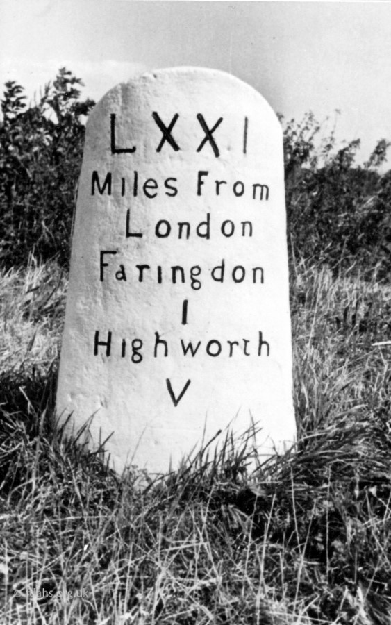
Highworth Road
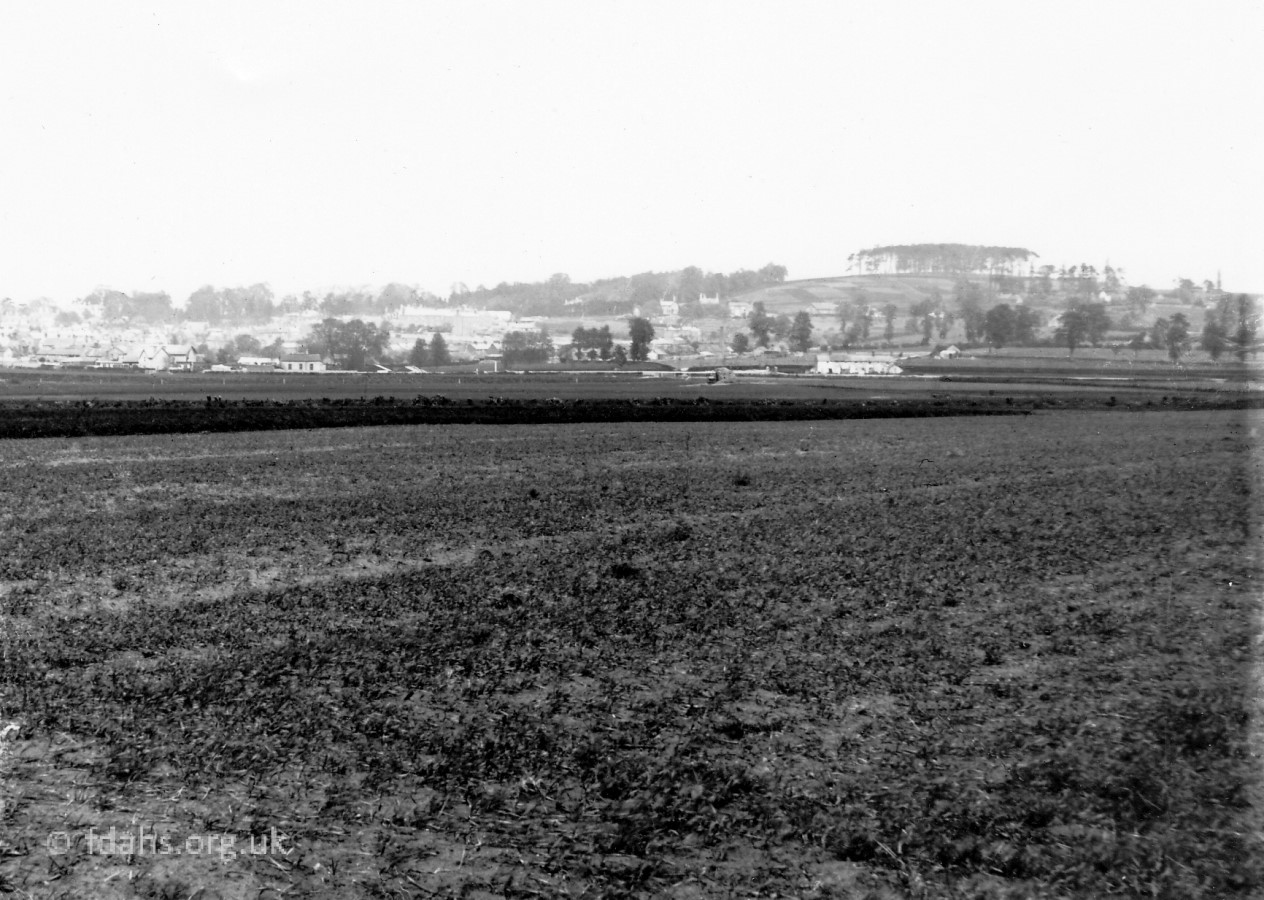
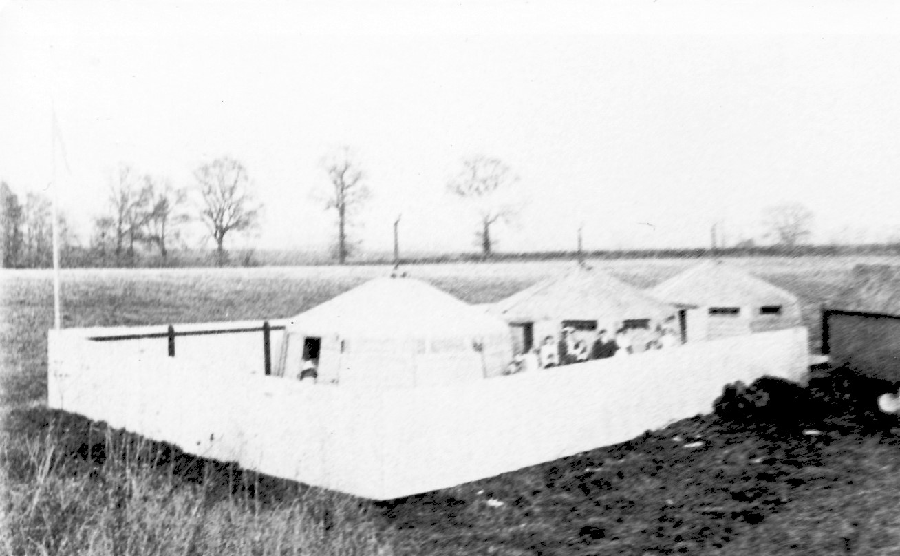
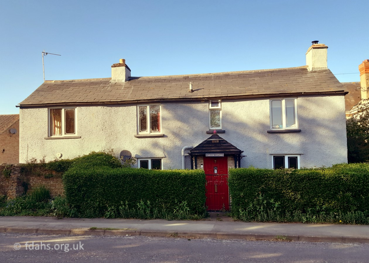
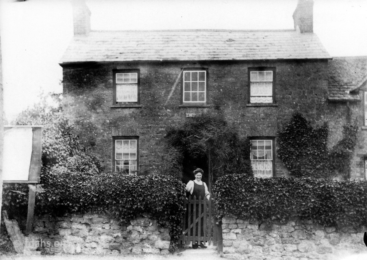
Not an old photo but this has been here a few hundred years.1905. A clear view all the way to the Folly from the fields below the lay-by. Back then the town was largely confined to the area left of the photo. No sprawling housing estates.c1900. A tented isolation hospital erected as a Scarlet Fever Unit in a field on the left of Highworth Road about where Westland Road is today.Fairview Cottage. Not an old photo but worth saying that there were no houses on Highworth Road other than a few widely spaced farmhouses like this one.
Coxwell Road/Street
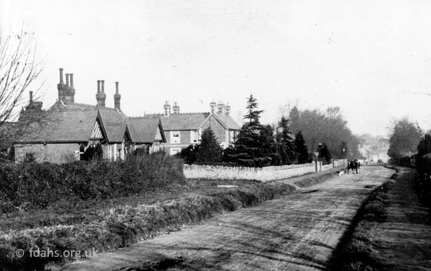
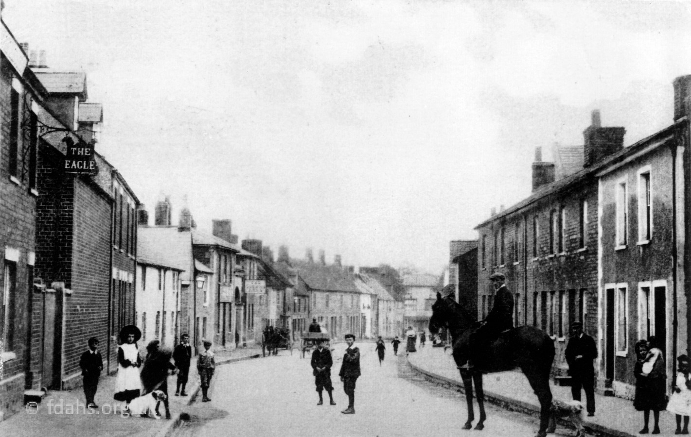
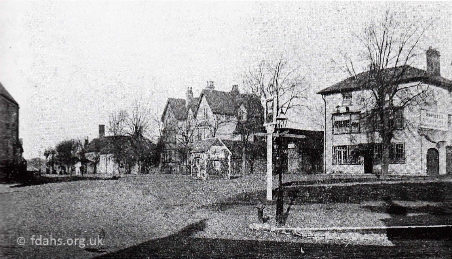
c1910. The old police house, opposite the entrance to what later became a service station and now Clock Tower Court.c1905. Faringdon Cottage Hospital on the left of Coxwell Road looking towards town. It later became the Health Centre and then private flats.c.1910. Further down, now on Coxwell Street, the Eagle is on the left. The Queens Arms is half way down and The Gardeners Arms is further down near the bottom of the street.c1910. The crossroads at the bottom end of Coxwell Street. On the left is the Methodist Church, then the Duke of York. The White Hart is across the road.
Gravel Walk
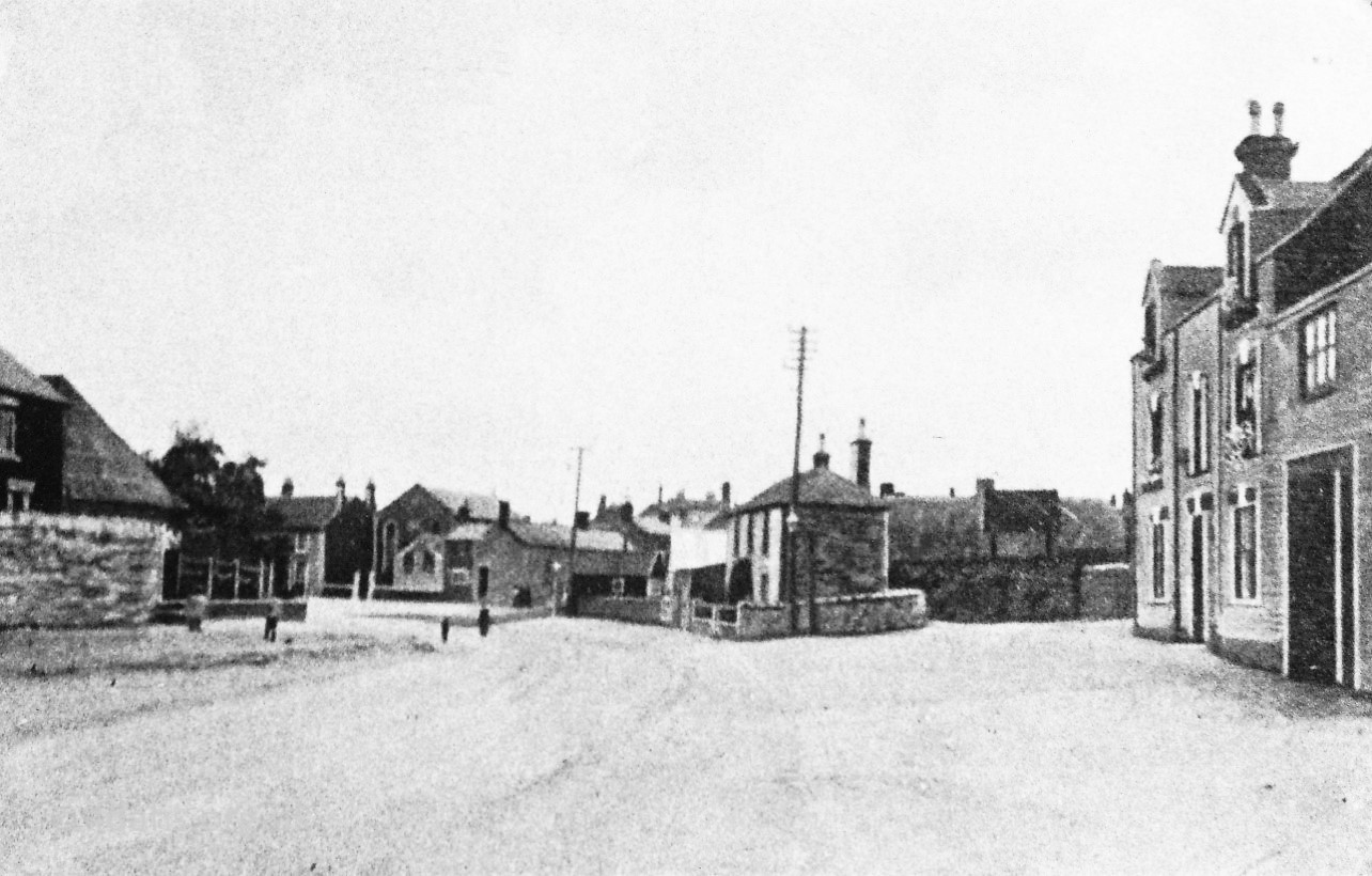
1910. The White Hart is now private flats. The public weigh-bridge and small buildings next door have been replaced with a similar block of flats.
Lechlade Road
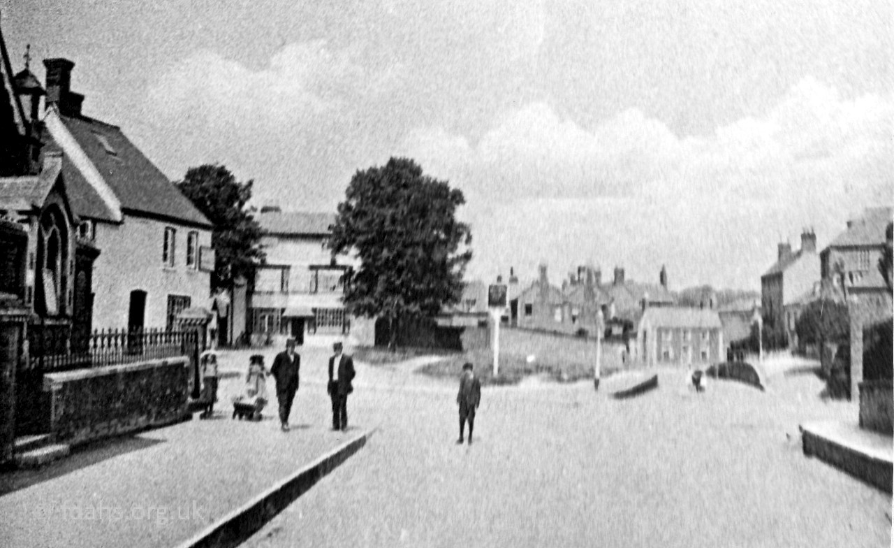
c1910. Looking towards the junction with Gloucester Street and Gravel Walk. Duke of Wellington on the right. Blind Alley is between the house and the hedge. The white roof is a carpenter’s workshop with saw pit inside and the black building is blacksmith’s shop – both demolished – now Aunties Emporium.
Gloucester Street
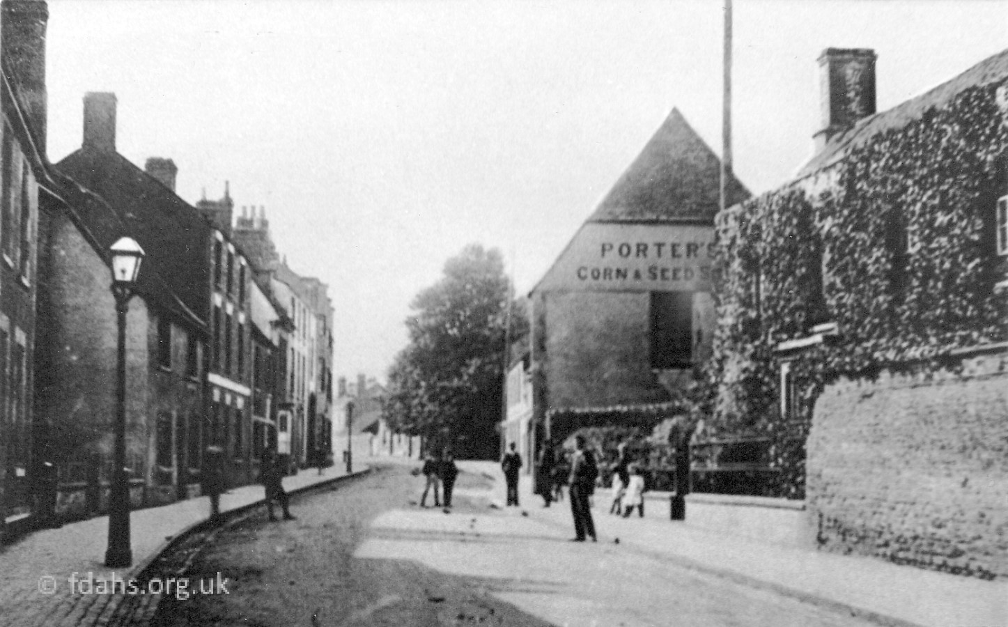
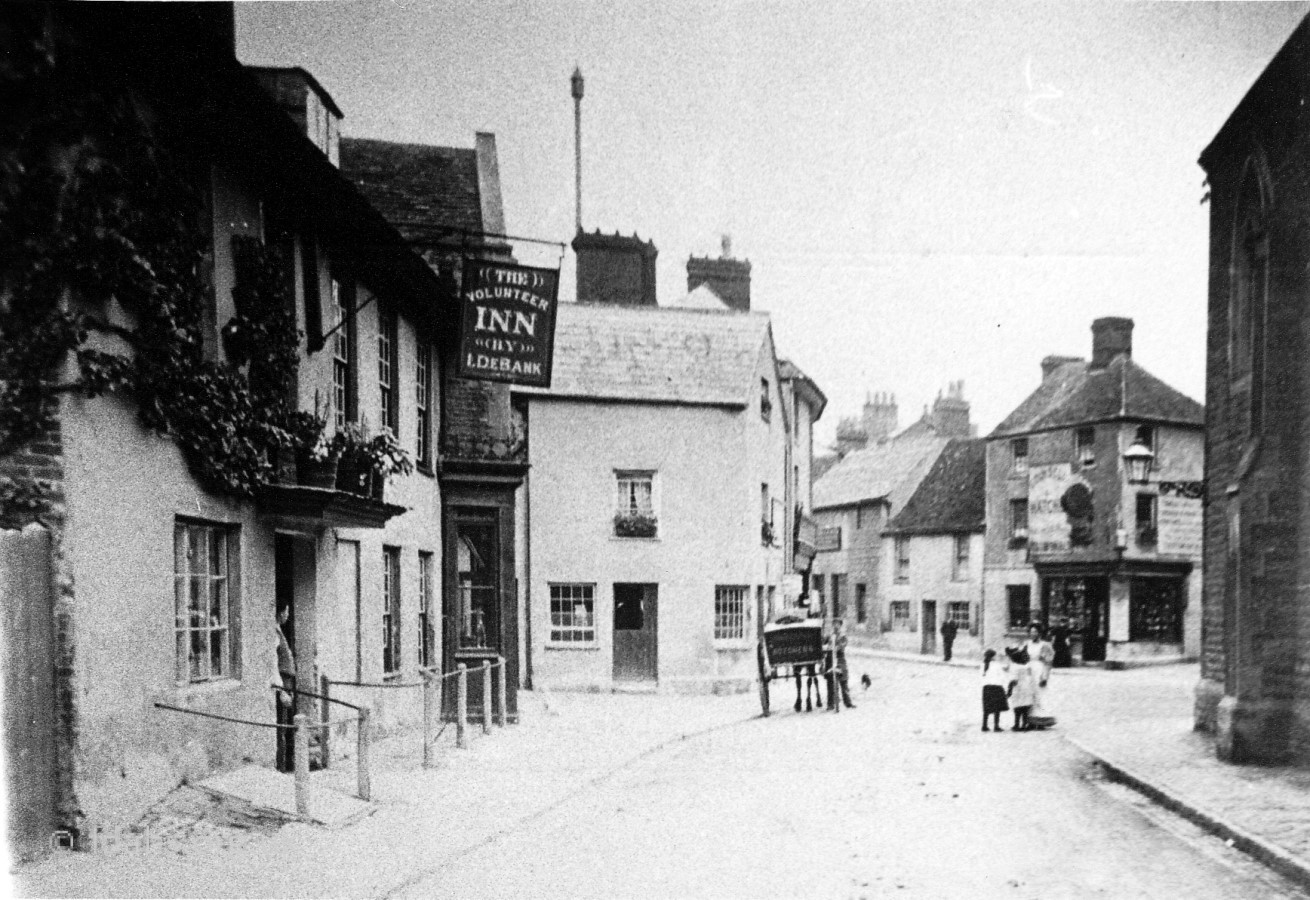
c1910. The top of Gloucester Street looking towards the town centre. On the left is the entrance to Parsonage Lane, Pound Close, and College Row, which no longer exist.c1910. The middle of Gloucester Street. Behind the tree and off photo is now the library. Under the tree is Elmside and the larger building further down was Porter’s Corn & Seed Store.Early 1900s. Looking back up the street, on the right is Porter’s Corn & Seed Store. The ivy covered house is Gloucester House, thought to once have been a farm house.1898. At the bottom of the street looking towards the Corn Market just past some old barns and cottages is the Volunteer Inn on the left and the Corn Exchange on the right.
Corn Market
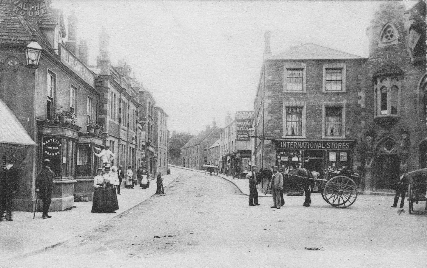
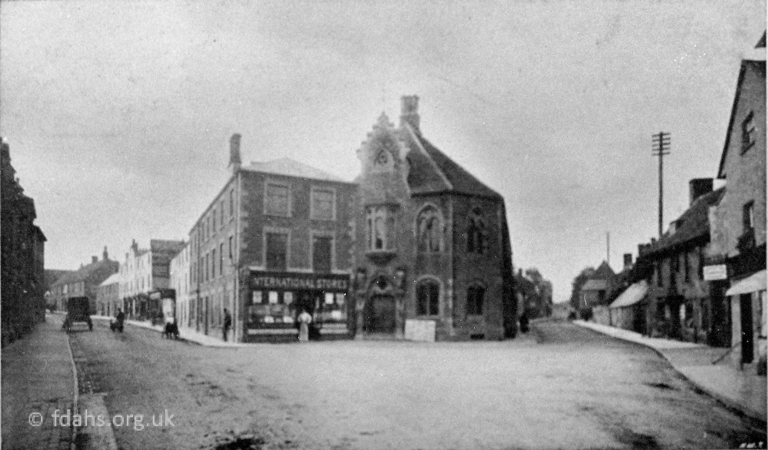
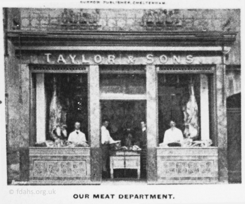
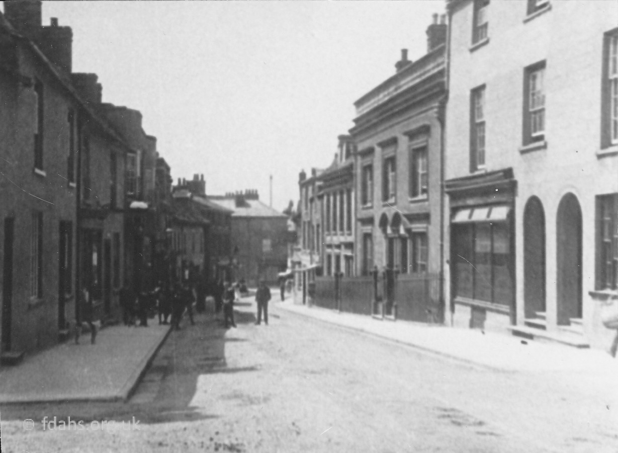
c1911 The practically deserted streets of the Corn Market.1904. On the left is #3 the Red Lion. The International Stores #4 faces the Corn Market. The Corn Exchange #5 can be seen on the right.1910. Taylor & Sons, at #1, a fishmonger’s shop in the Narrows at the beginning of Corn Market.1910. Mr Taylor also had a butcher’s shop & slaughter house at #6, next to the Volunteer Inn in Gloucester Street.
Marlborough Street
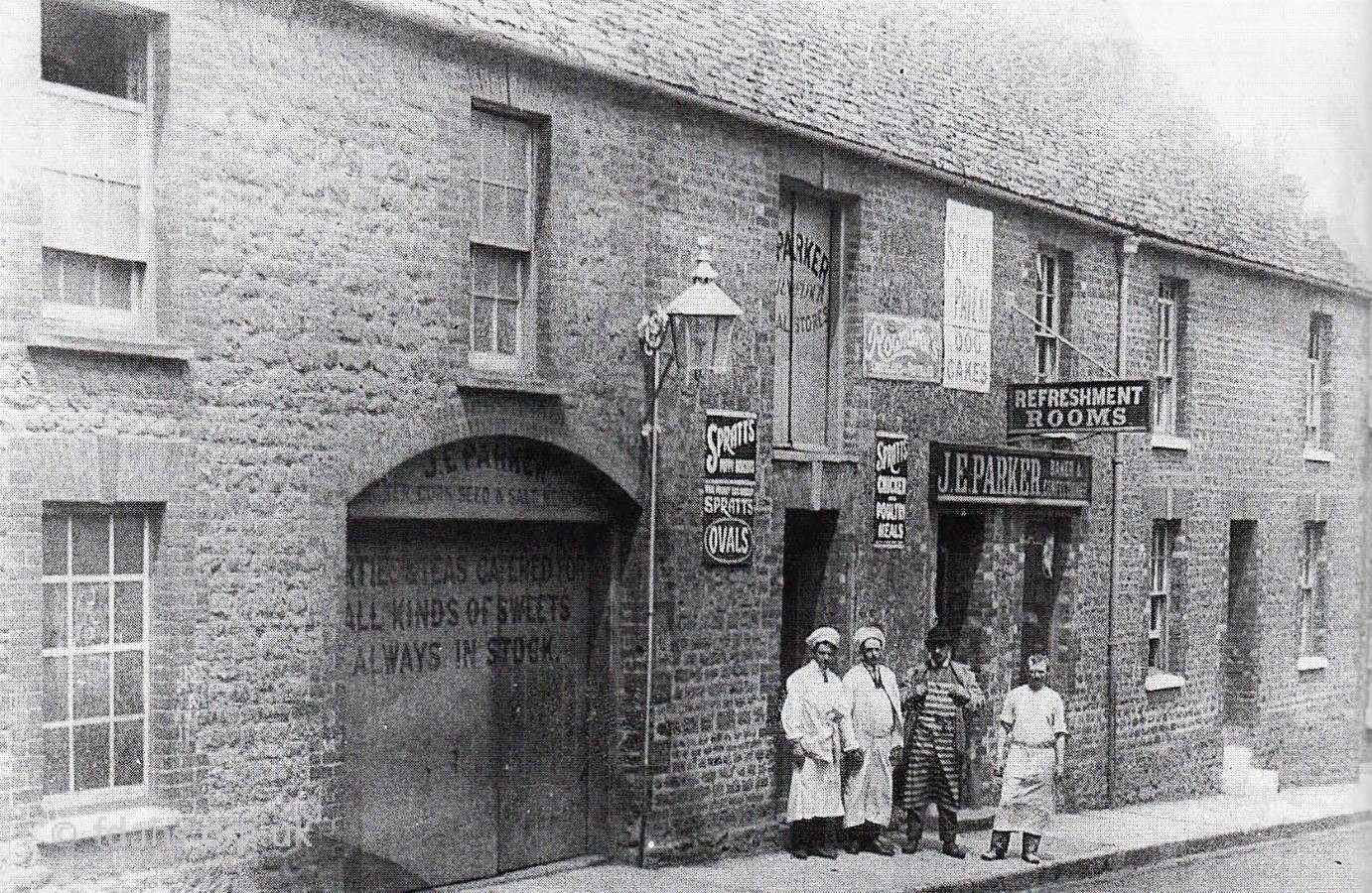
1890’s. Arthur’s Hill looking back down Marlborough Street towards Cornmarket. On the left off photo is a corner garage.1902. Next to the corner garage is ‘Buffer’ Foard’s grocery shop. The gated entrance through to back of shops later became a takeaway shop.A bit further down is Mr Parker’s Corn Stores, Tea Rooms and shop in Marlborough Street. Now all demolished to build the new police station.c1908. Further down towards Corn Market. On the right is the wall bordering the Congregational Chapel, which is now the Roman Catholic Church.
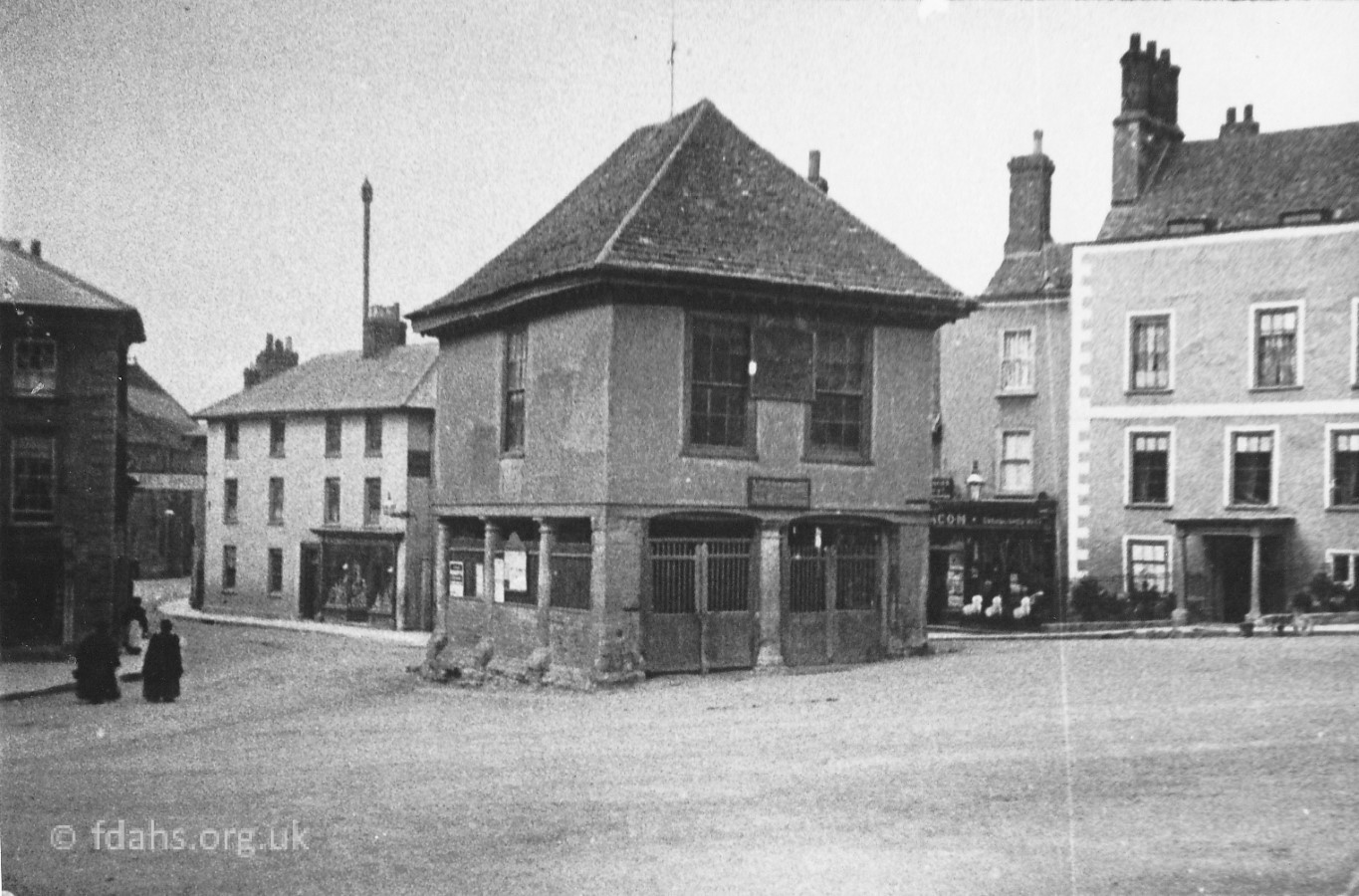
Market Place
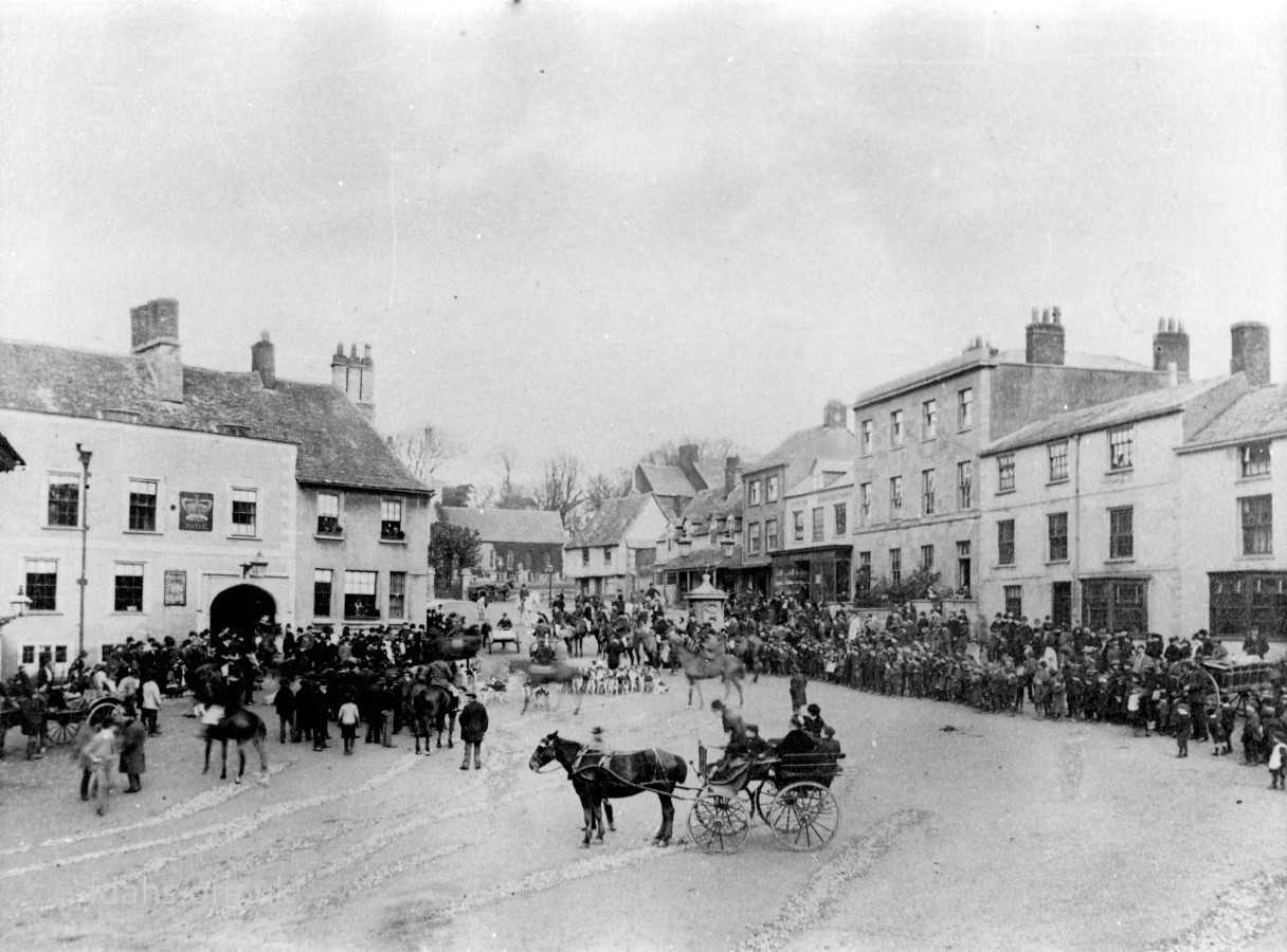
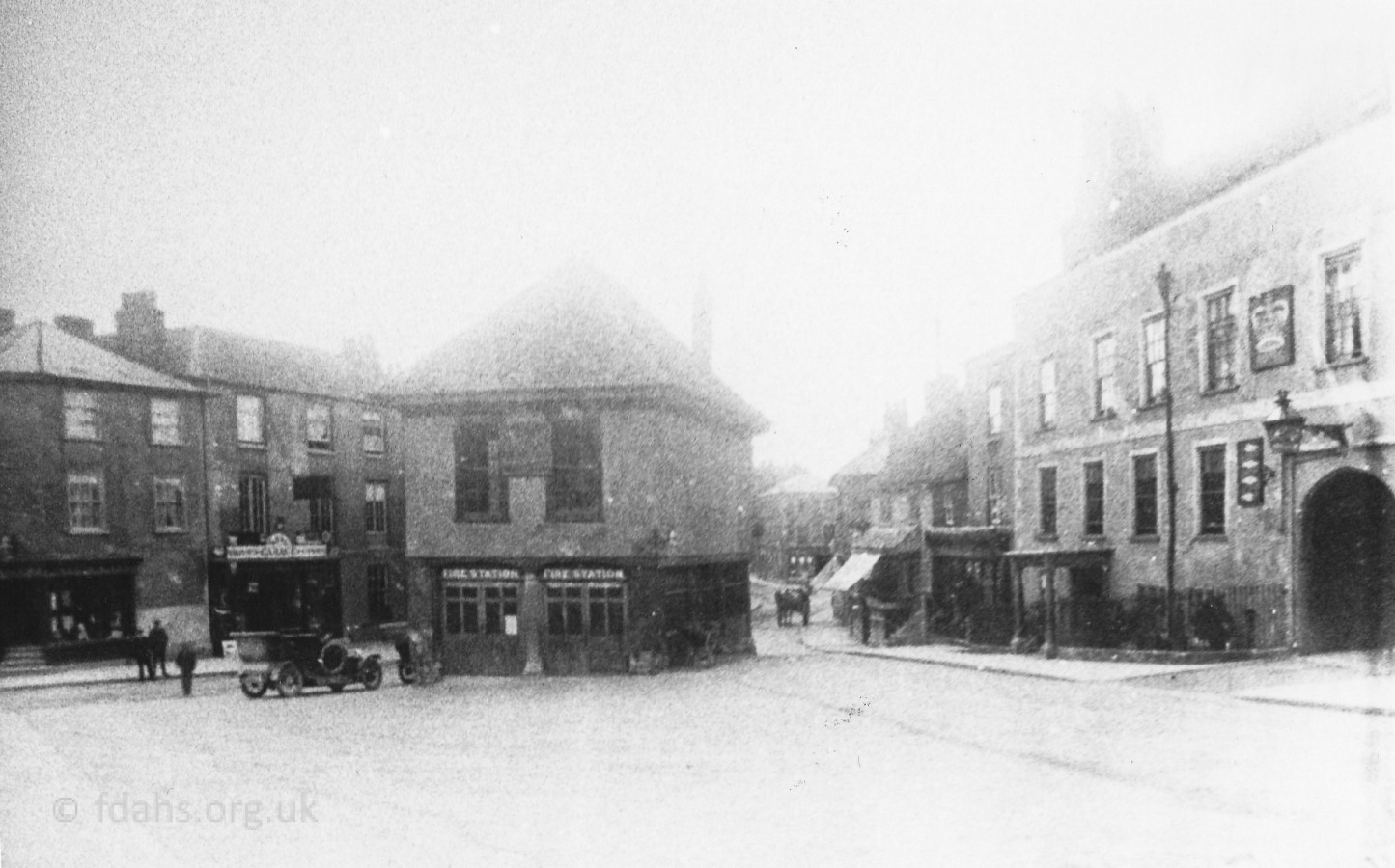
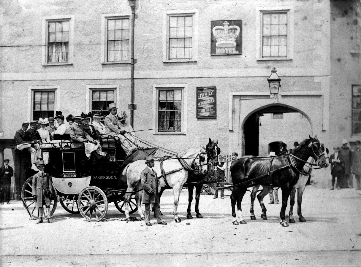
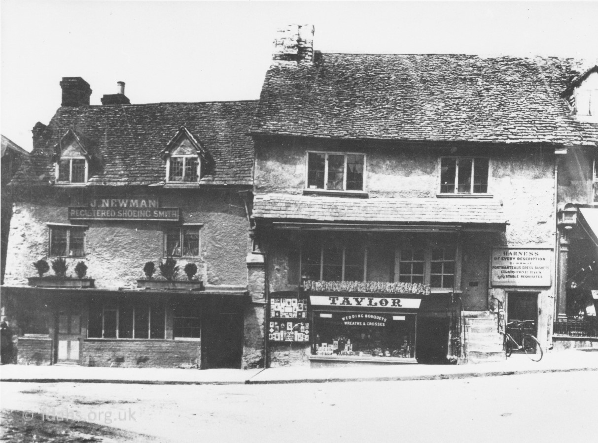
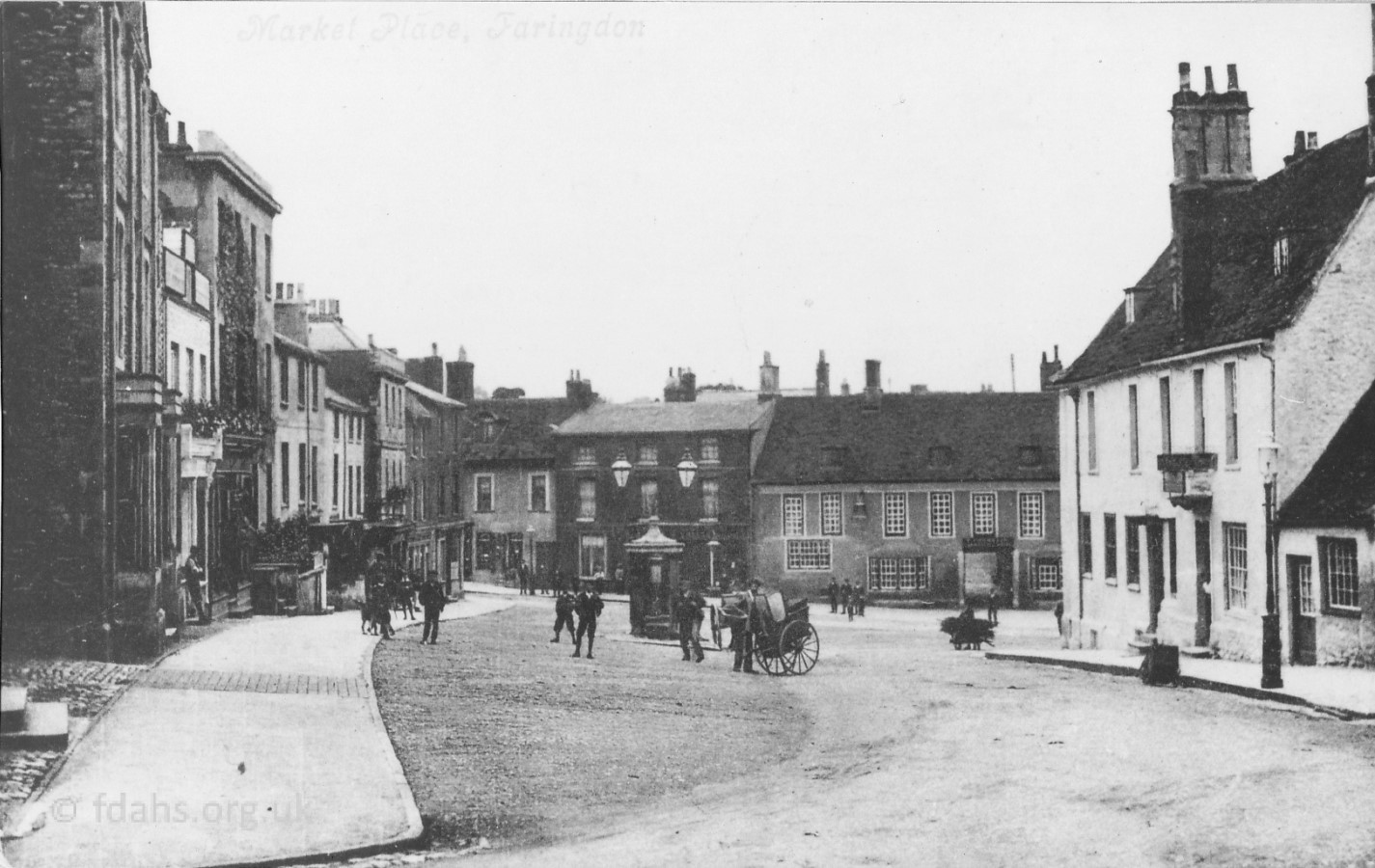
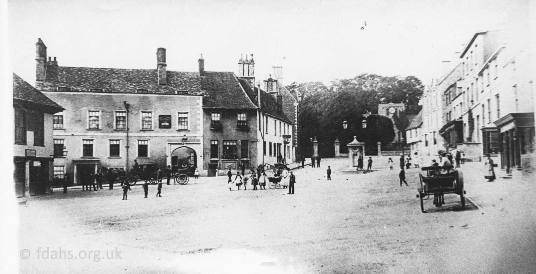
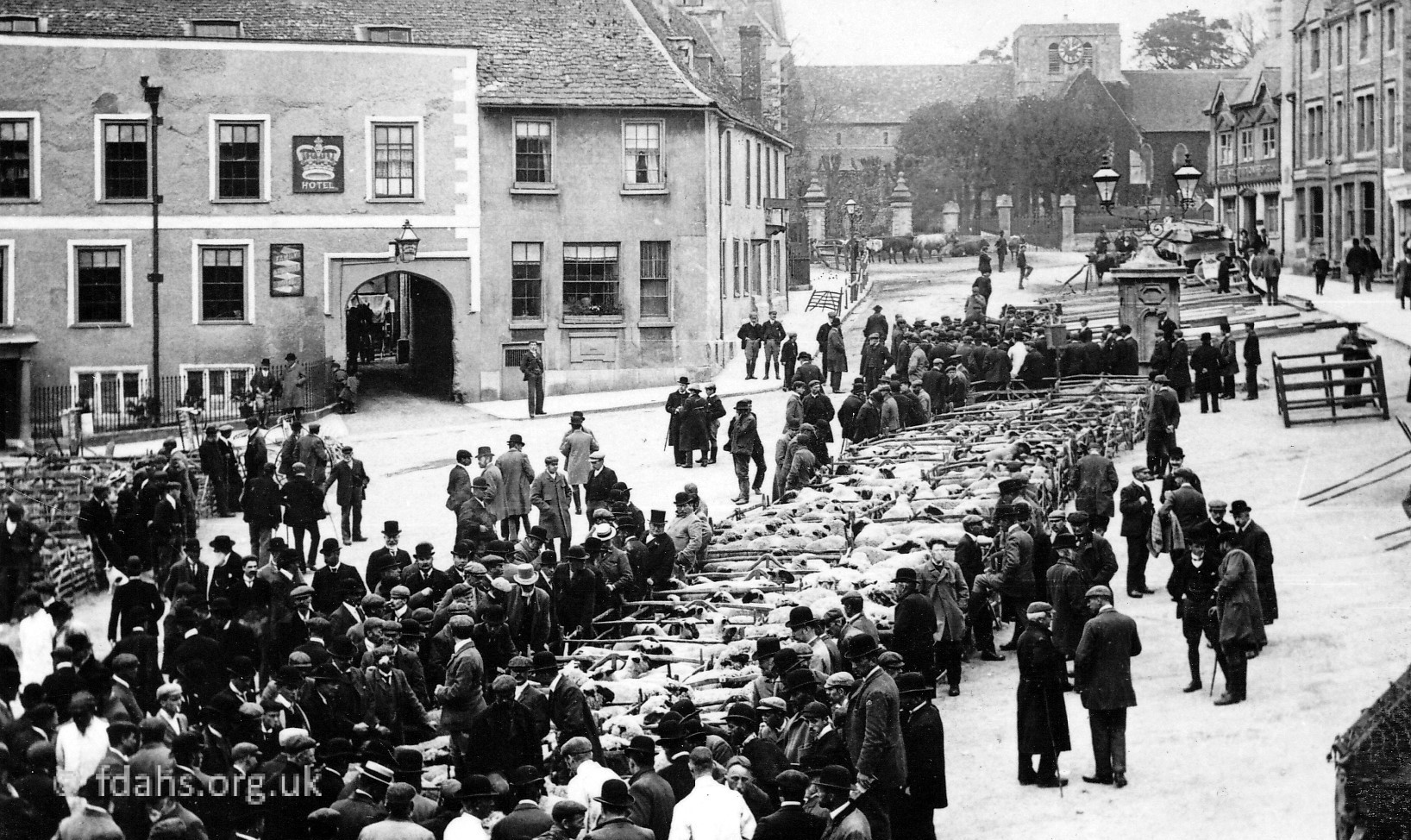
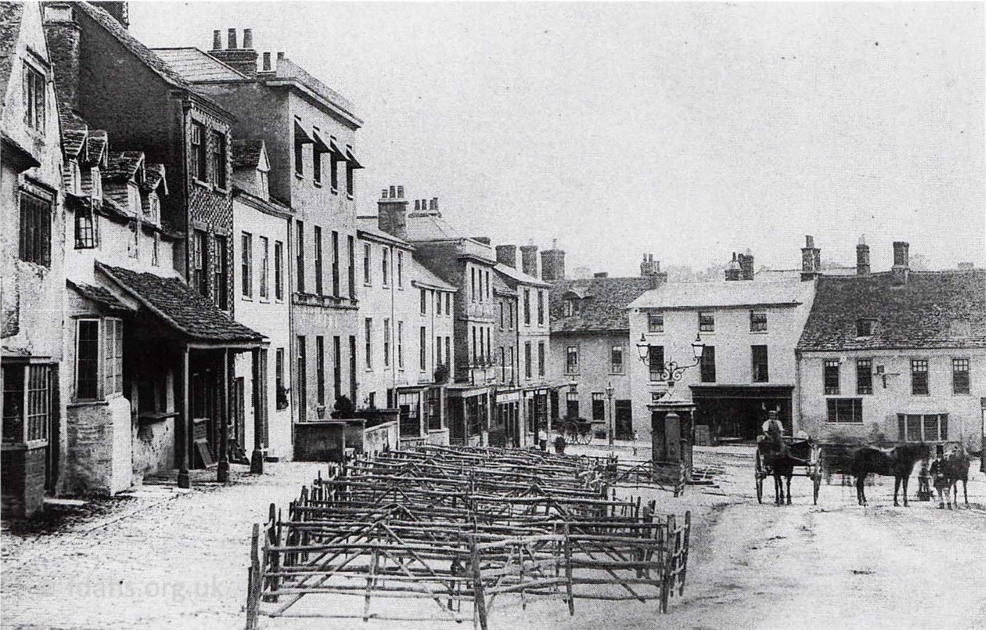
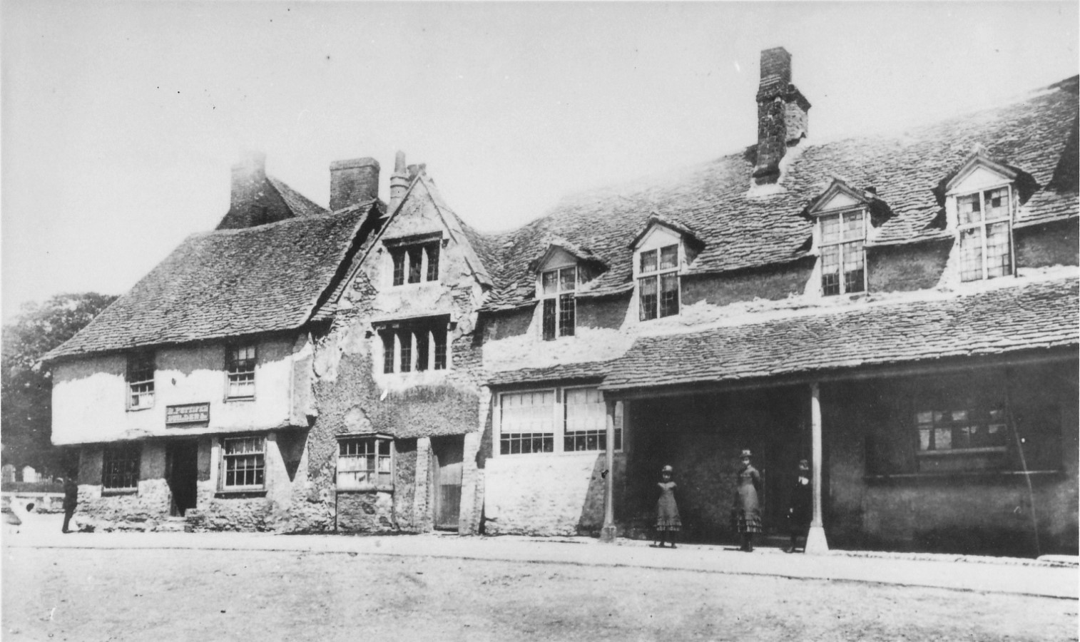
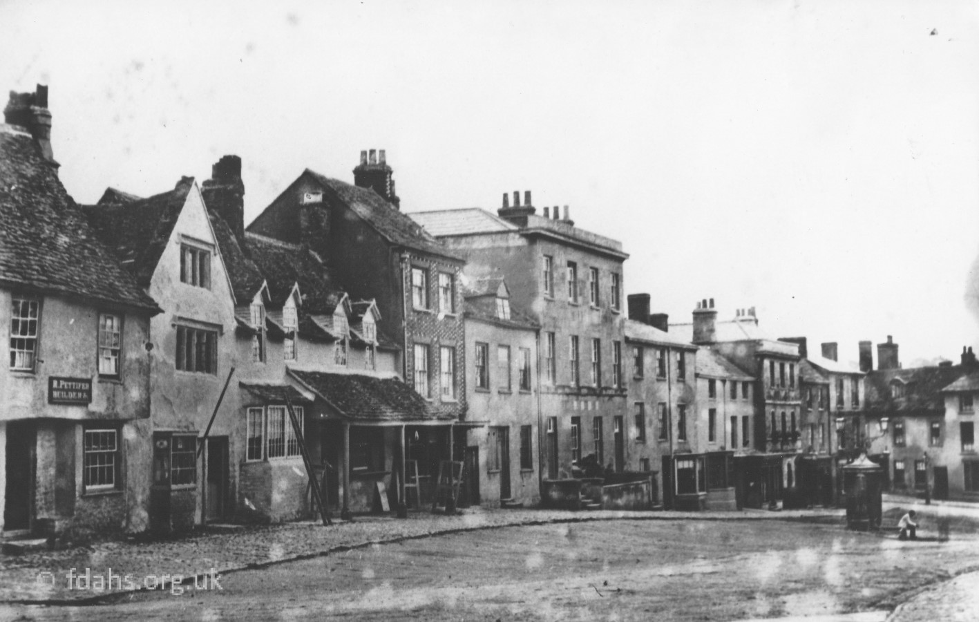
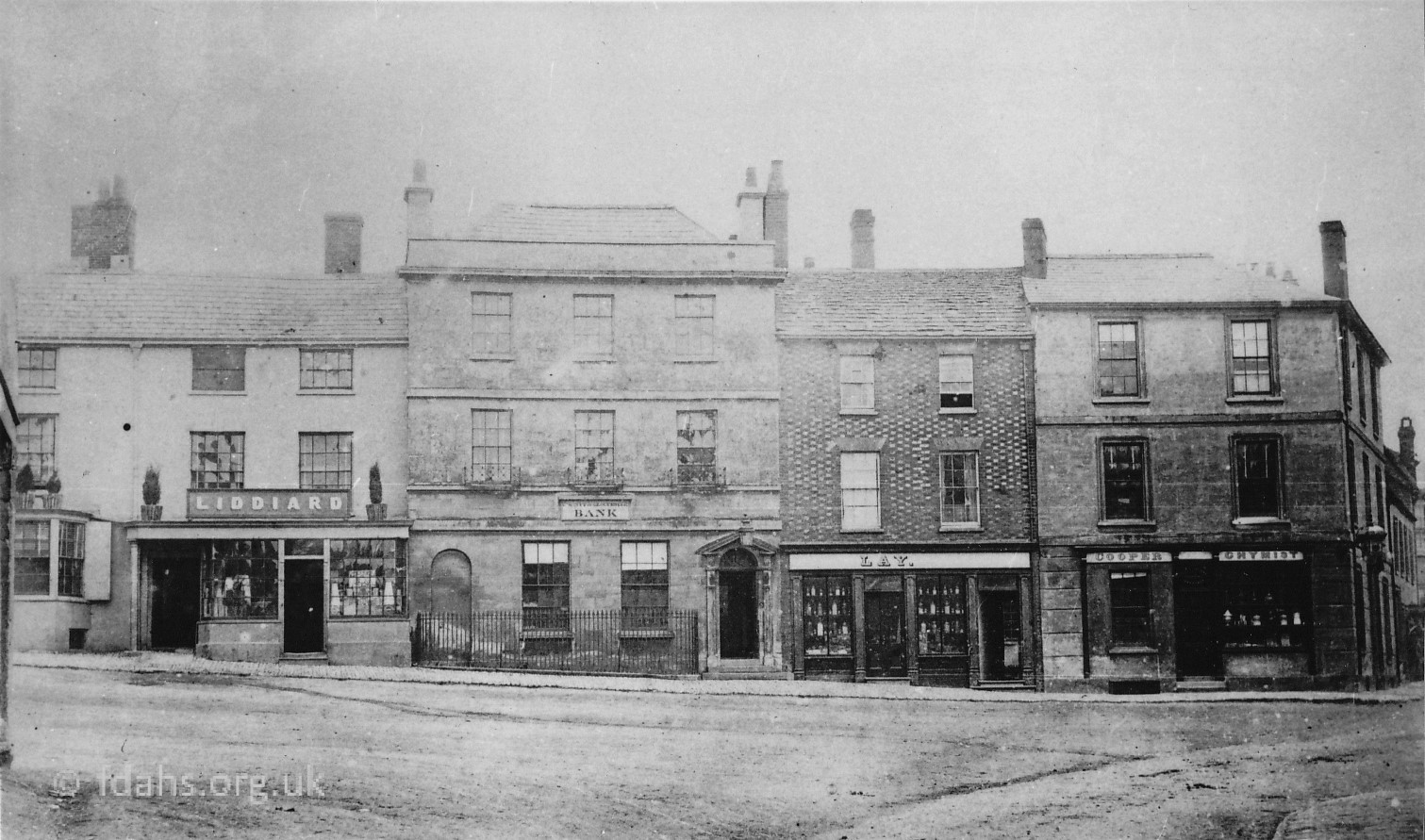
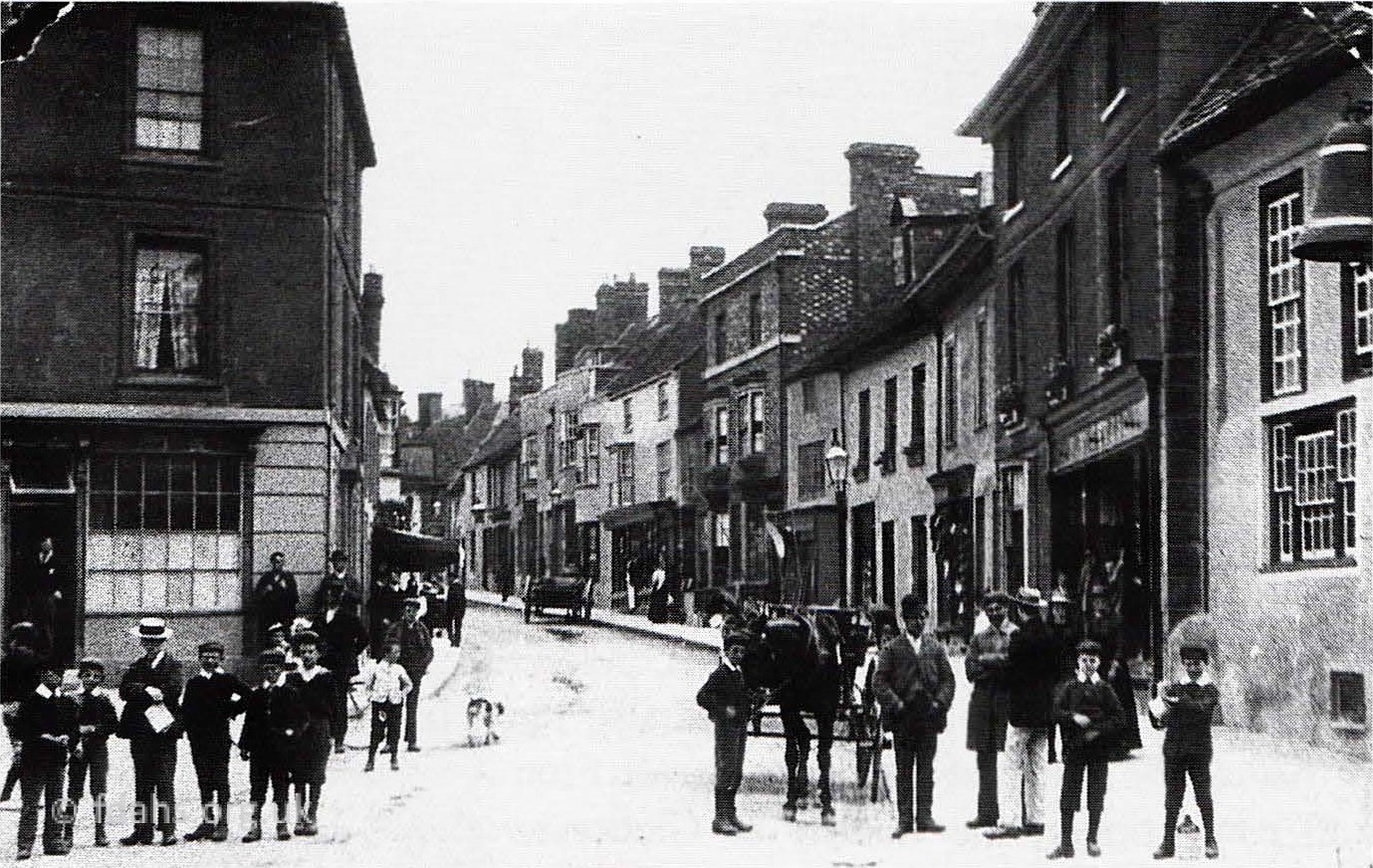
1881. Fox hunters on horseback with their hounds used to meet in the Market Place on Boxing Day, drawing large crowds.1900s. The Fire Station was housed in the Market Hall. Ann’s Garage to the left, which moved across the road in 1910. There were very few cars around at this time.c1910 – Hooper Deacon was a horse dealer in Swindon & would supply transport. This was a trip to Abingdon calling at Faringdon, Southmoor & Marcham. Fare £5 for outside, extra for inside.1910’s The Market Hall being used by the firemen but not yet outfitted with the ladder, net or bell.c1908. On the left, dated 1645, Joseph Newman, blacksmith since 1877. His forge was at the rear. Next door is Taylor’s, a greengrocer’s.1911. An early traffic jam in the Market Place. Foreign military attaches and Prime Minister, Mr Asquith, came to Faringdon to observe Army manoeuvres.c1890’s. Faringdon Market Place looking from the church.c.1890’s Market Place looking towards the church. On the left is the Town Hall with a board bearing the arms of George III between the windows.1904. Sheep pens in the Market Place1880. Faringdon Market Place with empty pens ready for market. Notice the gas lamps on the Portwell and the London Street junction.1880’s. Top, east side of Market Place before demolition in 1890 when the Salutation Hotel was built. Three old shops – Pettifer, the builder’s, a barber’s, and a sweet shop were here at this time.1880s. Looking from the church down, the top, east side of the Market Place again starting with the same three buildings that were later demolished.1880s. Bottom, east side of Market Place. From the left is George Ernest, grocer and bacon curer; Liddiard, grocer; County of Gloucester Bank; Lay, baker and confectioner; Cooper, Chymist.
Church Street
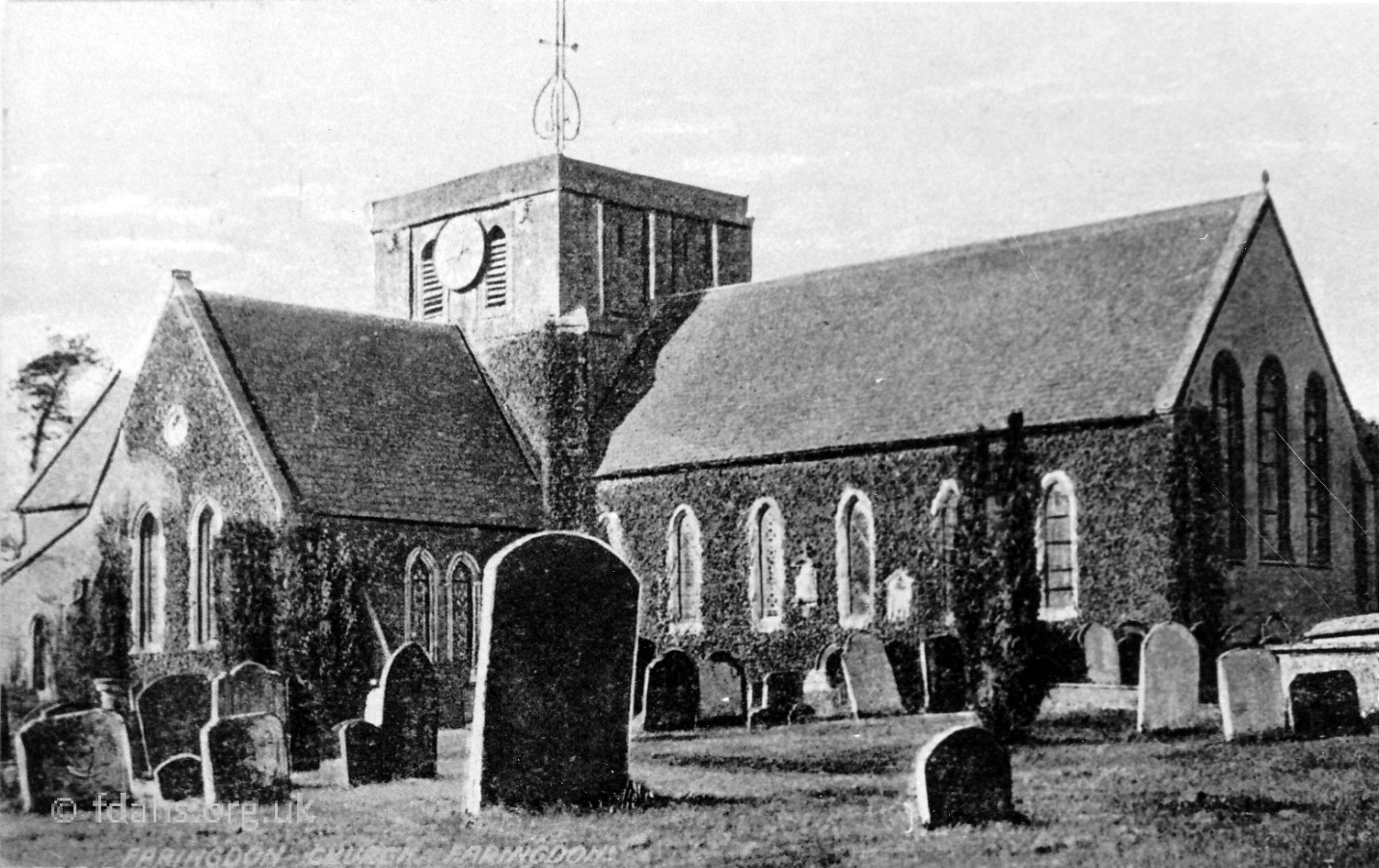
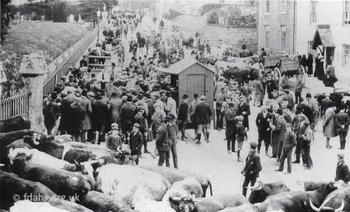
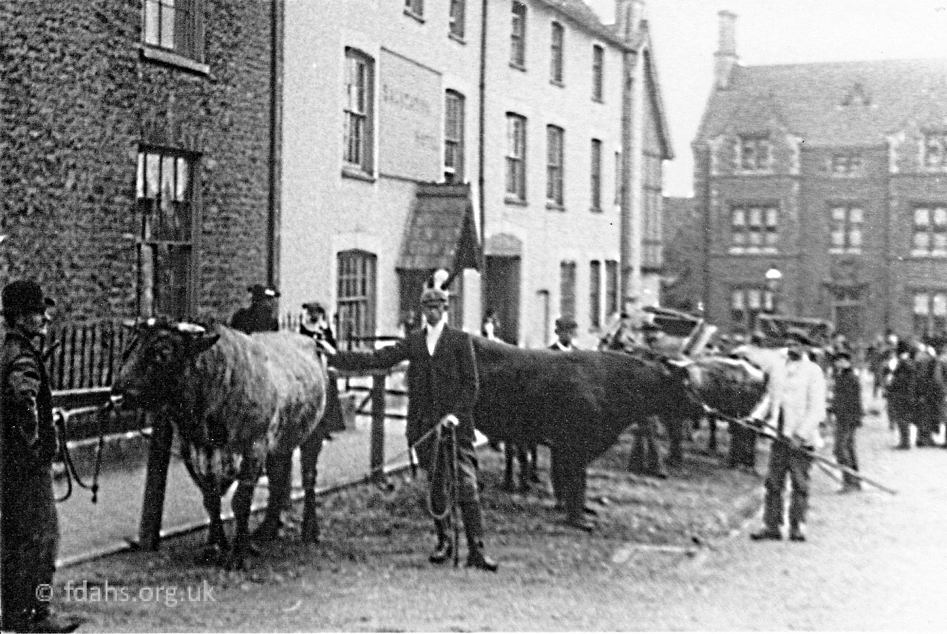
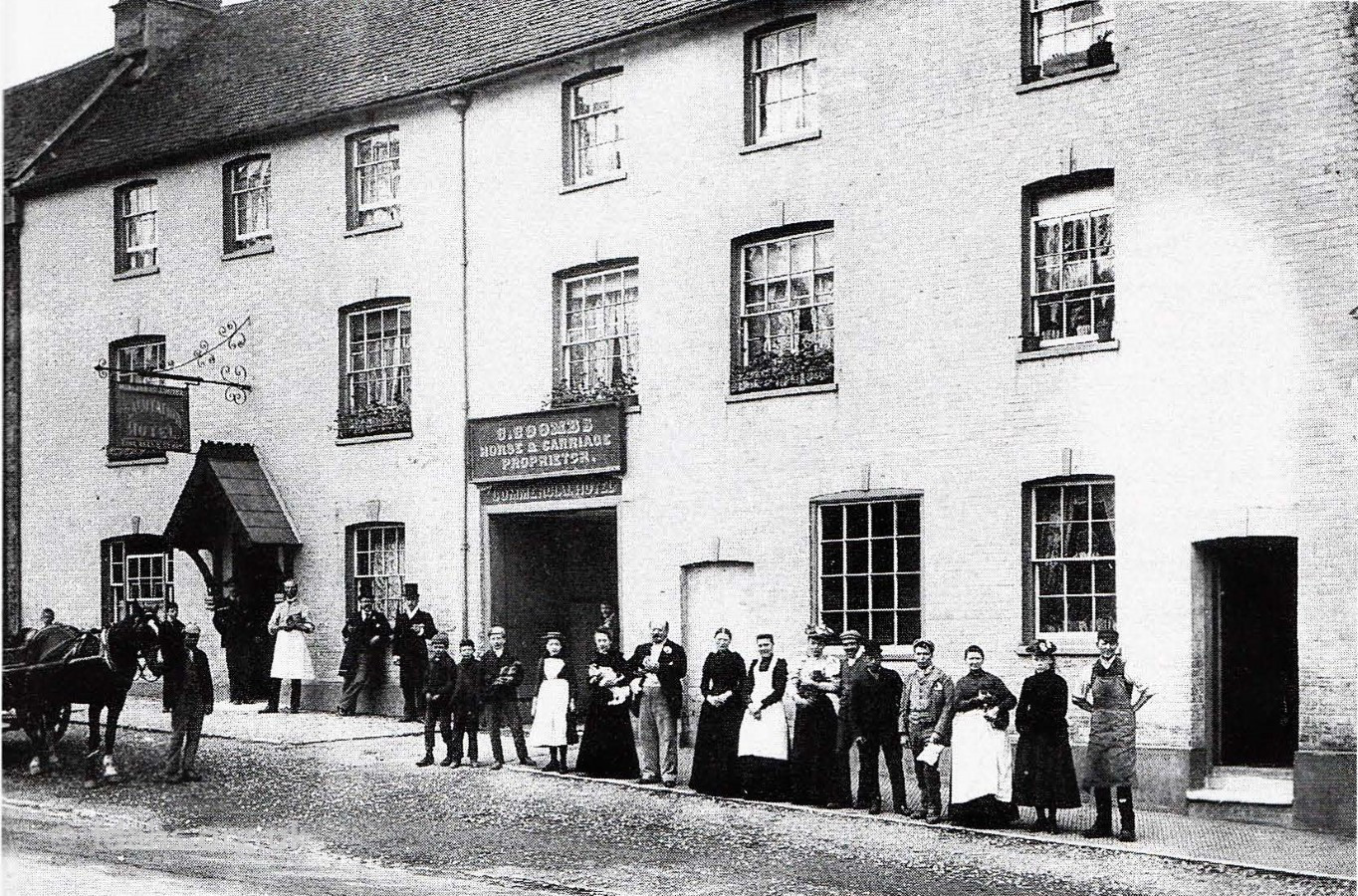
1906. All Saints Church built on the site of earlier buildings of the Saxon and Norman period. Parts of the church date from the 12th and 13th Century.1904. Faringdon Market. Milk cattle were enclosed near the Church gates while the dry and store cattle were tethered to rings in the wall further along.1900s. Faringdon Market. Bulls were tethered opposite the church beyond the Salutation Hotel.c1898. Proprietor, family & staff of the Salutation Hotel
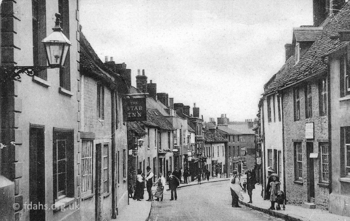
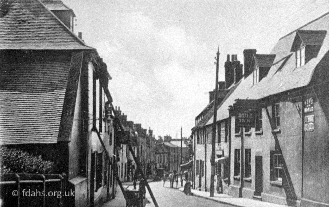
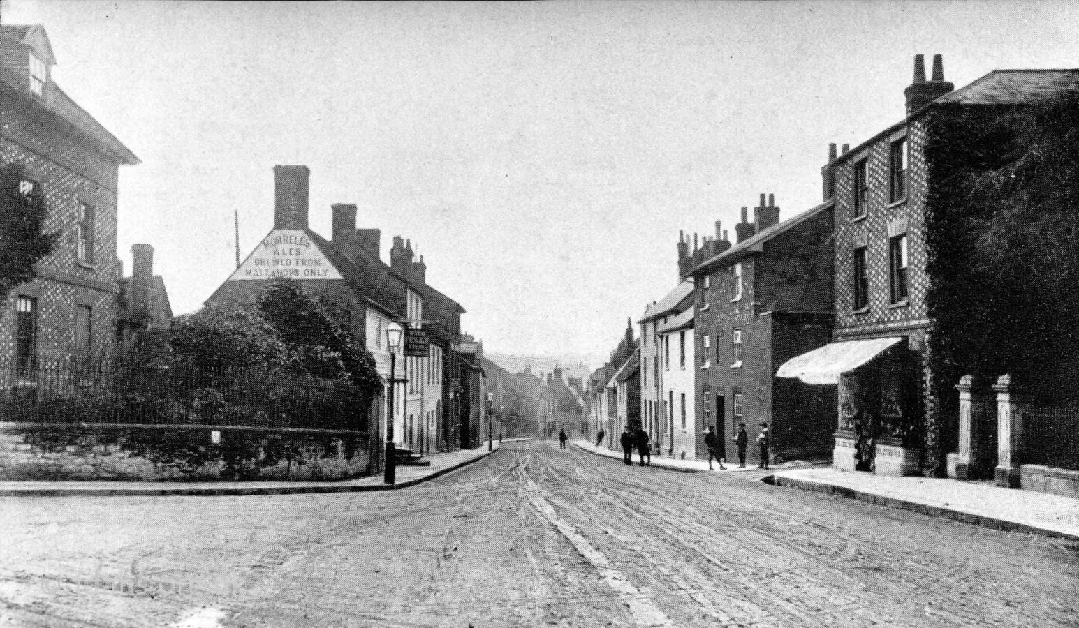
London Street
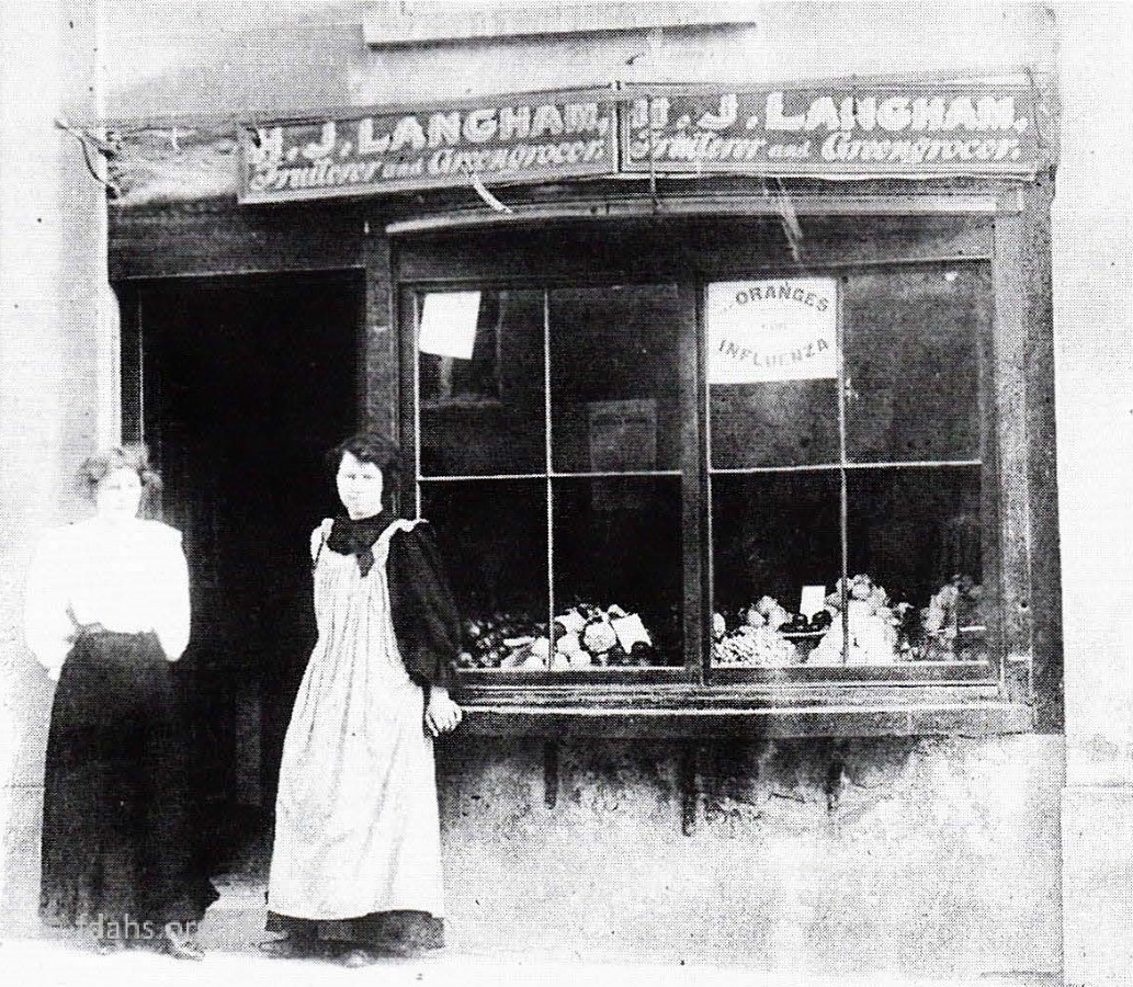
1910.Start of London Street. Possibly a market day because of the number of people around.c1912. Looking back from the corner of Skinners Lane looking back down London Street.1909. On the corner of Skinners Lane. Mrs H.J. Langham with her daughter Elizabeth outside the family’s greengrocer shop.1900s.Half way up and looking back is the Star Inn on the left.1900s. The Bull Inn is on the right opposite the Star Inn.Further up the street on the corner of Coach Lane, George Ernest Eastoe and his wife Alice are standing in the doorway of their grocery shop. They sold up in 1926 and it continued as a grocery shop until 1971.c1910. Looking back from the corner of Stanford Road. The Folly public house is on the left by the gas lamp and Eastoe grocers is under the awning across the road.