Radcot was once an important village and crossing on the River Thames, which formed the border between the Saxon kingdoms of Wessex and Mercia (and later between Berkshire and Oxfordshire). Rocote or Rodecot (Radcot) meaning “cottage by the road” is mentioned in the 1086 Domesday Book as a two family unit with 24 acres of farmland, owned by King William (the Norman conqueror) and managed by Alsi de Ferendone. Alsige or Aelfsige, as the name was normally written, was a favoured and very wealthy Saxon with other holdings that he was allowed to keep at Great Barrington and Windrush in valuable Cotswold wool country and he also had or gained many other properties elsewhere. The original hamlet and wharf at Radcot, containing 35 houses in 1086 and 10 houses in 1870 has otherwise slowly disappeared. All that remains today is a manor house, a farm and a pub. Having said that, there is still a lot to be recorded here about Radcot.
Radcot Bridge
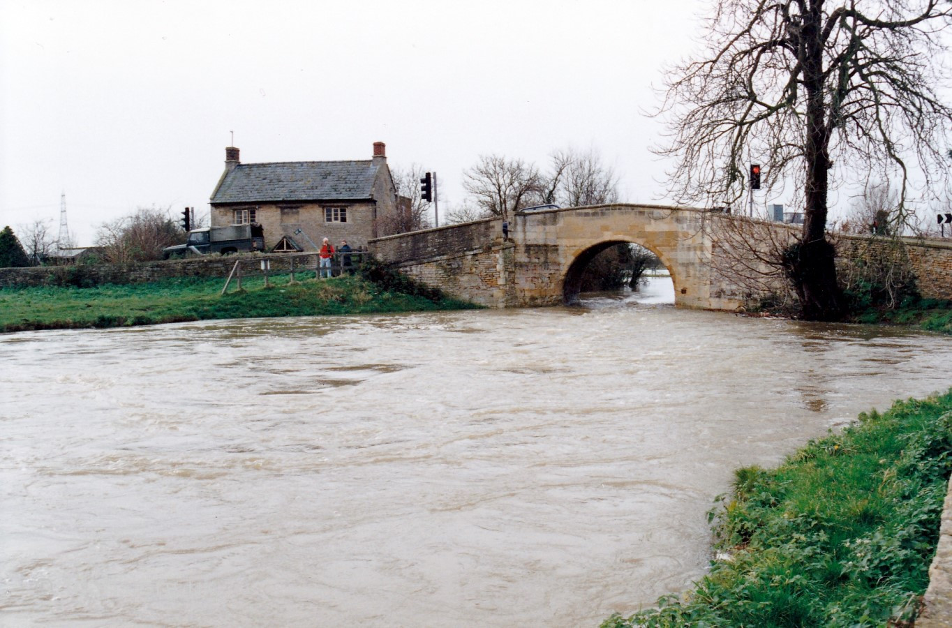
 When travelling from Faringdon, passing the cross-road to Pidnell Farm and Pidnell Cottages, first there are two low stone bridges over small brooks then three large ones which span the River Thames. The early 13th century Radcot Bridge (Grade II Listed) is the first large bridge of the three that you come to.
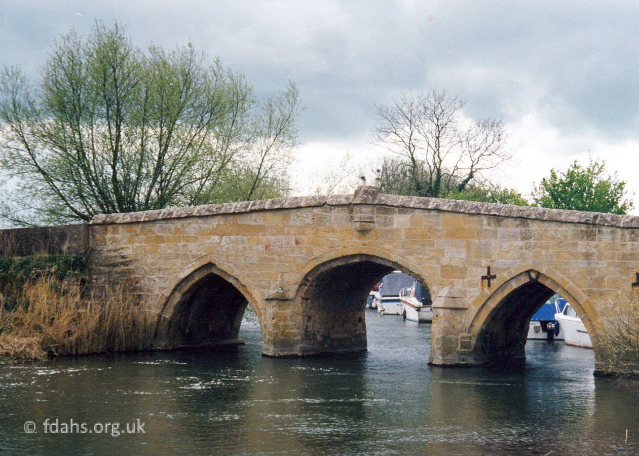
Pottery finds suggest a substantial Romano-British presence at Radcot, but the settlement was apparently abandoned in the post-Roman period until reoccupation in the mid 11th century. Back in the days of the Saxons (410 to 1066) the River Temes formed the border between the kingdoms of Wessex in the south and Mercia to the north, so there may well have been a bridge or bridges at this site during that time. The river in this area was much smaller than it is today, even more prone to seasonal flooding and surrounded by swamp in many places until a system of proper locks was created during the 18th century to improve navigation. It is thought possible that Radcot may be the site of the stone bridge mentioned in a grant of land made by King Eadwig to the Thegn (Lord) Eadric in 958. The Saxons were not well-known for building in stone so it, or at least its foundations, with repairs probably made using wood, may well have been there since Roman times. The earliest definite recorded evidence of a bridge and causeway crossing the River Thames at Radcot appears in the 1086 Domesday Book. Aelfsige of Faringdon had created an embanked causeway across the floodplain, most likely linked by timber bridges across the river’s various branches and side channels. Later, the Cistercian monks of St Mary at Cîteaux in Normandy were granted land by King John for the purpose of building a stone bridge across the river, which was completed in 1225 and therefore it is said to be the oldest existing bridge on the river; parts of it still exist today. The stone that was used came from Taynton near Burford and was considered to be amongst the finest available. At that time, the river marked the border between the counties of Berkshire and Oxfordshire (before the changes in 1974) and Radcot Bridge would have been an important crossing point, especially as it was the only major crossing all the way up-river from Oxford.
(A little later, in about 1229, a multiple arched stone bridge was also erected 4 miles to the west by the priory of St. John the Baptist, just beyond where the Thames is joined upriver by the River Cole and the River Leach at Lechlade in Gloucestershire. It wasn’t until around the 15th Century, when a new bridge, called Newbridge, was built 8 miles to the east where the Thames is joined by the Windrush. It was built identical in design but larger than Radcot Bridge. Tadpole Bridge, a single arch stone bridge built in between at Buckland Marsh and where there was once a wharf and a weir, dates from the late 18th century. All these bridges have needed repairs or reconstruction over the subsequent years.)
 Radcot Bridge had to be reconstructed in 1393 following its partial destruction in 1387 during a battle fought and won against troops loyal to the young, wildly extravagant and increasingly unpopular Richard II. One contrary record suggests that the royalist Robert de Vere attempted to escape across the bridge, but found it had been broken down and eventually was forced to swim with his horse across the stream to the imminent peril of his life. His armour was found and he was presumed drowned, though he later turned up in France.
The bridge was again severely damaged during the Wars of the Roses (1455-1485) and the central arch was later rebuilt as it appears today.
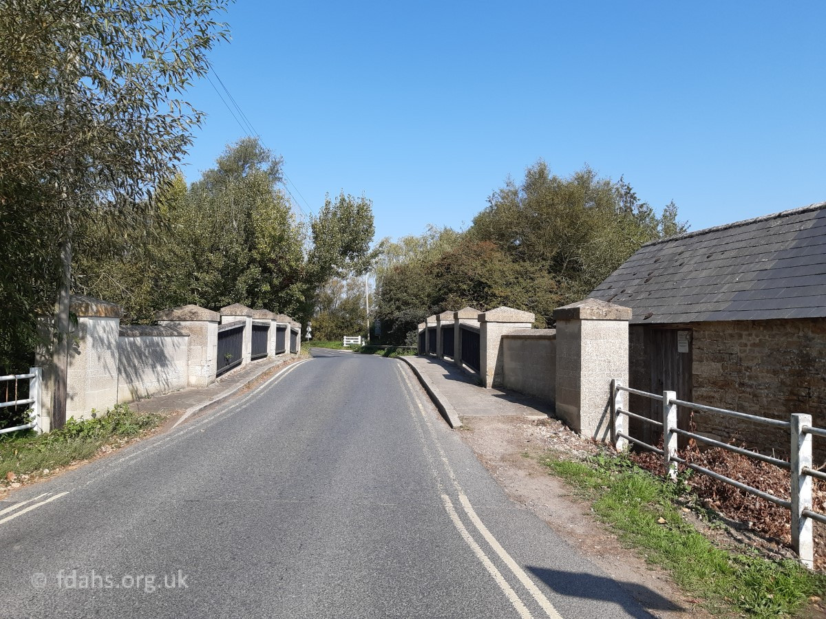
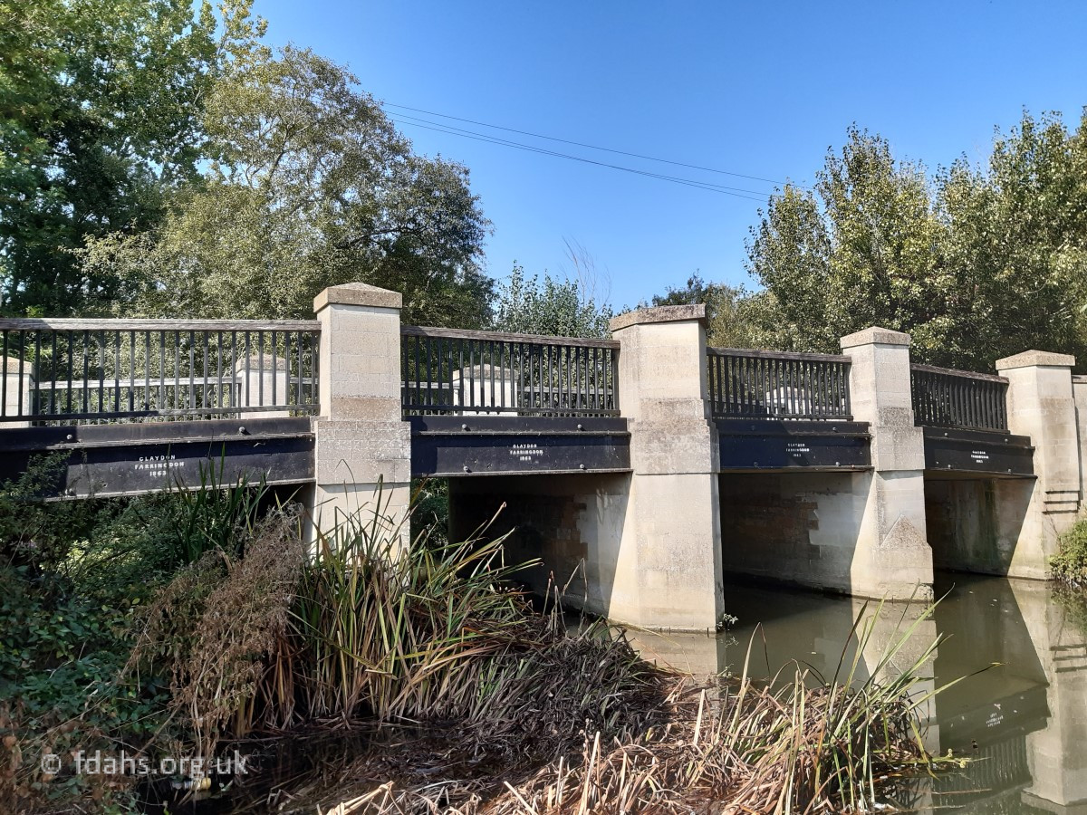
Radcot Canal Bridge
The road continues across a narrow island to a second channel of the river.
The bridge was once described by Thomas Baskerville in 1692 as having two arches (now just the one) and built with stone. It later fell into disrepair and was replaced with wood. In 1770 the road, previously maintained by the parish was taken over and vastly improved by a turnpike company. During the 1780s, the Thames was connected to the Severn by a canal and trade with Wales, especially coal, was booming. So in 1787 this channel or canal was widened to become the main route for navigation, a new stone bridge with one wide arch was built, and a toll was charged to cross it.
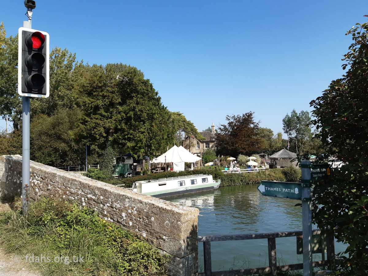
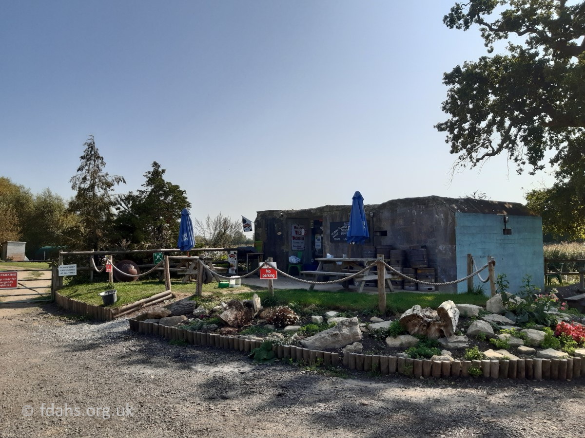
The first photo was taken in 2020 looking back downstream at the Swan from the left-hand traffic light shown in the main photo above. Since around the 1990s road traffic over the two bridges has been controlled by traffic lights. The National Trails Thames Path crosses the river at this bridge, the gate for going downstream can be seen on the bottom right. Opposite the Swan and shown in the second photo, is an old World War II pillbox now surrounded by a car park and converted to a cafe and camp-site office, quite possibly the only one that has been put into use today.

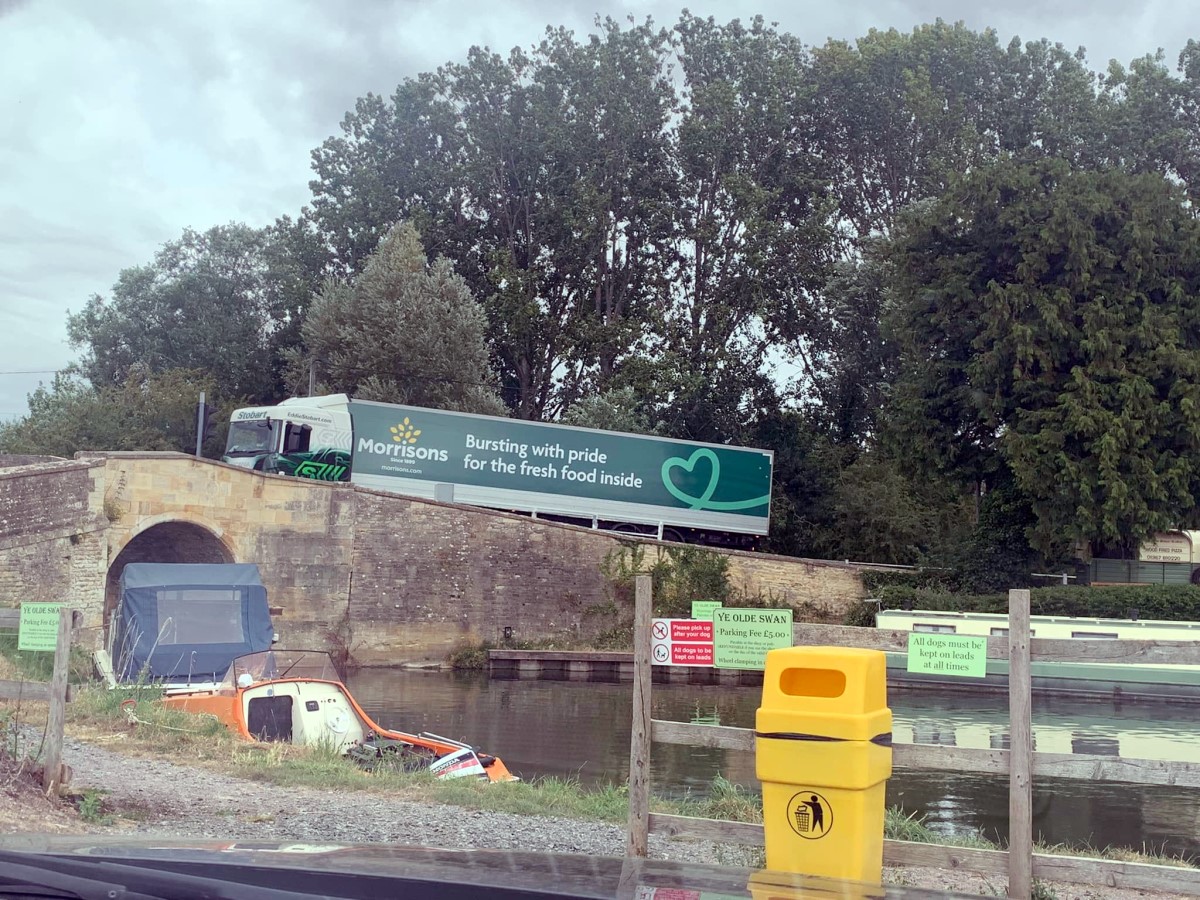
A closer look at the bridge shows evidence of one of many repairs that have been required in previous years. The problem continues even more frequently today as lorries get longer and heavier, and ignore signage of the alternative route via Lechlade. The road turning sharply right immediately after the bridge due to its diversion around old Radcot and castle, some 800 years ago (see below) only exacerbates the problem and they just get stuck.
The Swan Hotel
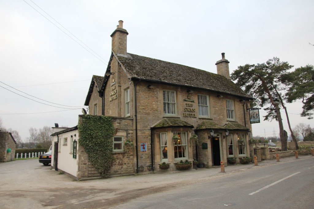
A tavern is known to have been here since at least 1692 and the frontage was rebuilt in 1873.

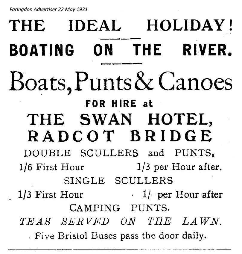
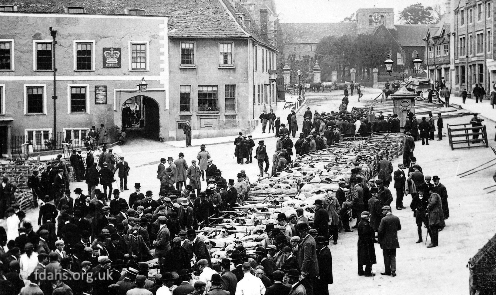
The postcard above shows a scene looking down river from the Canal Bridge. The Swan Hotel is on the left with a variety of boats on the bank and what looks like a large boathouse beyond; and the entrance to a third channel in the river that leads to Pidnell Bridge and the old Radcot Wharf. During the early 1900s it became a popular centre for swimming and boating with an annual regatta and swimming races. According to the above advert in the Faringdon Advertiser from 1931, five Bristol buses pass the door of the Swan Hotel daily – sadly there are no buses and no boats for hire today.
Extract from a childhood memoir of the 1930s in Faringdon:
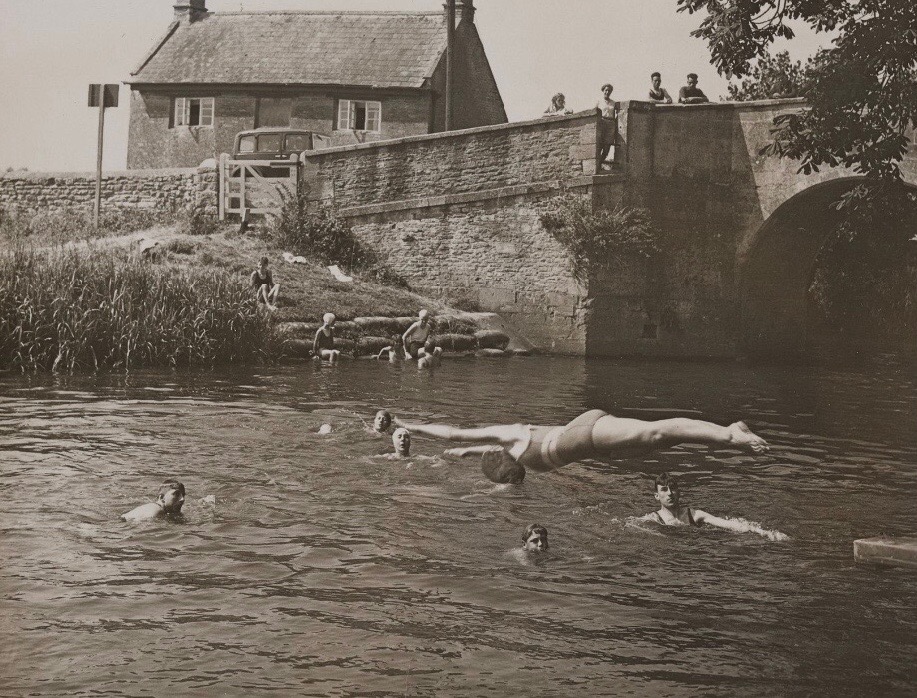
“In summer the river was the big attraction, every one learnt to swim down the “shallows” To get to these you turned left at Radcot Bridge went through a small gate, walk a long the tow path for a little way, then cut across country which cut off a bend in the river and that brought you to the shallows. The River Thames was only 2½ miles away and we often walked there and stayed all day paddling about in what we called the ‘shallows’ where the river overflowed onto the low flat ground. The walk there was soon covered by leaping ditches and playing chase but the return journey when we were tired, hot and foot weary seemed more like six miles. My brother, who could not swim, used to jump from Radcot Bridge into the fast flowing main part of the river.” More memories…
Radcot Wharf
Now disused for navigation, the third channel in the river was once used for access to a large wharf where produce such as wool, salt, fish, grain and building materials were loaded onto barges. Such activities had been going on since the early Middle Ages, before the castle was built and continued well into the 17th century. In particular the finest Taynton or Burford stone that was intended for the elegant buildings planned for Oxford and London (such as St Paul’s Cathedral) and even Paris was loaded here. The wharf was on the left of the road, opposite the Swan Hotel, and remains as the flooded wooded area seen today. The area is where the large trees are in the photos looking across the damaged Canal Bridge shown above.
Pidnell Bridge
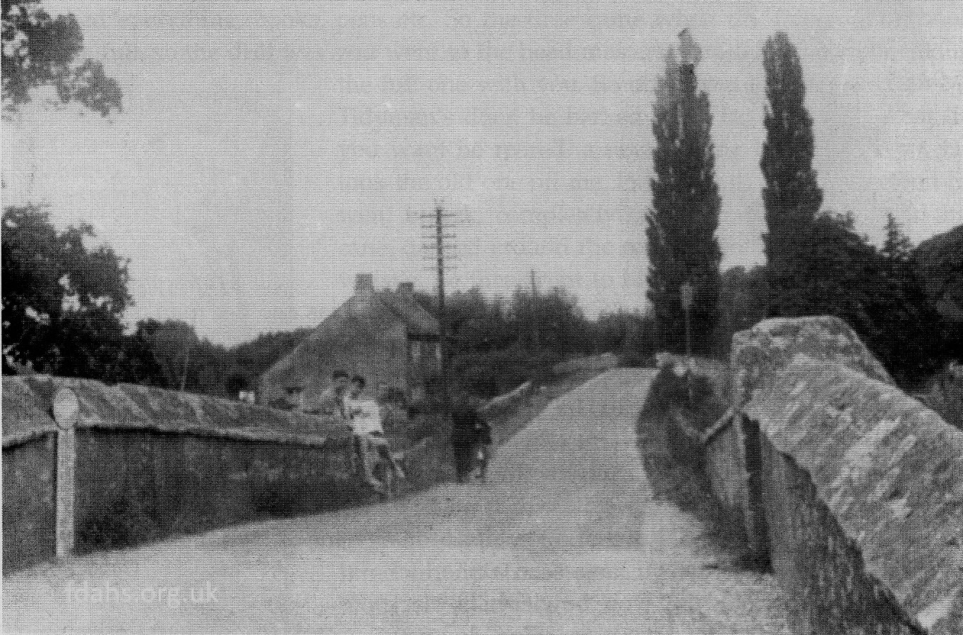
A little further on past the pub is a third large but narrow stone bridge over the third channel of the river, which is called the Pidnell Bridge Arm. Back in the days of turnpike roads, 1771-1878, there was a toll gate shed on this bridge, about where that old shed can be seen to the right of the bridge today.
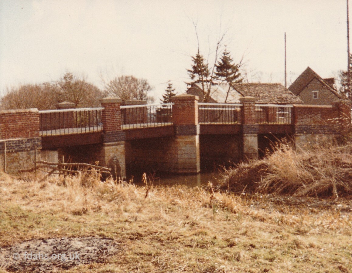 Pidnell Bridge was probably first built when the previously straight road was diverted slightly around to the east of Radcot due to a castle being built on its path in the early 12th century and hence a third and probably wooden bridge was required for the new road to cross a third branch of the river at this point. It was soon rebuilt along with the other bridges using stone. Pidnell bridge, described by Thomas Baskerville in 1692 as having had four rather small stone arches, was then owned by the lord of the manor, who demolished and rebuilt it in 1863 using iron and brick. This can be seen in the third photo on the left that was taken looking downstream in 1984. It was later faced with stone as shown in the two new photos above. The bridge gets its name from Pidnell, a small hamlet of a few cottages and a farm about three quarters of a mile away on the other side of the river, back towards Faringdon.
Radcot Castle & Village
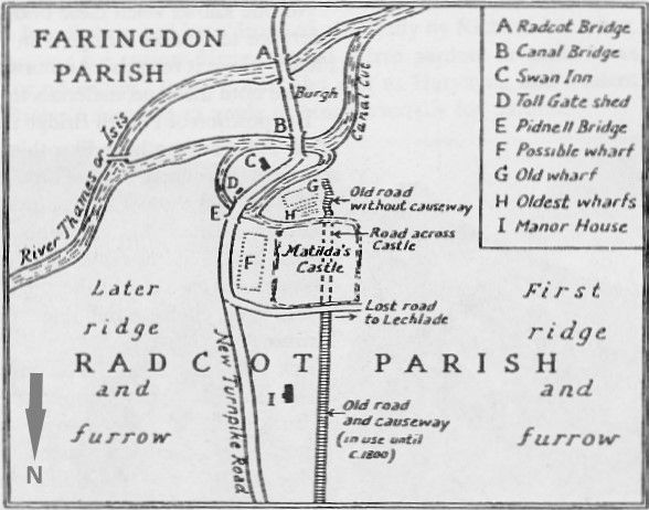 Looking down from the north, the sharp turn in the road can be seen to deviate from the old straight road through the village that was blocked when the castle was built. Crossing over Pidnell Bridge, the road then passes a field on the left where once stood the early 12th century wooden castle and moat. The castle was built for and held in 1142 by Matilda’s supporters during The Anarchy (1139–1154), the civil war with Stephen, and demolished in the late 13th century. There was also an 11th century chapel built by Aelfsige of Faringdon that was demolished in the17th century, possibly when the Civil War (1642-1651) fortifications were set up on the site. Further on the road passes the 17th-century Radcot Manor House and grounds on its way to the village of Clanfield. None of the houses of the original village on the old road remain there today and the road fell out of use around 1800.
Radcot Lock
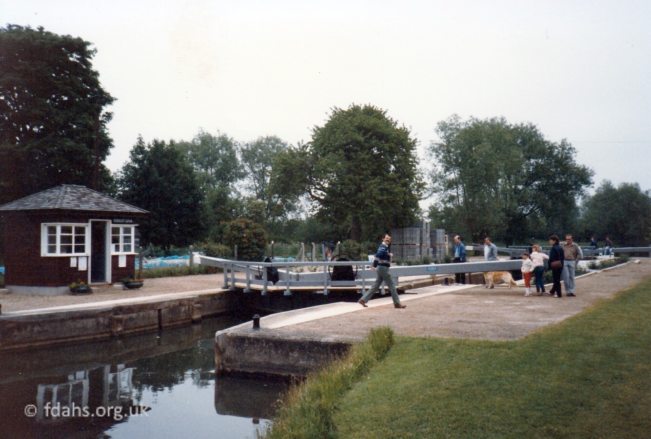 1986 Radcot Lock is just under a mile downstream of Radcot. A cut was dug in 1892 across a bend in the river just upstream from an old weir and flash lock at Old Man’s Bridge, which had been in use since at least the mid-1700s. The new weir is on the river on the other (northern) side of the island thus created. The lock-keepers house was built on the island – behind the office hut shown in the photo. The old house suffered from subsidence, so a new bungalow was being built at this time in 1986. The bricks delivered for the new building can be seen in the photo. Around 2013, a combined fish and canoe pass was constructed just upstream from the weir.
Old Man’s Bridge
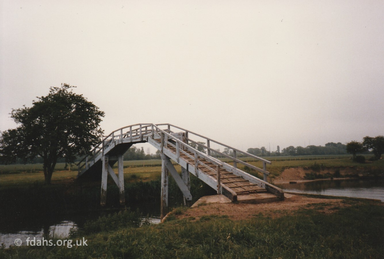 1984 Old Man’s Bridge or the High Bridge, just downstream from Radcot Lock, provides a route for a public footpath to cross the river. Before the building of the new lock upstream in 1892, an old weir and flash lock, with an ancient broken-down footbridge used to exist on this site. It had been in use since at least the mid-1700s and was known as Old Man’s Weir or Harper’s Weir. The new footbridge was built when the waterway was widened in 1868. There was also an inn on both sides of the weir. “The Spotted Cow” on the south bank and “The Trout” on the north. With only footpath access to surrounding farms and villages, they were there primarily to serve the river traffic. Because of their seclusion they were said to be the scene of much gambling, cock fighting, and other shady goings on.5 Landlord records for The Spotted Cow go back to 1851 Thomas Mayles and on to 1868 Thomas Sellwood.
References:
- PASE Domesday – domesday.pase.ac.uk/Domesday?op=5&personkey=48364
- British History Online – Langford Parish: Radcot – www.british-history.ac.uk/vch/oxon/vol17/pp250-269
- Radcot Bridge and Newbridge. By M. R. Toynbee – www.oxoniensia.org/volumes/1949/toynbee.pdf
- Radcot and its Bridge. By E.A.Pocock, 1966 – www.angelfire.com/ok4/clanf/radcot.htm
- The Stripling Thames. By Fred Thacker 1909 – https://thames.me.uk/thacker1909.htm#Oldmans
- Photos scanned directly from society archives.
Researched by Ian Lee, May 2020. Updated October 2021.