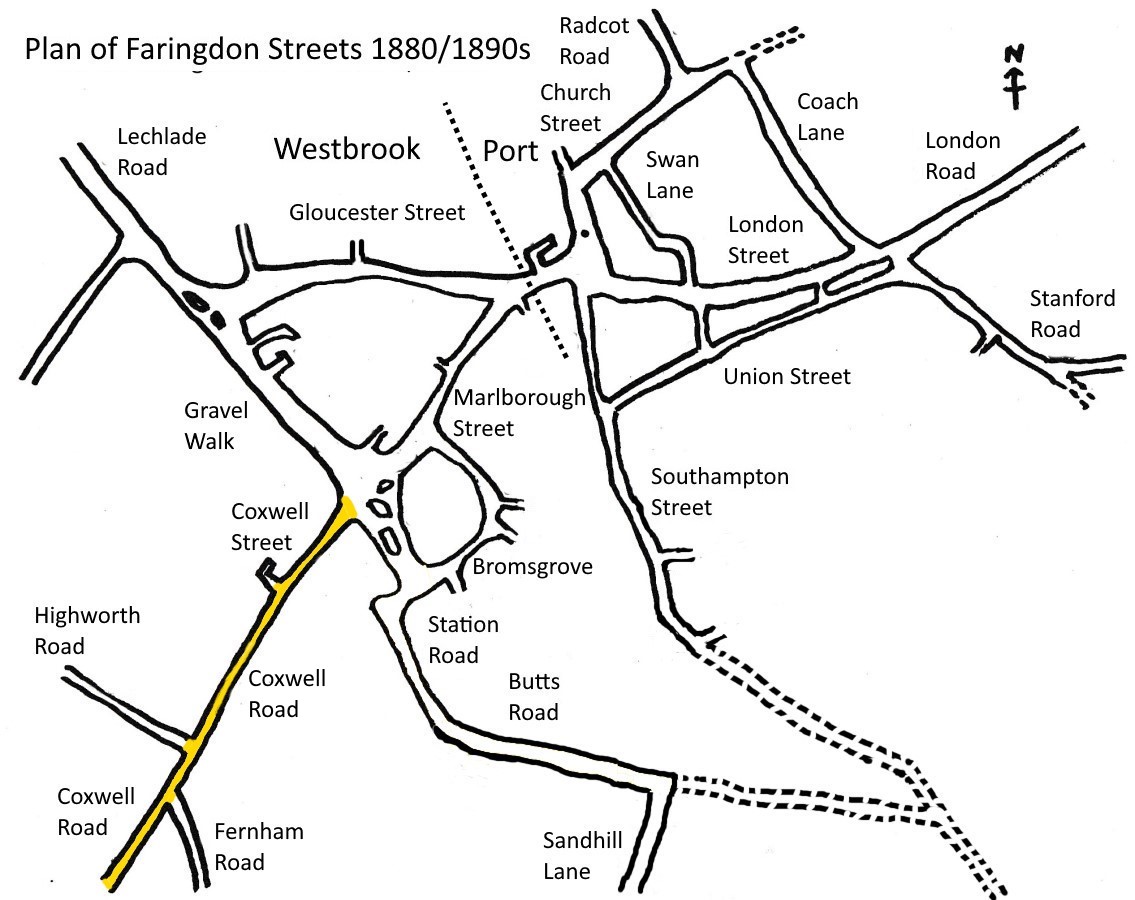
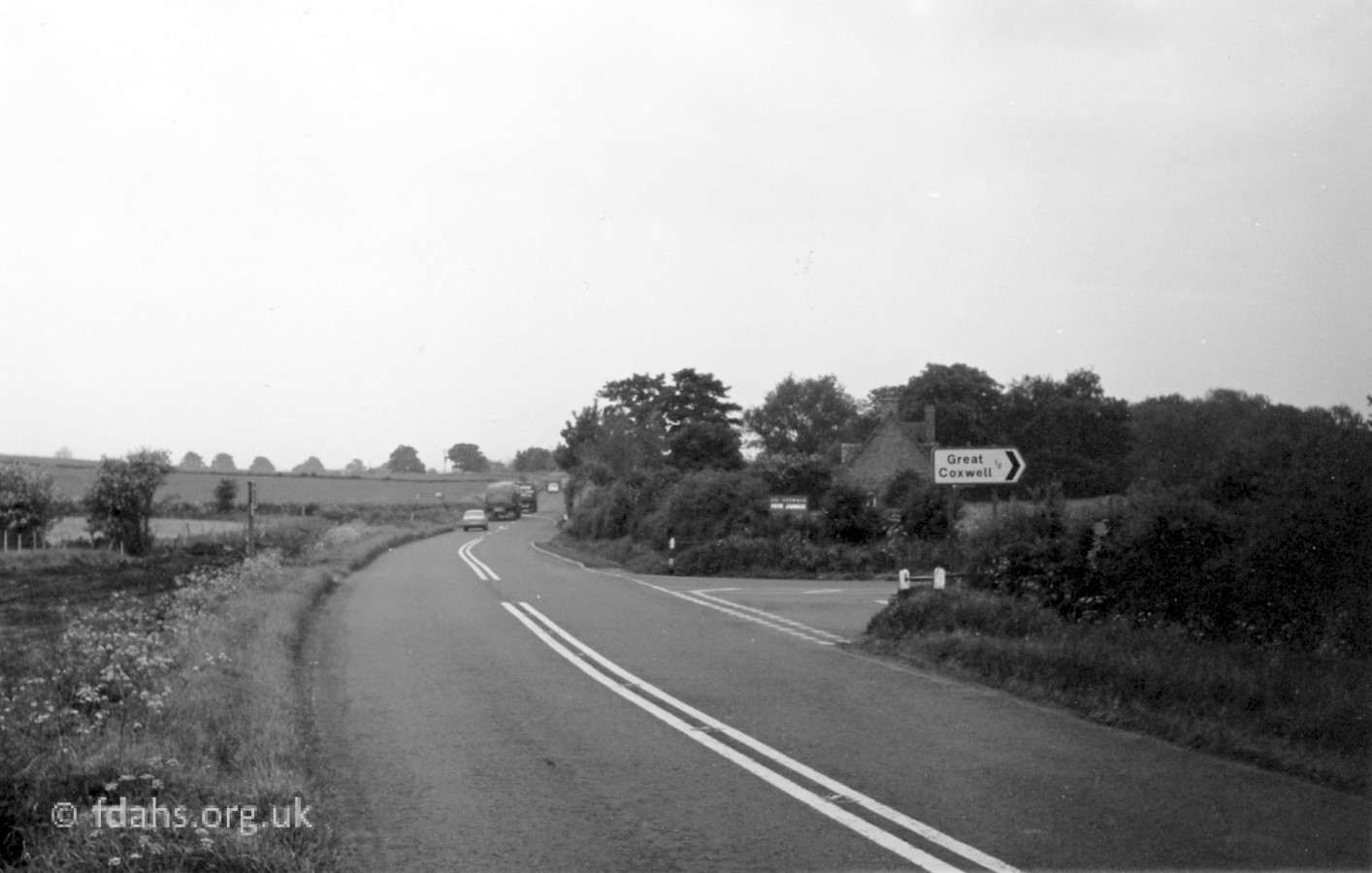
 Coxwell Street heads south-west from the roundabout at the end of Marlborough Street. At what was the Eagle public house, before the junction with Coxwell Gardens opposite, it changes its name to Coxwell Road, earlier called Shrivenham Road, both nearby villages along the way. Faringdon’s last surviving toll gate was situated at this point along this road, it being a turnpike road to Bristol, Bath and Somerset, whose local upkeep had to be paid for.
This is one of the roads that made Faringdon the important five-way road junction of the past. It was once part of the main road (A420) from Oxford to Swindon, and onwards to Marlborough and Salisbury or Bath and Bristol before the bypass was built in 1979.
See Shops & Businesses for an updated history of occupation and Business Directories & Advertisements for Coxwell Street. Also Burtwell & Drew, the electrical goods shop at 19 Coxwell Street has its own page.
Also see our house by house tour of Coxwell Street & Road in the Year 2000.
Views of Coxwell Street in the 1900s
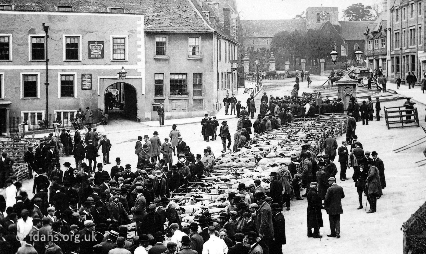
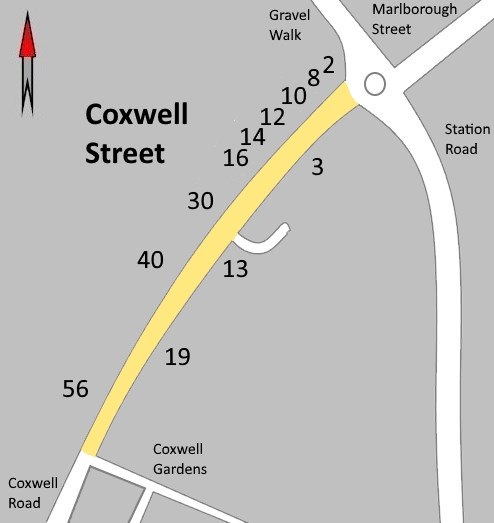
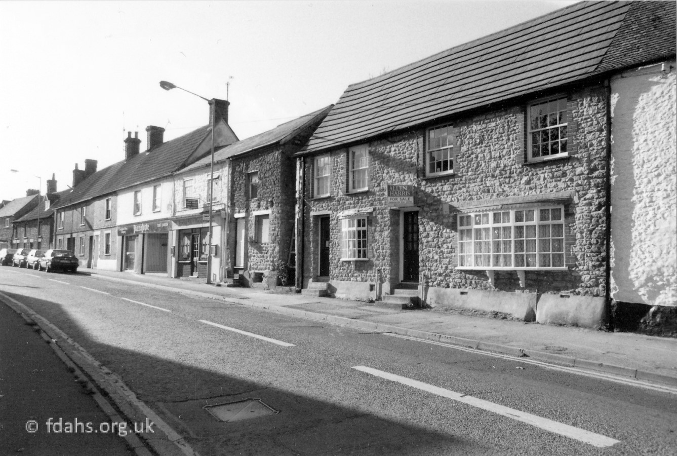
 1912. The crossroads at the bottom end of Coxwell Street – looking up the whole street to the Eagle Inn and the old toll gate at the end. The ‘white’ buildings on the corner with Station Road on the left have now been demolished. The darker building further up the street is #3 the current cycle shop (photos below). On the right is the Methodist Church then the sign for Gardener’s Arms public house can be seen at #10.
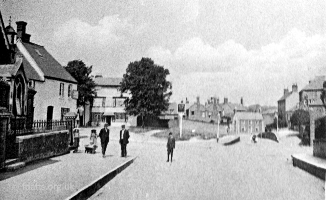 1912. Looking back towards town from the other side of the same crossroads. On the left is the Methodist Church next to the Duke of York public house on the corner, licensee Michael Giannadrea. The inn was demolished around 1970 and the new United Church now stands there. The left-hand turning is Gravel Walk, on the far side of it can be seen the White Hart with its inn sign standing on the corner. The road facing is Marlborough Street showing where the road was cut away at Arthurs Hill to lower it for the horses. To the right is Station Road, which led to the railway station.
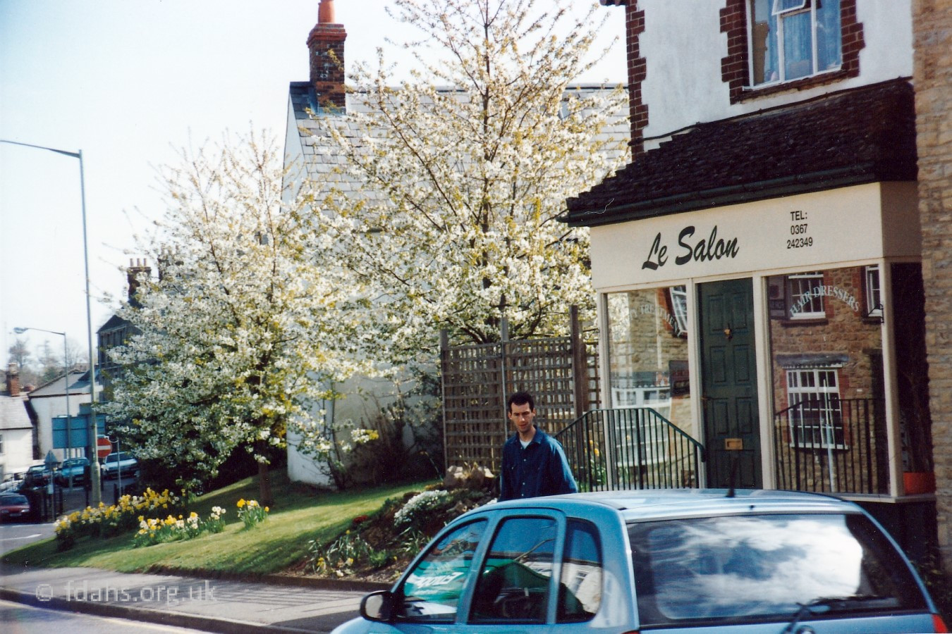 1994. Looking back towards Station Road, ‘Le Salon’ at #3 Coxwell Street was originally a butcher shop and has changed many times since – various hair salons, a party shop, a bride shop, and now since about 2018 a bike shop.
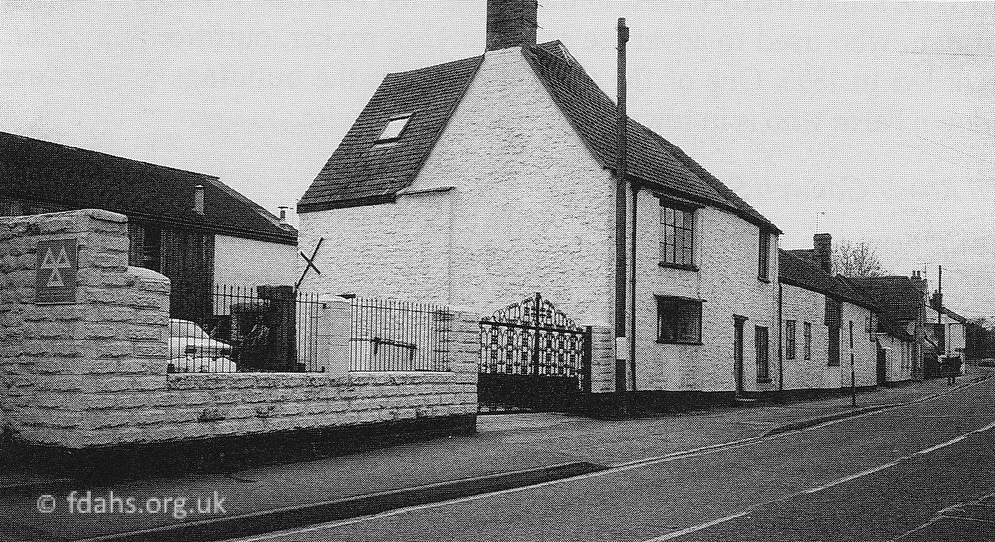
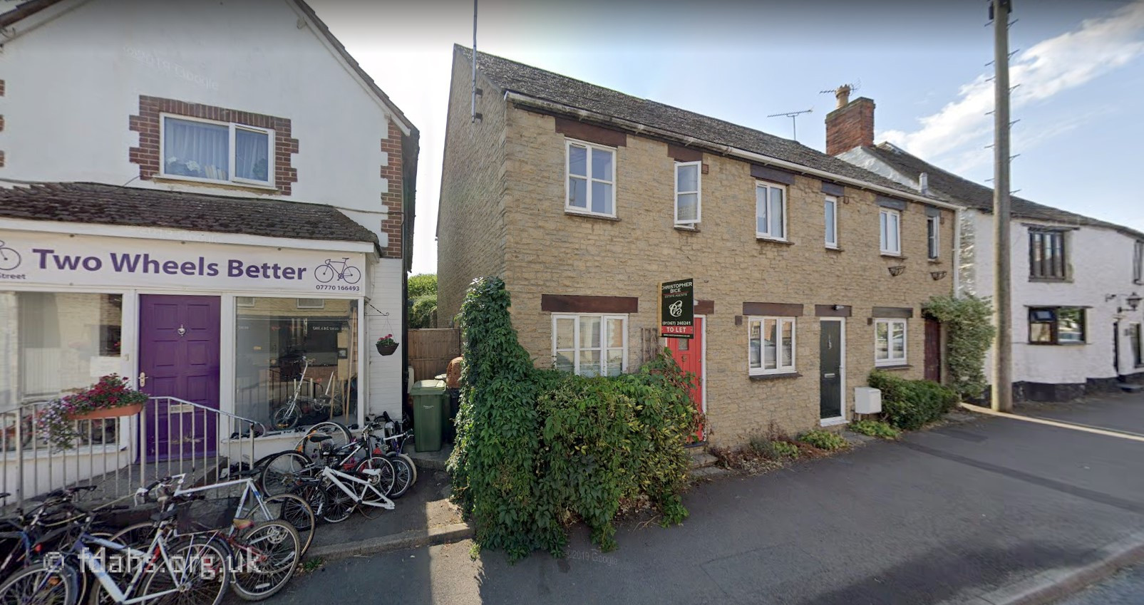
1990 & 2018. Quarry Engineering on the left through the iron gates; now the new terraced houses in the second photo, which are addressed as #7-9 Nichol Court. Previous owners were Ballard & Sons, blacksmith and wheelwright, who occupied it from at least 1895. The large white house at #7 in both photos is Ballards Cottage. The Ballards were followed by Frank Lane, then D.W. Lansdown, before Quarry Engineering took it over. The shop at #3 was originally a butcher shop and has changed many times since – various hair salons, party shop, bride shop, and now a bike shop.


1991 & 2000. Just beyond Ballards Cottage shown in the previous photos is another entrance to Ballard’s yard, which has now become Nichol Court. The old building, which is attached to the right of Ballards Cottage has been converted into homes. They are addressed as #10-11 Nichol Court, and new houses were built in the yard behind.
 1995. On the opposite side of the street just past the church is what used to be the Gardeners Arms at #10 . It closed before the 1980s and is now two private houses. Further up the street is an Indian restaurant and Pianoforte,a piano shop where a sports shop used to be.
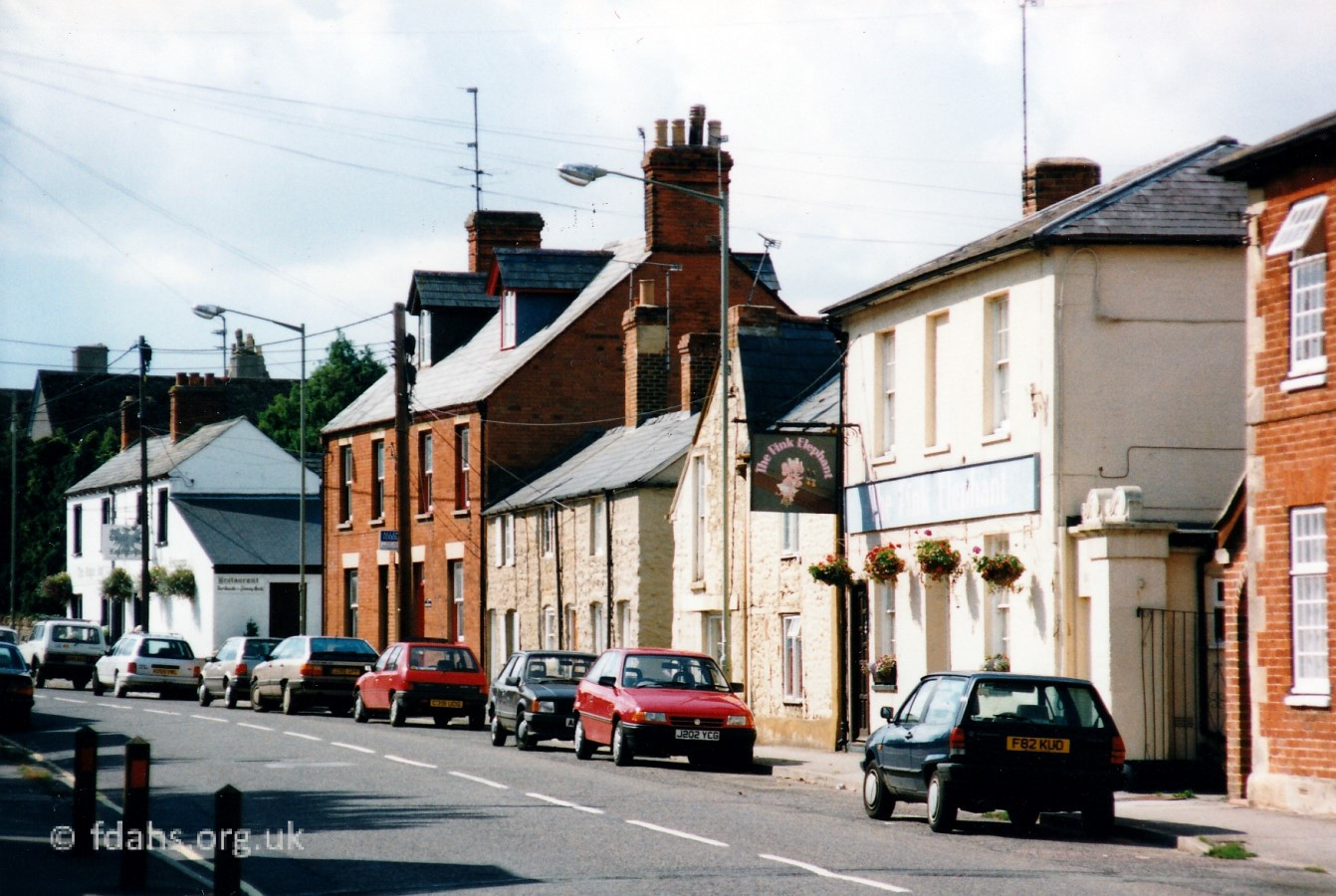 1994. A little further up the street. The Pink Elephant public house on the right at #40 Coxwell Street was originally The Queens Arms until it was renamed in the 1970s. It was later renamed again as The Riddle but soon finally closed down in the late 1990s. It then became Pianoforte, a piano shop and the building was also given the name ‘Ivory House’. In 2014 the building was converted into a private house.
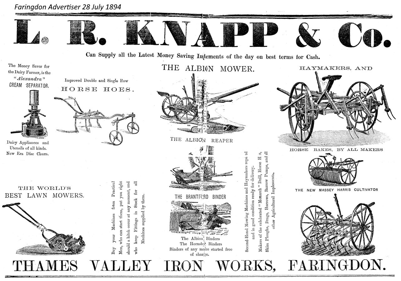 Back in 1894 there was a yard behind the Queens Arms containing the Thames Valley Iron Works, which was run by L.R. Knapp & Co. A big company in Faringdon at this time specialising in the supply of farm implements. There is also an old cottage and converted barn #38.
 There used to be an arch spanning the access to Queens Arms Yard between the red brick house #36 on the right and the pub #40 next door. The arch and the Queens Arms sign can just be seen half-way down the street in the 1910 photo below. This house sold lamp oil and petrol in small cans for horseless carriages. It also had a cellar and brewery for the pub next door and up until the 1970’s was the games room for the renamed Queens Arms when it became the Pink Elephant. There was a pool table in what is now a bedroom, darts in what is now the bathroom, and a well under the lounge. It was converted into a private house the 1970’s by a local builder called Barry Wadcock. In what is now the rear garden there was a spring for watering the horses and two buildings, a cottage and possibly stables, now demolished.
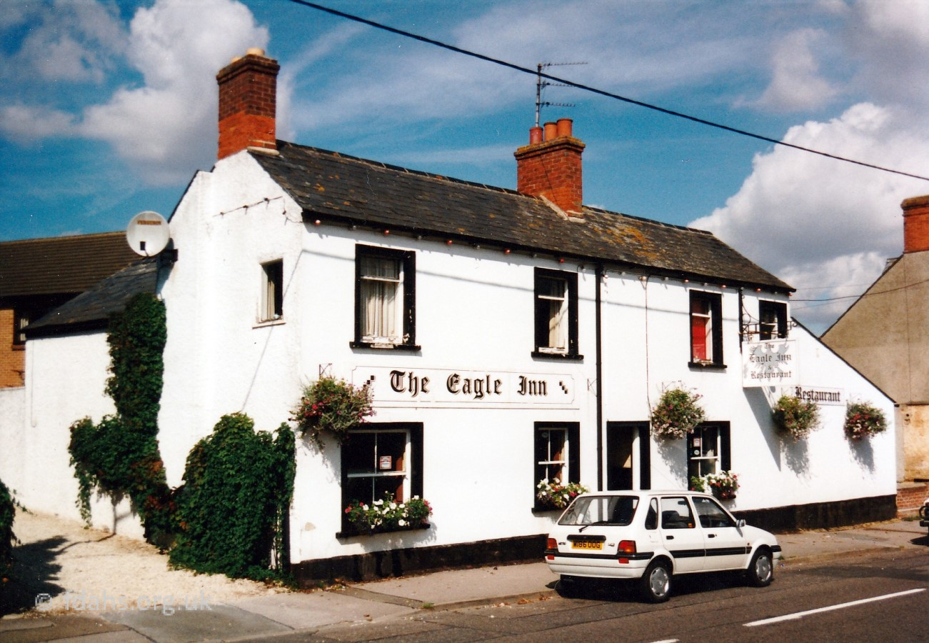 The Eagle Inn, at #56 can be seen at the end of the street. It is the last property in Coxwell Street as hereafter it becomes Coxwell Road. The Eagle, the last of the four pubs originally on this rather short street, closed down in the 2000s and was converted to a private house.
Just past the Eagle used to be the Toll House, now the front garden of 2 Coxwell Road and the driveway to 2a Coxwell Road. It is believed to have been demolished in the early sixties prior to the construction of the bungalow, which is now 2 Coxwell Road. Faringdon’s last Toll Gate was reported to have been demolished when a haulier was driving home from Swindon late at night. The man was very drunk and fell asleep on the cart and so the horse failed to stop and walked straight through the Toll Gate.
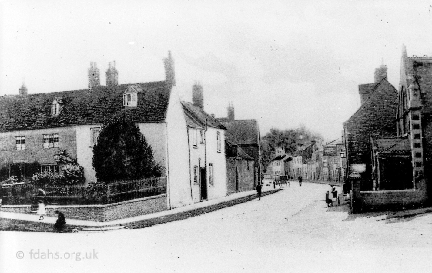
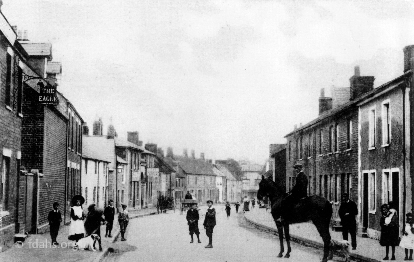 c.1910. Looking back towards town from the end of Coxwell Street. The Eagle, #56 is on the left. The Queens Arms is half way down on the left at #40, where it is joined by an arch at this time to #36. The Gardeners Arms #10 is right down at the bottom of the street. The man on the horse is the local doctor, Dr. Kennard, accompanied by his faithful dog. This dog stayed with the horse whilst the doctor was making his calls, and allowed no one to approach the horse. Note how high the pavements are from the unmade road. Children used to sit on the pavement and dangle their legs over the edge. The children in the picture are dressed in the costume of the day. Note the breeches and caps worn by the boys and the gleaming white apron and hat worn by the girl on the left. The Pink Elephant became The Riddle for a short time then closed down in the 1990s. The Eagle closed down in the 2000s. Both are now private houses. Coxwell Street now becomes Coxwell Road.
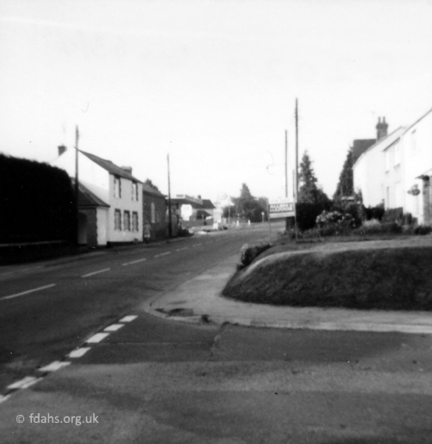
 Looking away from town, the Eagle pub sign can just be seen on the right and houses #31-35 on the left before the old wall. This is the end of Coxwell Street and beginning of Coxwell Road. At the end of the old stone wall on the left, which is a lot longer than it looks, there used to be access to Eagles Coaches then Barnes Coaches Ltd, which was located behind the houses up there facing the road. Coxwell Gardens (sheltered housing) has now been developed on that site (see below). What was left of the stone wall was replaced with brick at some time before 1982 but that fell down and is now a low wicket fence set further back off the road and covered with roses bushes. There is a car park and garages directly behind for some of the new houses at the end of the Eagles housing development accessed from Station Road.
Views of Coxwell Road in the 1900s
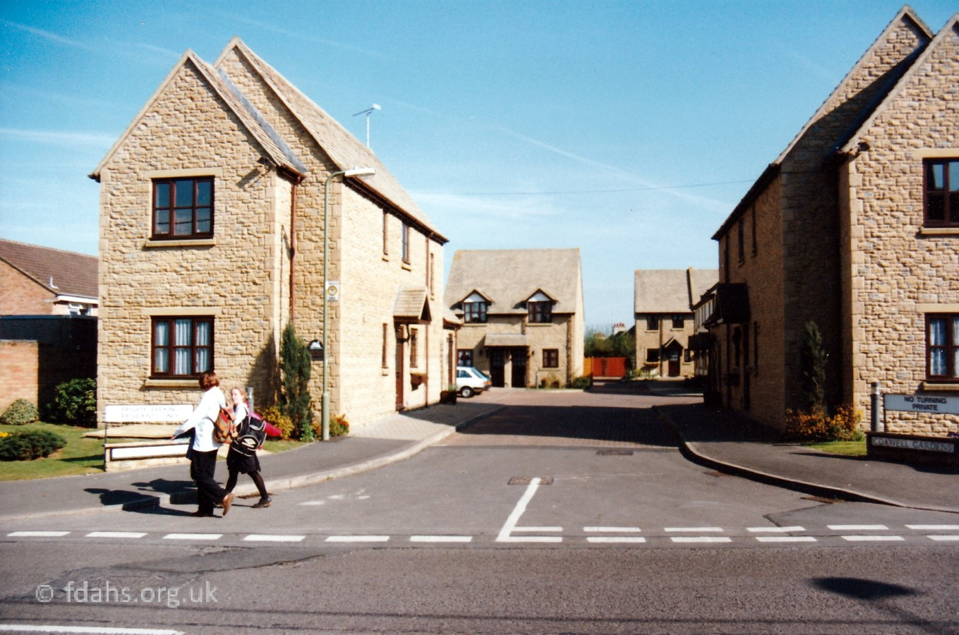 1994. This is the first property on the left in Coxwell Road, a new sheltered housing estate called Coxwell Gardens. The site was previously used by Eagles Coaches then Barnes Coaches Ltd.
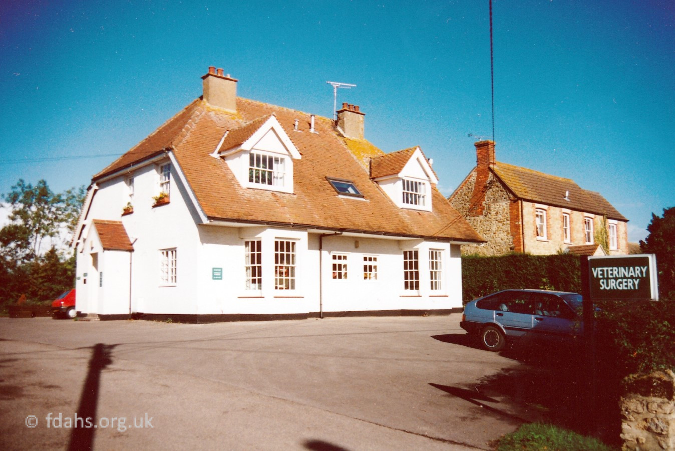 Further up the road on the right, before you reach the old health centre, is the Danetree Veterinary Surgery at #14 Coxwell Road.
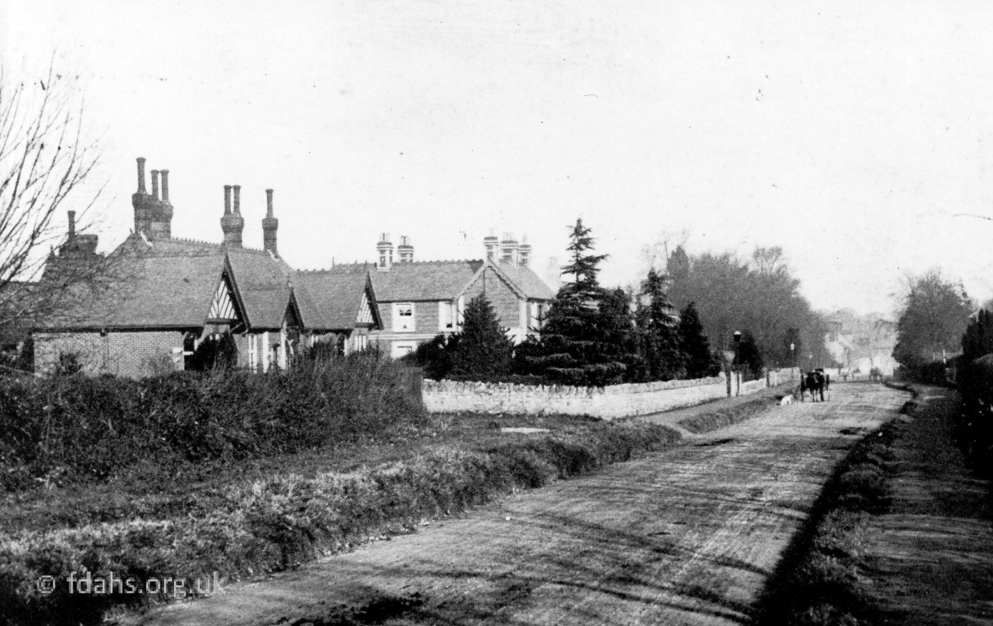 c1900. Faringdon Cottage Hospital on the left of the Coxwell Road looking back into town. It later became the Health Centre for local GP’s until a new premises was built towards the end of Park Road; then it was converted into flats. Note the unmade road with the horse and trap approaching. There were Tea Gardens on the opposite side of the road at this time, now all large detached houses.
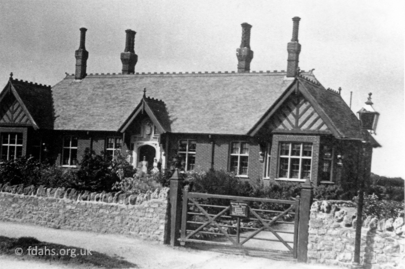 The Cottage Hospital was erected in 1892. Captain William Dundas initiated public subscriptions to help build it and contributed a considerable amount of the money required. The first Matron was Miss Rosa Broughton. The medical officers were J.P. Lockwood, H.D. Ley and C. Spackman; the consulting surgeon was H.P. Symonds from Oxford. The hospital was comprised of two wards of two beds each, one for women and one for men; two private wards of one bed each, one male and one female; matron’s sitting room and an office. A mortuary was added the following year and a couple of years later there was an operating room and a probationer’s bedroom added. The first major operation was for Mrs Elliott, wife of the Saw Mills proprietor, who had a burst appendix. A well-loved matron, in later years, was Gertrude Taylor, sister to Percy Taylor the butcher.
 2000. Built in the 1930s on the right-hand side of the road, #28 Coxwell Road was the home Dr Harding in the 1950s, Dr Taylor in the 1960s, and Dr Walters in 1970s. Dr. Harding had his practice in the back and waiting room in the front. The other part was his home.
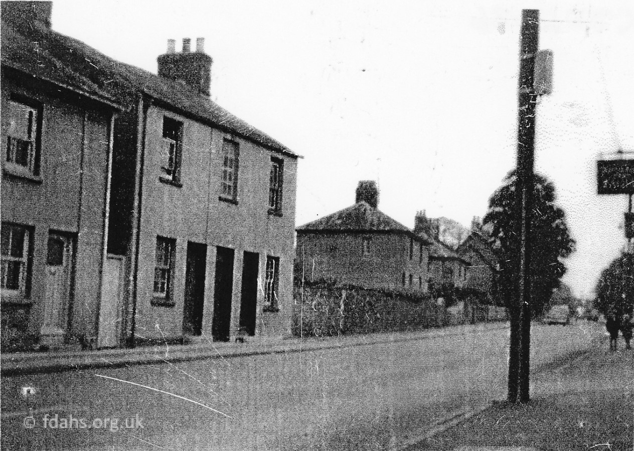
 1982. Coxwell Road looking away from town from the corner of Highworth Road. Off photo to the left is the footpath leading to Marlborough Gardens, which in 2024 was given the name Alan Hickmore Way. He was a Town Councillor (Labour) for many years. The four old terraced cottages (No’s 36-42) on the right appear on a map of 1876. On the opposite side of the road at that time, there was just one building and open fields. The next junction up the road on the left is Fernham Road where a service station could then be seen on the corner at this time.
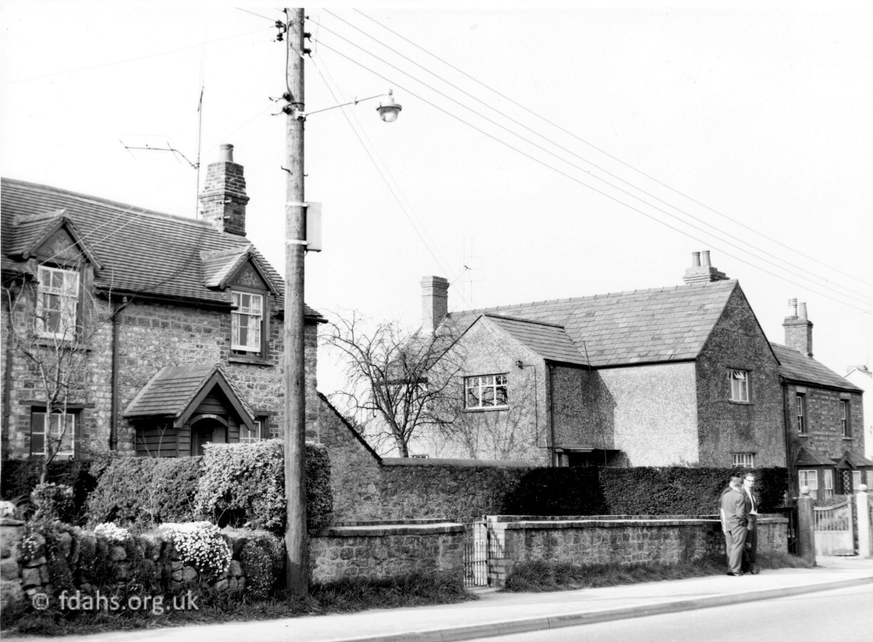 c1950s. Just past the four old terraced cottages shown above are No’s 48-44 Coxwell Road, the semi-detached property shown here on the right. The house, No 48 on the left was called “Kosykot” and can also be seen on the right in the photo below of the old police house at No 50 to which it was attached. A plan of the land in 1924 shows that the house was owned by Hon Mrs R Craven. It was demolished around the 1960s to be replaced by the new detached house shown to the right in the newer photo below.
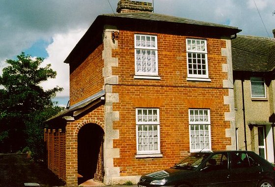
c1910 & 2021. The old police house at 50 Coxwell Road, which is directly opposite the entrance to what later became a service station and now Clock Tower Court. The house appears marked on a map from 1876. There is a date stone, which is now difficult to read, but according to a previous owner it once showed more clearly that it was built in 1865. This followed the opening of the police station in Coach Lane in 1858. The sign above the door and almost hidden by the bush says ‘COUNTY POLICE’. The local ‘Bobby’ would often be seen on his bike, cycling all the way through the town on his way to the Police Station in Coach Lane, way up London Street – nearly a mile distant. A plan of the land in 1924 shows that the house was owned by Captain Wrisberg. In 2021, after some years of neglect and sold with an accepted application for its demolition, it is currently being renovated by the new owners.
The house attached on the right in the old photo is No.48 and is shown more fully in the photo above it. The outside wall of No.50 shows signs of that previously attached house having been demolished and the newer photo here shows the new detached house that was built in its place.
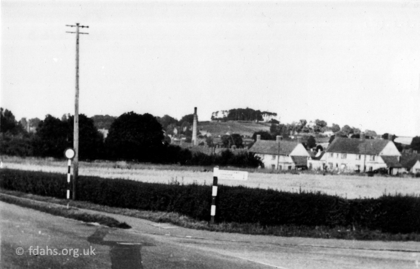 1953. A little further up and on the opposite side of the road to the old police house, arriving at the corner with Fernham Road where the service station would later be built and then followed by Clock Tower Court. The tall chimney of the dairy and the Folly can be seen in the background across the field. The white terraced houses have just been built in the new Marlborough Gardens development.
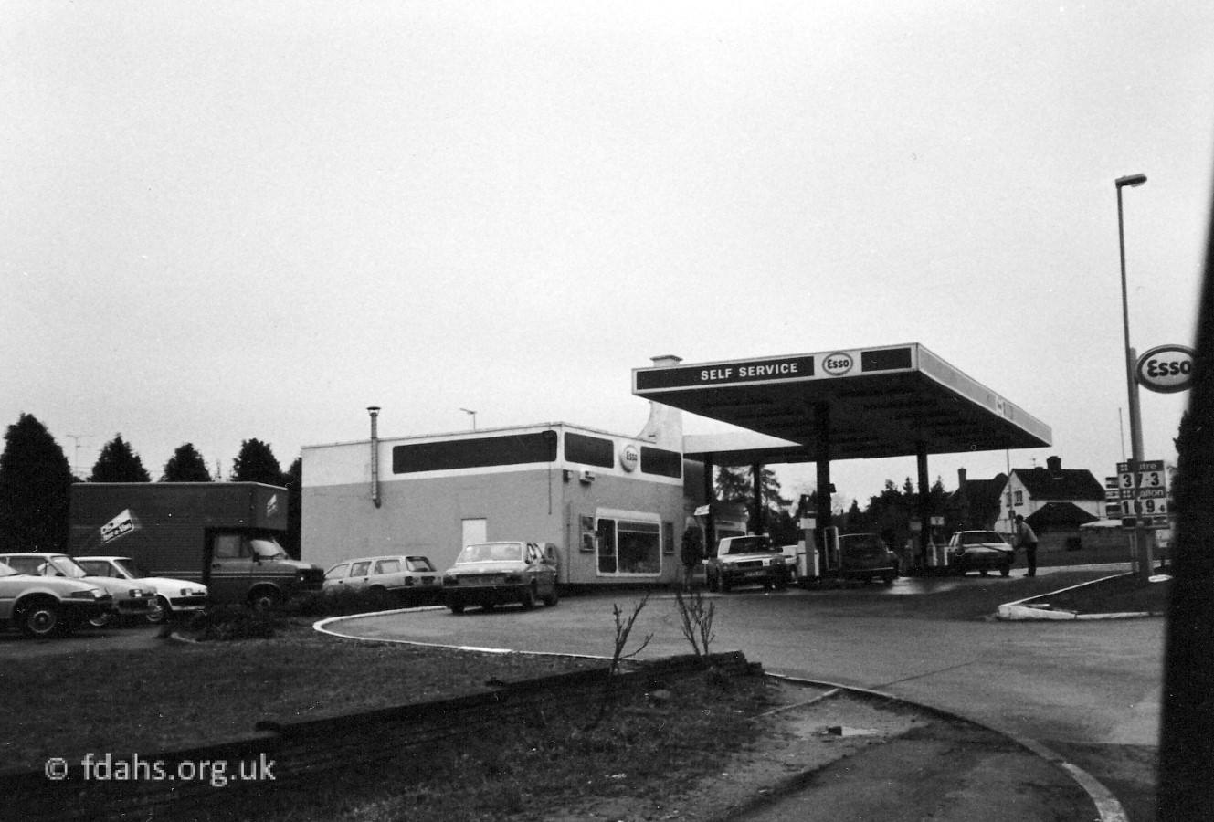 1986. The Eagle Motors Service Station, then on the corner with Fernham Road at this time. It was very busy when all traffic passed through Faringdon but when the bypass was opened in 1979, the trade dropped away. By 1991 it had moved to the end of Park Road and the site was redeveloped for new housing – Clock Tower Court.
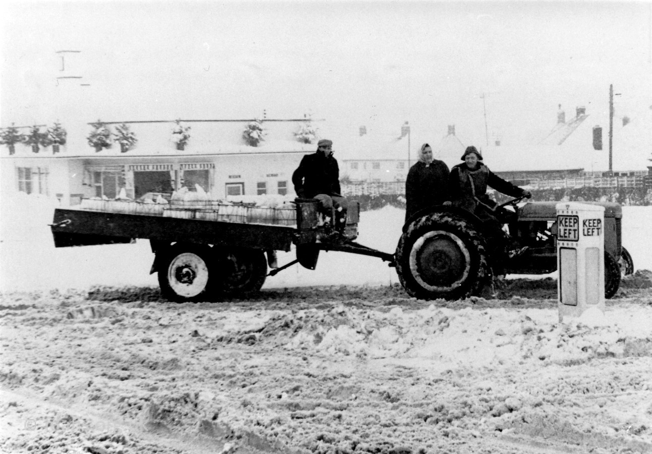 During the severe winter of 1962-3, the White Horse Dairy had to hire tractors and drivers to enable the milk deliveries to get through to the outlying villages. This was a Sunday morning delivery of milk for the dairy outside Eagle Motors Service Station on the corner of Coxwell Road and Fernham Road. Bill Carter is driving his tractor that he used on his market garden. Ann Carter (no relation) is behind him and her husband Jimmy is sitting on the trailer.

1991. Looking up then looking back at the Fernham Road turning. The service station is now demolished and the site redeveloped for new housing – Clock Tower Court. Fernham Road leads to the secondary school, leisure centre, and Coxwell Lodge Nursing Home, but no longer to the village of Fernham, as it was cut off by the new bypass in 1979.
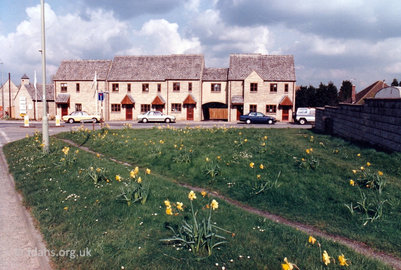
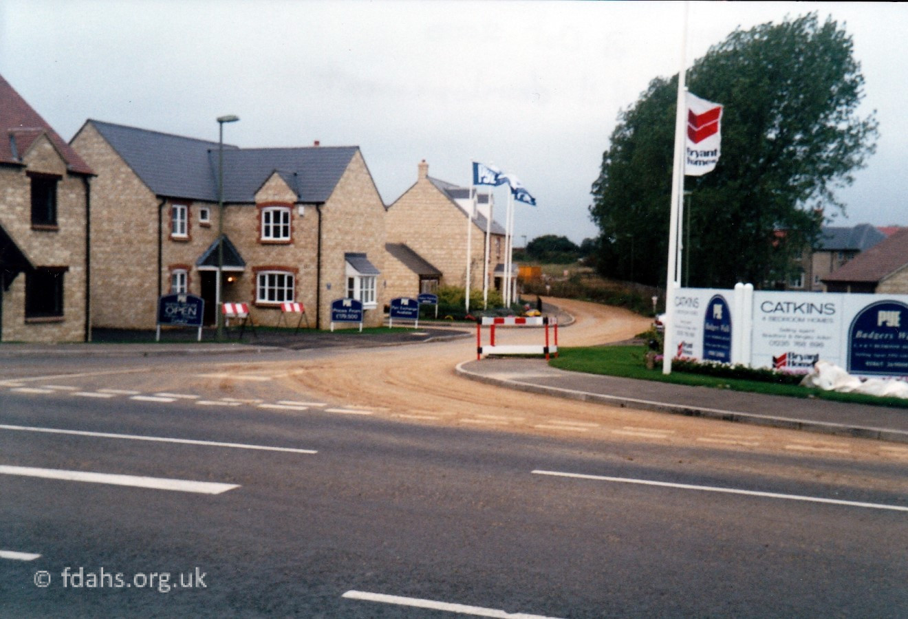 2000. Beyond the turning to Fernham Road, at the top of Red House Hill and on the right, is the new Badgers Walk housing estate. The entrance road, previously a track known as ‘Badgers Walk’ has been named Coleshill Drive. The road has risen 89 feet (27m or a 5 storey house) from the brook under the road in ‘The Narrows’. The road here had to be closed for 4 weeks to lower the hump at the new site entrance and a bungalow was also demolished.


Researched by Ian Lee, January 2020.