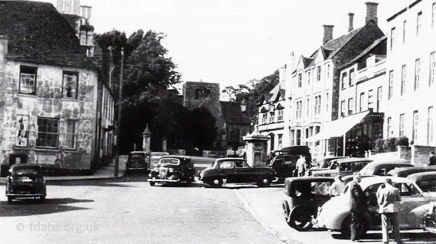
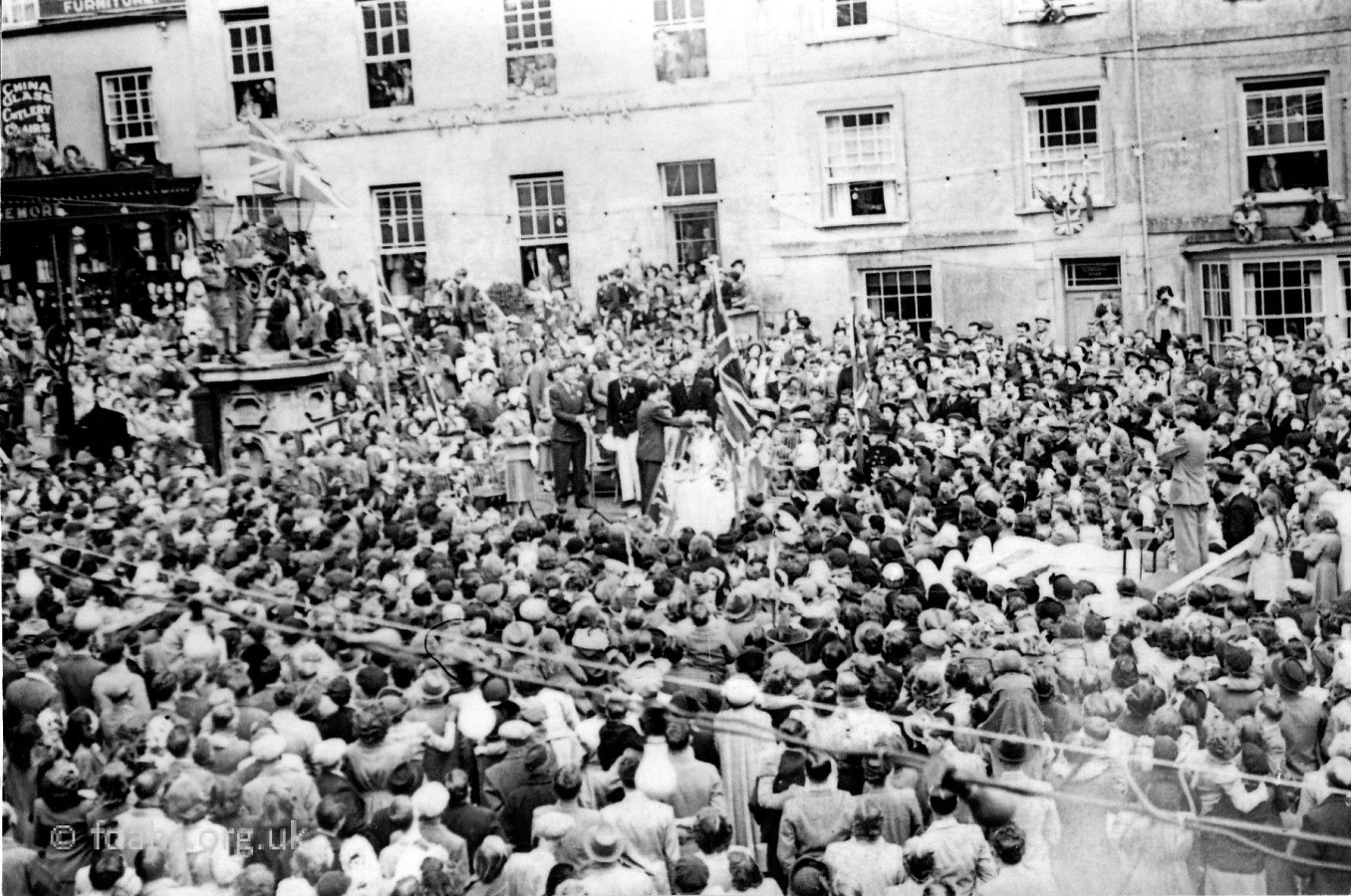
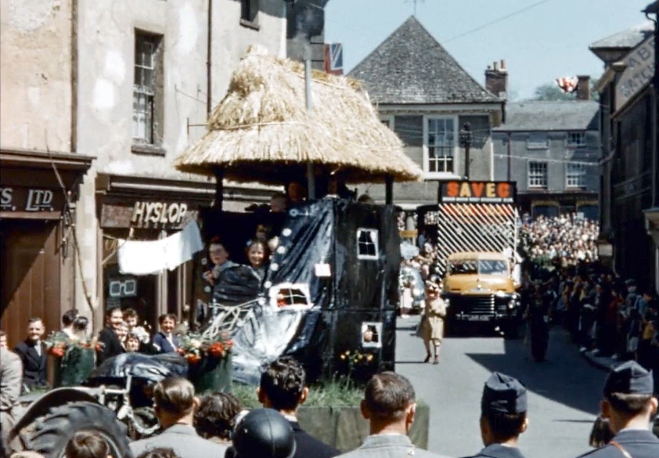
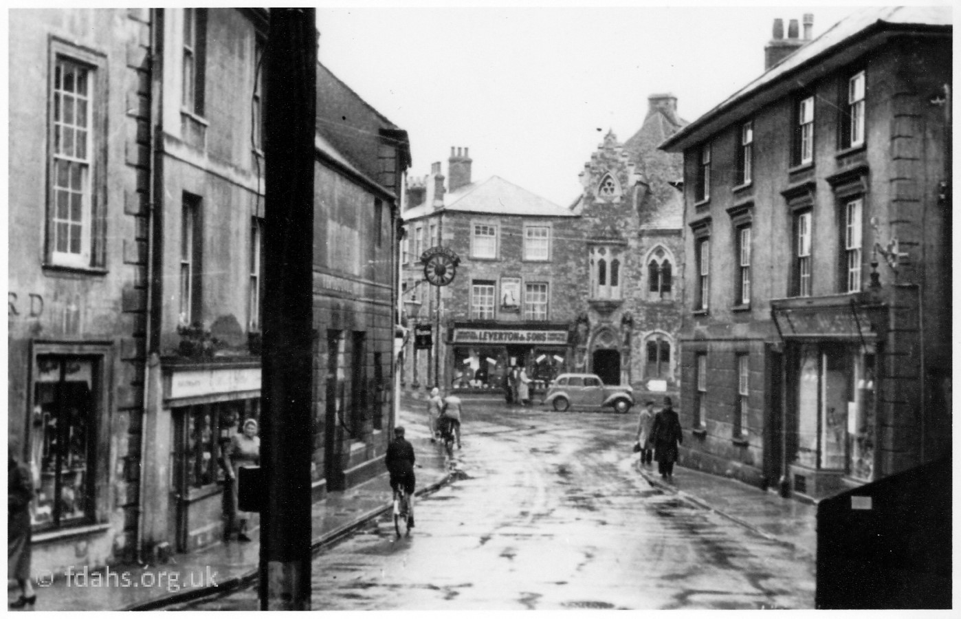
 1953. The Crown Hotel, as it was then called is in the background on the left and the broken church tower can be seen in the distance on the right. In the foreground on the left is Jack Davis from Langford’s coal-yard in Bromsgrove, and the man holding the bike is Arthur (Stoker) Edgington. The man wearing breeches, just behind on the right, is Stanley Liddiard from Liddiard’s shop. Just in front of the Portwell is Burtwell & Drew’s Raleigh three-wheeler van.
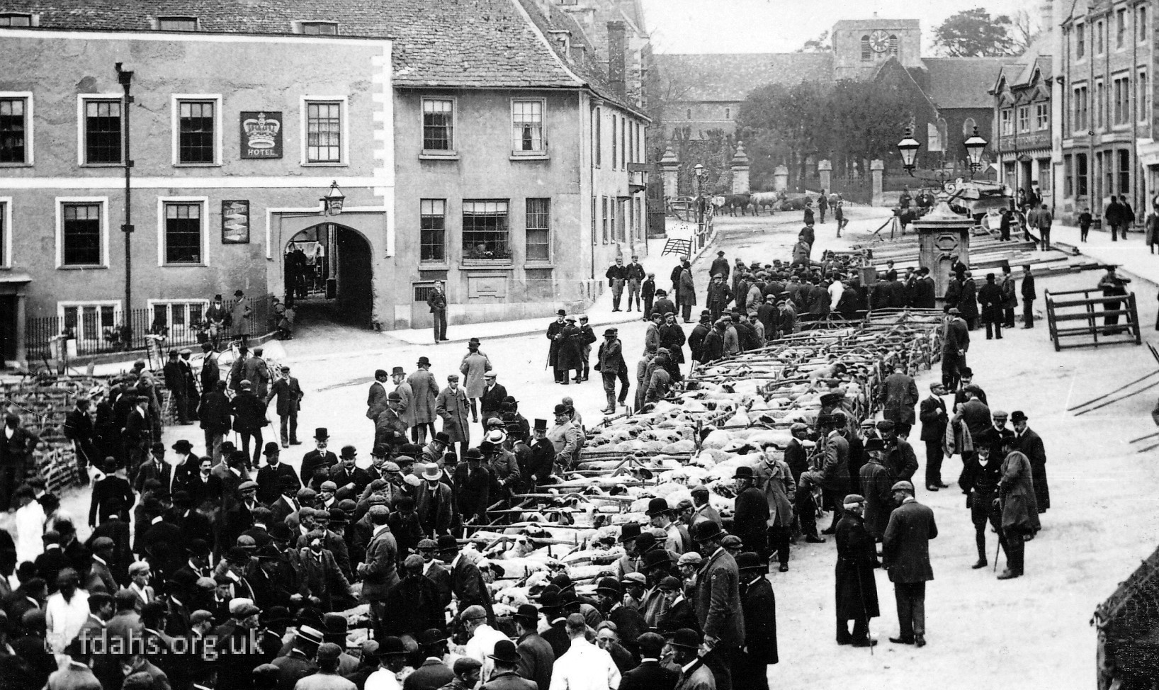
1953. Similar photos looking north from the Market Place towards the church. Parking problems have started, yet only 1 in 10 households in the UK owned a car in 1950 and the horse and cart was still a very common sight. On the right is #1 the Salutation Hotel with #2 Crowdy and Rose, solicitors, next door. Then comes #3 the butcher’s shop, owned at various times by Heavens, Boycott and Wright. Next is #4 the hardware and china shop owned by A. E. Lismore who also ran a converted bus to sell goods and paraffin to the outlying villages. The last building on the right is #5 the Old Pump House with the Portwell in the street out front. This had been the County of Gloucester Bank but was given to the town by Lord Faringdon for a peppercorn rent to be used as an ex-serviceman’s club and then became the Community Centre. Opposite, on the left is #26 the corner of Portwell House which was formerly the Angel Inn and Post Office.
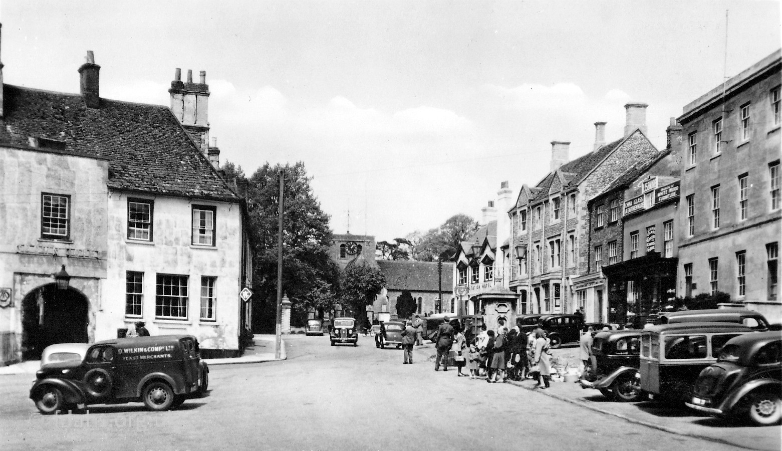
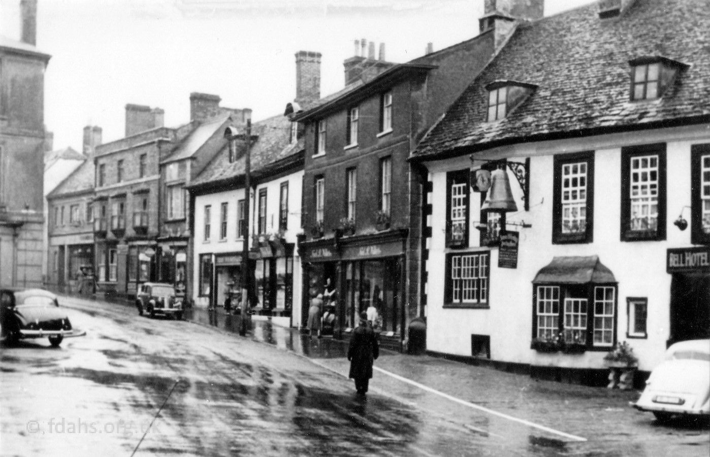 1953. Backing up to look at the start of London Street. To the left of The Bell at #11-12 was Noel Wilkes’ ladies and gents outfitters. Then going up London Street are Frank Thair’s boot and shoe shop, W.H. Smith’s paper shop, Shenton’s sweet shop, a private house, and Chamberlain’s grocery shop.
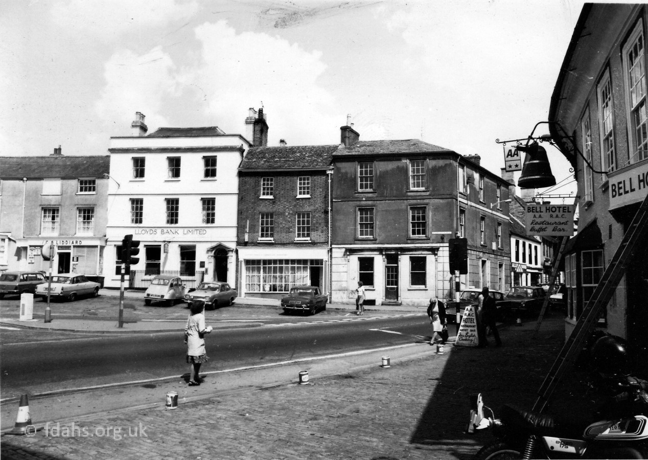
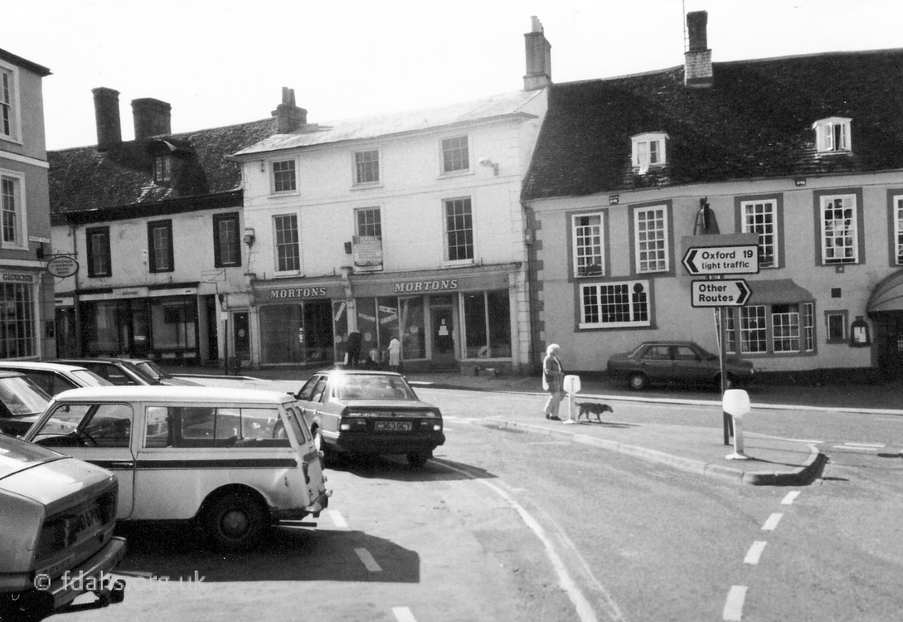 1986. A later look at the corner of London Street. On the far left of the photo, is #10 Market Place, which was then occupied by Cheltenham & Gloucester Building Society. Crossing over London Street is #11-12 Market Place, immediately to the left of the Bell Inn. This was Mortons in the year of its closure. It was a shop selling an assortment of goods bicycles, clothes, haberdashery and toys. It was well known that you could go into Swindon to buy something, fail to get it and come back to Mortons and find it. Previously this belonged to Wilkes (draper). The shop was then split into two, Faringdon Travel on the left and Blockbuster Video on the right. The shop to the left of Mortons is #2 London Street. It looks empty here and must be in the process of being converted from Baileys shoe shop to John Maxwell Hairdressers at this time.
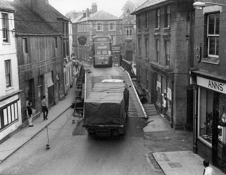
1963. Bailey Bridge in The Narrows
Looking up ‘The Narrows’ towards Cornmarket. A firm had been laying a telephone cable or it may have been Swindon Gas Board laying gas pipes recently, and in so doing, had damaged the old brick culvert taking the stream under the A420 through Faringdon. Sewage drains also went under the road and there was seepage of water and sewage. To inspect these pipes, use was made of TV cameras (one of the first times this happened) to discover what the damage was. It was found that bricks had collapsed from the brick culvert and were blocking the drains.
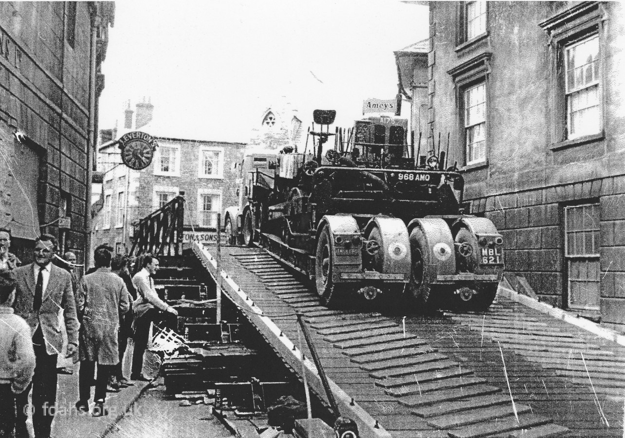
At this time there was a lot of traffic passing through Faringdon; lorries from Pressed Steel were passing every two minutes, in addition to all the other traffic. This was the main trunk road between Oxford and Swindon and the traffic could not be easily diverted or the road closed so it was decided to ask the army for help.
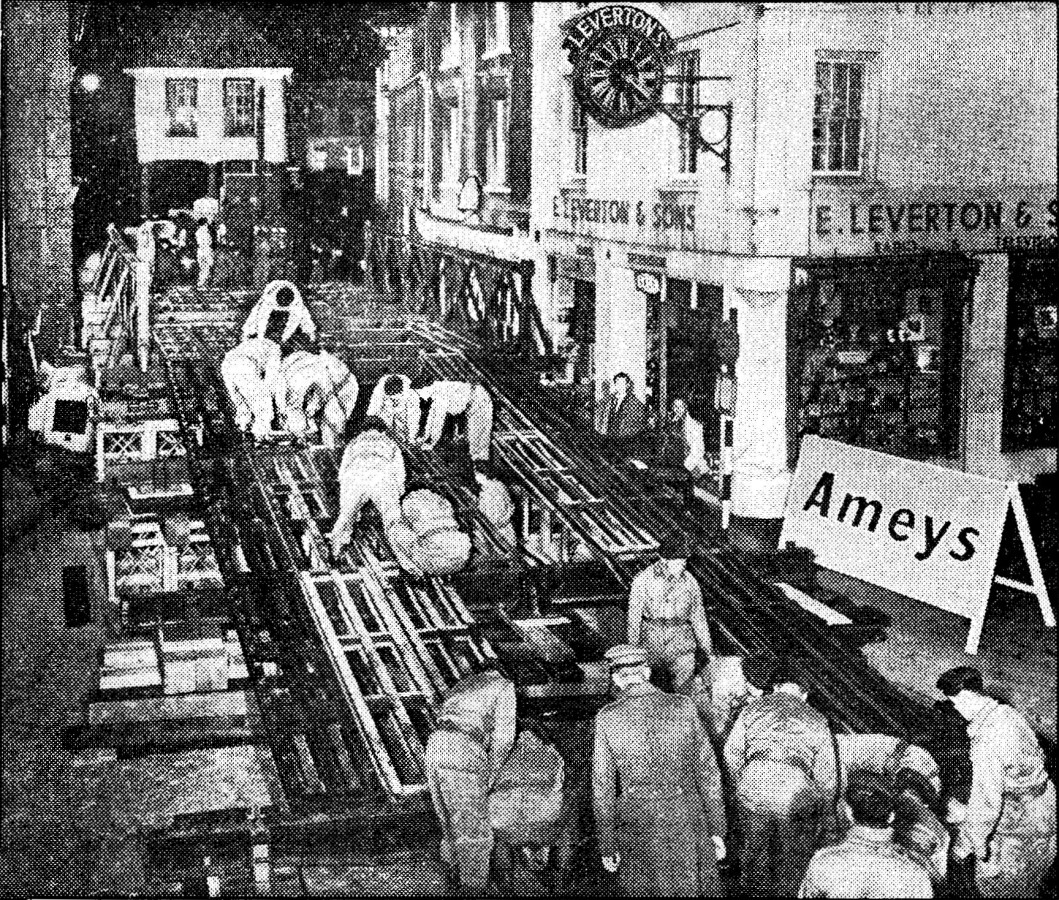 Ghurkas from the 68th Independent Field Squadron from Tidworth, 65 of them, were given the job of erecting a Bailey Bridge* over the road so that traffic could continue to use it while repair work carried on underneath. They arrived on Saturday 7th September and the area began to look like a battlefield with all the soldiers, lorries, cranes, heavy steel girders and other equipment scattered around the Market Place. The road was closed from midnight and re-opened at noon on the Sunday. The bridge was 150ft long and 20ft wide. The first vehicle to use it was the 2 pm bus from Oxford driven by Norman Skinner. The bus became stuck on the crown of the bridge as the incline was too steep, and had to be towed off. The incline was reduced and the traffic began to flow. However, the bridge was wide enough for two cars but not for two lorries, so traffic lights had to be put there because of the chaos caused. Lorries were constantly being stuck on the bridge and sightseers came from afar just to drive their cars over it. The repair work was completed in a week and then the bridge was removed.2
* A Bailey bridge is a type of portable, pre-fabricated, truss bridge. Donald Bailey, a civil servant in the British War Office, proposed the idea in 1936 and it was developed for military use during the Second World War.
1993. Flash Floods & Sand from the Folly Fields
Looking up ‘The Narrows’ (another problem!) towards Cornmarket and turning around to look back into the Market Place.
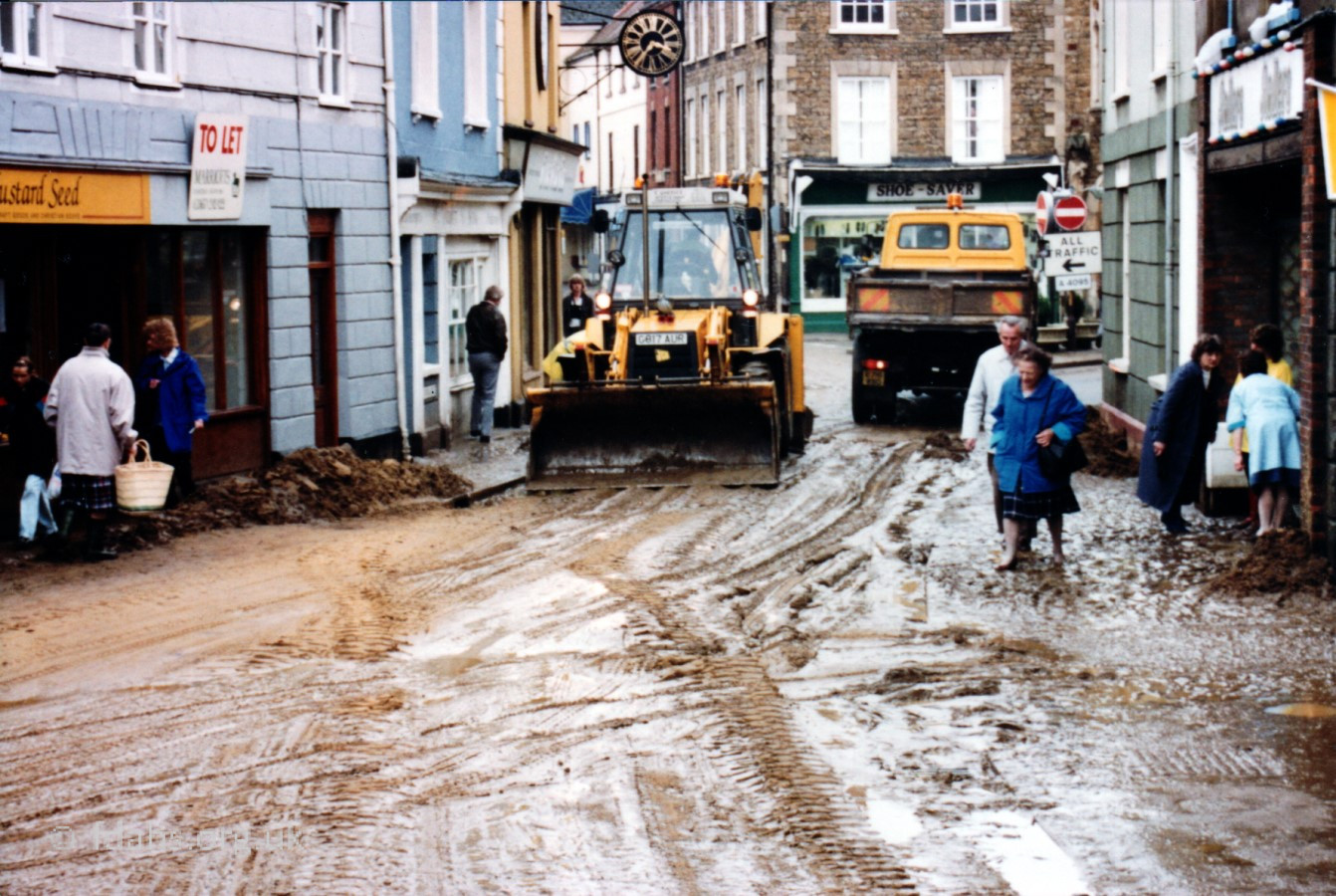
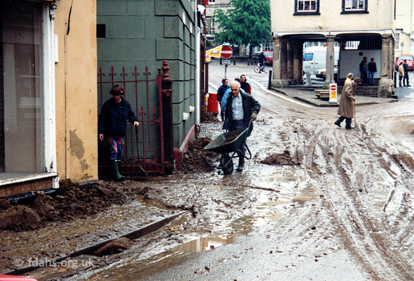
The low lying centre of Faringdon, where a brook was once forded here, was left smothered in tons of sand swept down from the recently cleared and ploughed fields on Folly Hill. On the morning of 26 May 1993 a thunderstorm of exceptional severity struck this area. During hours of torrential rain all the roads into Faringdon became rivers heading down towards this point in the centre of town. Five inches of rain fell in twenty four hours. Shops and houses were flooded as well as their cellars and caused a considerable amount of damage. The costs of damage caused by the floods were over £100,000. The town is nestled in a dip amongst hills on the greenstone ridge overlooking the Thames Valley – Folly Hill rises 167 feet (51m) above this point and Marlborough Street/Coxwell Road rises by 89 feet (27m) in the opposite direction, Church Street and Southampton Street going cross-ways both rise by around 30 feet (9m) so the only natural exit is via the brook that is now hidden under the road and shops either side. More… The Great Flood of 1993 (pdf) 4


<<< Faringdon Market Place 1870s-1940s
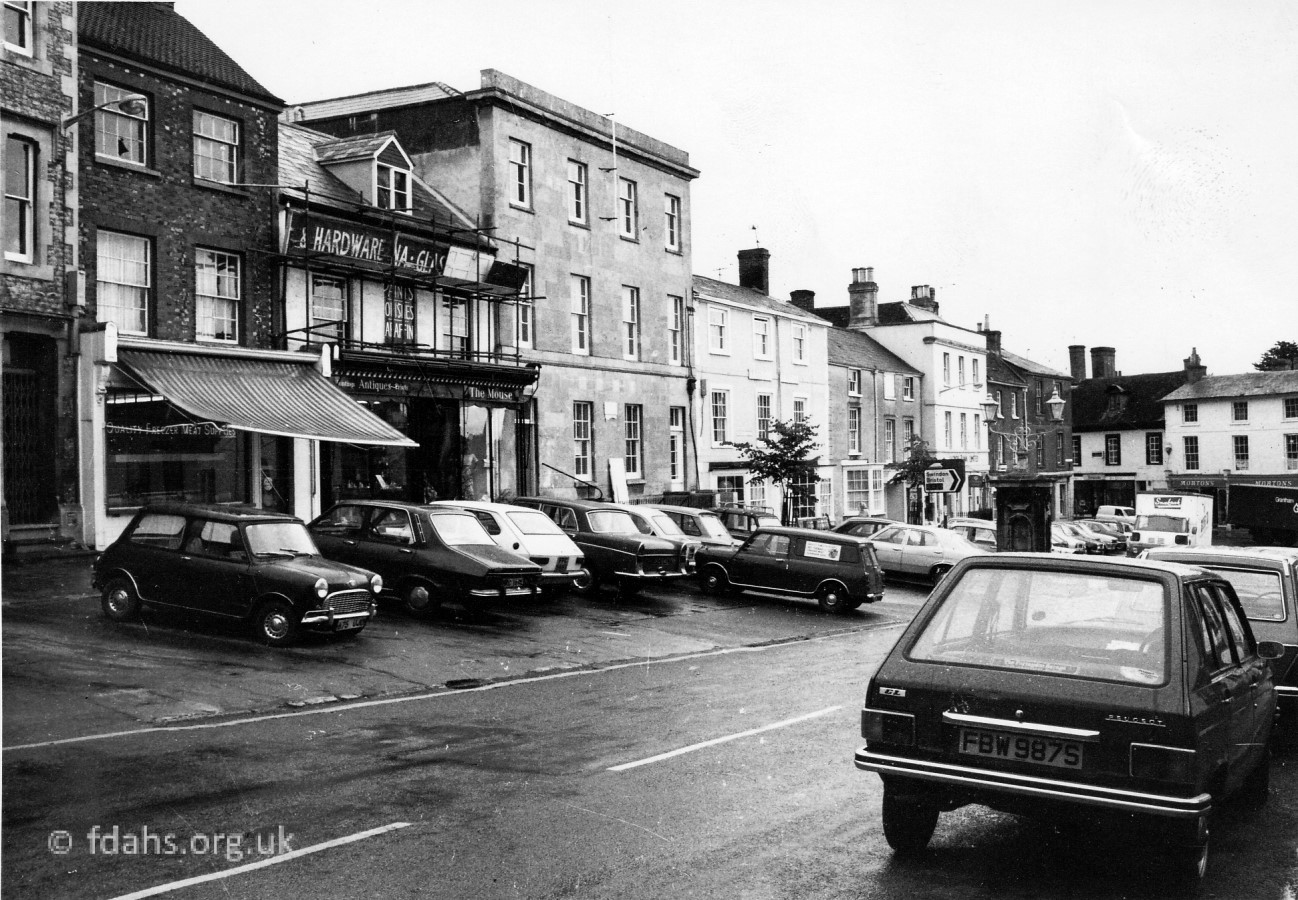
See Market Place Shops & Businesses for a brief history of occupation
See More Photographs & Further Details
See Advertisements in local media
See Faringdon in 1972 – “A Miniature Los Angeles” street protests about the traffic fumes
See Faringdon Market Place in the Year 2000 for a house by house tour.
See Faringdon Streets for an indexed list of all streets in Faringdon.
References:
- The Changing Faces of Faringdon and Surrounding Villages – Bk1-3. By Rosemary Church, Jim Brown, Millie Bryan and Beryl Newman. Robert Boyd Publications.
- Faringdon Advertiser, 13th September 1963.
- Faringdon and The Vale Venture, 29th May 1993.
- Faringdon Folly, June 1993, p12-15 – The Great Flood of 1993 (pdf)
Researched by Ian Lee, December 2019.