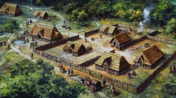
 Early people worked there way up the River Thames and the ancient Ridgeway track, building hill forts on the dunes or downs south of the river. (Celtic/Gaelic dùn and meaning ‘hill or hill fort’). Still visible today are the Neolithic chambered long barrow at Wayland’s Smithy, the Bronze Age ‘White Horse’ and the Iron Age Hill Fort on the Ridgeway along the downs above Uffington. Settlements developed around the freshwater springs at the base of these hills.
Closer to the river along the hilly edge of the ‘Vale of the White Horse’ settlements sprang up that were eventually given descriptive names like ‘Swine dun’ (Swindon), ‘Blunt’s dun’ (Blunsdon) and ‘Fern dun’ (Faringdon). Say the latter like a Scot with a rolling Celtic/Gaelic ‘r’ – ‘fair-ren-dūn‘ and you can see where we are going with this. The final syllable was probably pronounced like a northerner would say ‘gun’ or ‘bun’, and not how we say done, doon, down or dune. This possibly provides the best pronunciation for the original name as it was then spoken, but nothing is as varied and changeable as human speech and spelling.
Very little language from our early Britons (British Celts) and the following Roman occupation actually survived through the Saxon period. The old Celtic word dun, once used throughout northern Europe, still lingered in English place names but was replaced by the Anglo-Saxon hyll in common speech; however, we still talk of sand dunes and chalk downs today. The problem with spellings in English is that we don’t use accents on our vowels to aid pronunciation like the other European languages from which it developed – via language invasions of mainly Lower German (Angles & Saxons), Danish, Norse, and Norman French. [When, in 1066, Norman French arrived with its roots in Roman Latin as the language used by the new ‘posh’ nobility; hills became mountains, pigs became pork, and folk on foot became pedestrians. Also, Latin in its pure and multisyllabic form was the universal language used by the Christian Church throughout Europe and they were often the nobility, teachers and scribes of the day. That is largely why we ended up with two or more words meaning similar things.] The dropping of accents on our vowels as the English language developed makes for simpler spelling in some ways but we don’t even use a consistent combination of vowels as an alternative to show accurate pronunciation. Also, vowel sounds constantly changed over the centuries and varied in different parts of the country. Worse still was that the early scribes simply made up spellings as they went along. They didn’t even bother being consistent within the same text, as can be seen in the market charter of 1218 below.
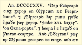
The Saxon Chronicles (925)
 [Translation of this Saxon Chronicles extract:
Yr. 925. This year Edward king died in Mercia at Fearndune. Ælfweard his (2nd) son very soon there died “about 16 days later” in Oxford. Their bodies lie in Winchester. And Æthelstan (his 1st son) there of Mercia was chosen to be king…]
The name ‘Fearndune‘ (written ‘Færndun‘ in some versions) meaning ‘Fern Hill’, first appears written down in the Saxon Chronicles referring to the death of the King of the Anglo-Saxons, Edward the Elder (actually that happened in 924 CE). This was around the time when England was starting to be united into a single kingdom. It also states that it was in the old Saxon Kingdom of Mercia so probably not actually this town as once believed, it being only just over the border in the Kingdom of Wessex. It is now thought to be referring to Edward’s estate on the Welsh border 12 miles south of Chester, now called Farndon-on-Dee; shortly after putting down a rebellion there. But it does remain as the most likely origin of this and similarly named towns.
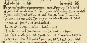
The Domesday Book (1086)
 The first definitive recording of this town’s name was in the Domesday Book (1086). Ferendone (in the hundred of Wyfolhd* and county of Berchescire**) is recorded with 47 households – 17 villagers, 12 smallholders, 16 slaves, 130 acres meadow, 1 mill, 1 fishery, 1 church.
* The hundred (administrative district) of Wyfold consisted of Buscot, [Great] Faringdon, Eaton [Hastings], [Great] Coxwell, and [Little] Coxwell.
** The county name of Berchescire (1086 CE) derived from the earlier Bearrocscir (839 CE) – Bearroc, a Celtic word meaning “hilly place” plus Anglo-Saxon ‘scire‘, pronounced ‘shire’. Faringdon was transferred from the county of Berkshire to Oxfordshire in 1974.
Faringdon Market Charter (1218 & 1313)
The name next appears, losing the final ‘e’ but with two different spellings in the Market Charter (1218):
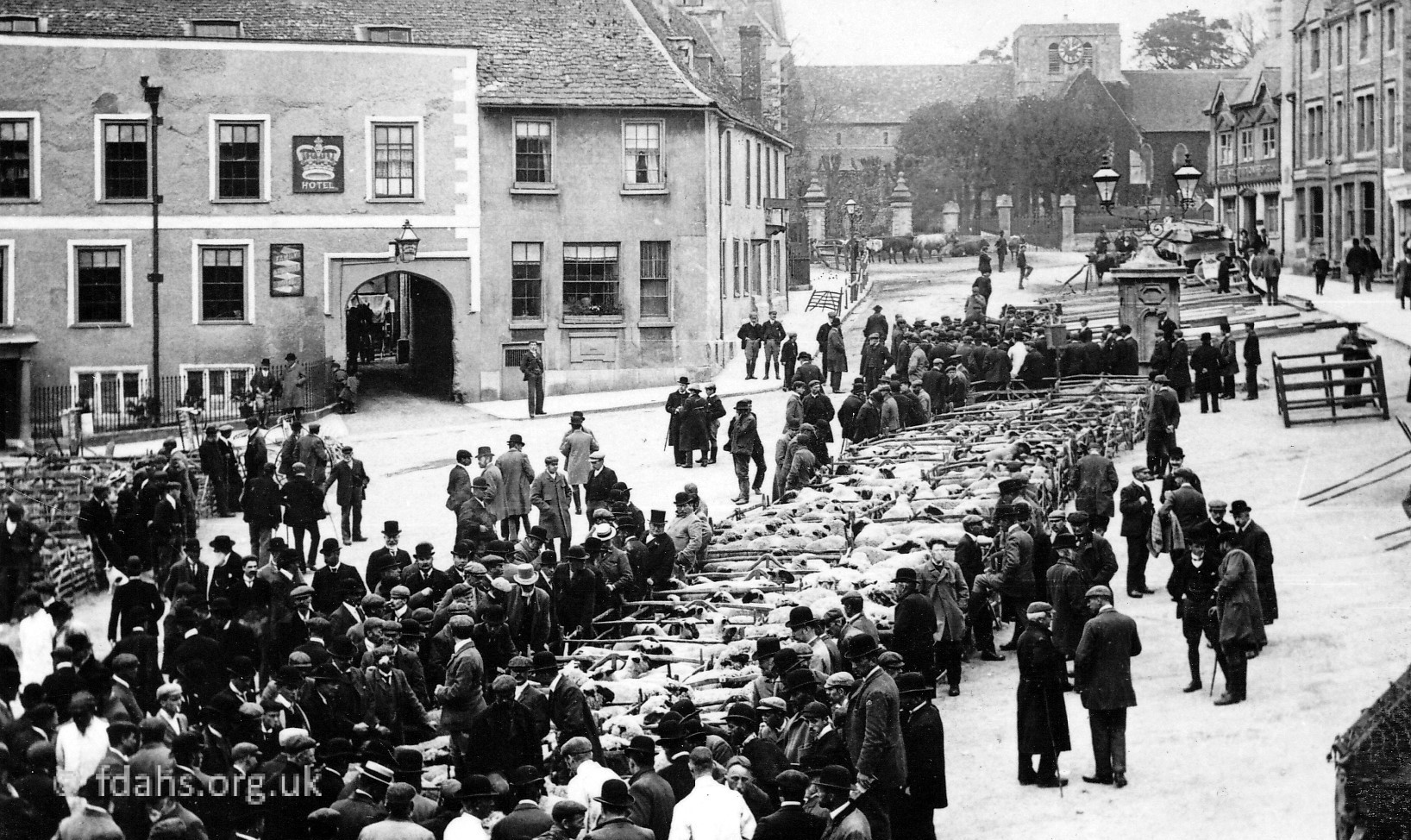
 On 7th March 1218 during the reign of Henry III, the Shire of Berkshire was ordered to ensure that the market in Ferendon or Ferendun be henceforth held on Mondays so long as this does not cause a nuisance to other markets in the vicinity. Nearly a century later, on 18th February 1313, King Edward II granted that the day of the market in ‘Chepyng (Market) Farendon’ may be changed to Tuesday. The Latin influenced names ‘Parva‘ (Little) & Magna (Great) Farendon‘ were also already in use around this time.
Spellings varied over the years as various scribes just made up their own rules, and as shown in the charter above, consistency was not considered to be that important. It was recorded as ‘Fernedun’ (1203), ‘Farendon’ (1225), ‘Farenduna‘ (1233), ‘Farndon’ (1242), ‘Farindon’ (1275), ‘Faryndon’ (1327) and then almost finally ‘Faryngdon’ & ‘Chepyngfaryngdon‘ (1501), also ‘Farington’ (1542). The current spelling ‘Faringdon‘ appears on old maps of the area (1736, 1753 & 1761) although sometimes with a double ‘r’ or ‘ton’ instead of ‘don’. It may be interesting to note that the nearby homestead/hamlet of ‘Fernham’ has remained practically unchanged.
References:
- Place-Names and Topography in the Upper Thames Country: A Regional Essay by W. J. Arkell, p16/18, https://oxoniensia.org/volumes/1942/arkell.pdf
- The Gough Map of Great Britain: https://www.goughmap.org/settlements/8052/
- Old Maps Online – A map of the county of Berks – 1762: : https://www.oldmapsonline.org/map/unibern/000992352
- Oxford-Fyfield-Faringdon-Purton Road Strip map by J. Owen & E. Bowen – 1753: https://www.amazon.com/Oxford-Fyfield-Faringdon-Purton-road-strip-OWEN-BOWEN/dp/B019P3CJU6
- National Library of Scotland – Berkshire VIII.SW (includes: Great Coxwell; Great Faringdon; Little Coxwell; Shellingford.): https://maps.nls.uk/view/97772849
- British History Online – Parishes: Great Faringdon: https://www.british-history.ac.uk/vch/berks/vol4/pp489-499
- Open Domesday: https://opendomesday.org/place/SU2895/great-faringdon/
Researched by Ian Lee, November 2018.
